Skip to search
Skip to main content
Skip to first result
Digital Commonwealth
Folders
Sign Up / Log In
Search for
Search
Search
Search
Basic
Advanced
Explore
Map
Collections
Institutions
Formats
For Educators
Primary Source Sets
Lesson Plans
Using Primary Sources
Searching Digital Commonwealth
For Institutions
Join Digital Commonwealth
Conferences, Trainings, & Events
How to Contribute Collections
Digitization Services
Board & Committees
Frequently Asked Questions
About
About Digital Commonwealth
News & Announcements
Copyright & Terms of Use
Harmful Content Statement
Partners
API
Contact Us
Search
Search Constraints
Start Over
Save Search
Your search:
More Like
commonwealth:2b88qf60f
✖
Remove constraint More Like: commonwealth:2b88qf60f
« Prev.
|
10,901
-
11,000
of
11,002
|
Next »
Sort
by relevance
relevance
title
date (asc)
date (desc)
Number of results to display per page
100
per page
per page
10
per page
20
per page
50
per page
100
per page
View results as:
List
list view
Maps
map view
Gallery
grid view
Search Results
10901.
Westfield
10902.
Westfield, Mass : 1875
10903.
Westford, Mass : 1886
10904.
West-Indies, n. coast of Haiti, from Monte Christi to Fort Dauphin Bay ; Fort Dauphin...
10905.
Westindische Inseln
10906.
West-Indische paskaert : waer in de graden der breedde over weder zyden vande...
10907.
Westliche halbkugel
10908.
West-Russland angrenzende teile des Deutschen reiches und Österreich-Ungarn
10909.
Weymouth, Mass., 1880
10910.
W.H. Smith & Son's new railway map of the British Isles
10911.
Whale chart
10912.
What the administration has done : map showing the progress of the national armies...
10913.
What's up? South! : world map
10914.
Where the fight will be centered, if there is one
10915.
Whippy Harbour, south side of Viti Levu ; Suva Harbour, south side of Viti Levu ;...
10916.
White Haven
10917.
White Islands Harbour : Port Stephen's ; Liscomb Harbour ; Houlton Harbour ; River St....
10918.
White Mountain National Forest : New Hampshire-Maine
10919.
White Mountain region, New Hampshire : showing lands being acquired by the United States
10920.
The White Mountains of New Hampshire
10921.
Whitinsville, Mass.
10922.
Whitinsville, Massachusetts : 1891
10923.
Whitman, Massachusetts : 1889
10924.
Whitman National Forest, Blue Mountains Division, Oregon
10925.
Whitman National Forest, Minam Division, Oregon
10926.
The whole story in a nutshell!
10927.
Wickford, Rhode Island : 1888
10928.
Wigorniensis comitatus cum Warwicensi, nec non Conventriae Libertas
10929.
Wilbraham
10930.
Willard's new map of the Hudson River
10931.
[Willard's new map of the Hudson River for 1844]
10932.
William Gropper's America, its folklore
10933.
Williams' telegraph and rail road map of the New England states, eastern portion of...
10934.
Williams' telegraph and rail road map of the New England states, eastern protion of...
10935.
Williamstown, Mass
10936.
Willimantic, Conn., 1882 : from Blake Mountain
10937.
Wilmington, Del : 1874
10938.
Wilmington, Delaware
10939.
Wilton, N.H
10940.
Wiltonia sive comitatus Wiltoniensis : Anglis Wil Shire
10941.
Winchendon
10942.
Winchester, Middlesex County, Mass : 1886
10943.
Winchester, N.H : Cheshire County, 1887
10944.
Wind and current chart of the North Atlantic [sheet 1]
10945.
Windsor, Vermont : 1886
10946.
The Windward passage from Jamaica, betwene the east end of Cuba, and the west end of...
10947.
Winnebago County, Wis.
10948.
Winter sports map of the Berkshire Hills
10949.
Winthrop - anciently Pullin Point : our peninsula in 1624
10950.
Woburn, Mass., 1883
10951.
Wollaston, Massachusetts
10952.
The Wonderground map of London town
10953.
Wood County, Wis.
10954.
Woodland Cemetery in Dorchester and Roxbury main entrance on Walk-Hill Street : five...
10955.
The woods are full of them
10956.
Wood's Holl [sic], Falmouth, Mass
10957.
Woodstock, New Brunswick : 1889
10958.
Worcester County : Essex County
10959.
Worcester station
10960.
Worcestershire
10961.
Worcestershire and Gloucestershire
10962.
The world
10963.
The world
10964.
The World
10965.
The world, according to the latest discoveries
10966.
World freedom : a factual & pictorial map
10967.
[World map]
10968.
[World map]
10969.
[World map]
10970.
World map of A.D. 1544 (the Sebastian-Cabot map)
10971.
World map of the major tropical diseases
10972.
The world, on Mercator's projection : showing the different routes to California, and...
10973.
The World, on the globular projection with a graduation for the measurement of...
10974.
The world turned upside down
10975.
The world upon globular projection and with a gazetteer of information
10976.
The world with all modern discoveries
10977.
World wonders : a pictorial map
10978.
Worley's map of Dallas and suburbs
10979.
Wrentham, Massachusetts, 1888
10980.
Wright's map of La Crosse
10981.
Wright's map of Milwaukee
10982.
Wyld's military map of the United States, the northern states, and the southern...
10983.
Yaggy's geographical study [title page] : comprising physical, political, geological...
10984.
Yarmouth, Nova Scotia : 1889
10985.
Yellow Sea, west coast of Korea, A-San Anchorage : from a Japanese government survey...
10986.
Yellowstone National Park : from surveys made under the direction of F.V. Hayden and...
10987.
Yellowstone National Park, Big Horn Mountains and adjacent territory
10988.
Yggdrasill, the mundane tree
10989.
Yosemite Valley
10990.
Yuenan renmin kang mei jiu guo xing shi tu
10991.
Zambales
10992.
Zeilan Insula
10993.
Železnička i brodarska karta Kraljevine Srba Hrvata i Slovenaca = Carte des chemins...
10994.
Zentral- und Südafrika
10995.
Zhongguo di zhi tu = General geological map of China : Peking-Tsinan Sheet
10996.
Ziron 1920 political map
10997.
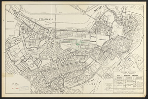
Zoning districts, city of Boston : Map I Boston proper
10998.
Zoning districts, city of Boston
10999.
Zoning districts, city of Boston
11000.
Zoning districts, city of Boston
« Previous
Next »
1
2
…
106
107
108
109
110
111
Limit your search
Subject
Real property--Massachusetts--Boston--Maps
2,278
Landowners--Massachusetts--Boston--Maps
2,117
Boston (Mass.)--Maps
1,966
Roxbury (Boston, Mass.)--Maps
351
Dorchester (Boston, Mass.)--Maps
317
Cambridge (Mass.)--Maps
266
Brookline (Mass.)--Maps
236
Real property--Massachusetts--Cambridge--Maps
216
more
Subject
»
Place
North and Central America
7,816
United States
6,577
Suffolk (county)
3,339
Massachusetts
3,212
Boston
3,199
Europe
963
Middlesex (county)
617
Canada
427
more
Place
»
Format
Maps/Atlases
10,943
Manuscripts
215
Prints
51
Books
35
Objects/Artifacts
10
Drawings/Illustrations
8
Posters
4
Available to use
No known restrictions
10,932
Creative Commons license
47
Date
View distribution
Current results range from
1482
to
2023
Date range begin
Date range end
View larger »
Collection
Norman B. Leventhal Map Center Collection
11,000
Boston and New England Maps (Collection of Distinction)
5,106
Urban Maps (Collection of Distinction)
4,847
Maritime Charts and Atlases (Collection of Distinction)
750
American Revolutionary War-Era Maps (Collection of Distinction)
615
Boston Redevelopment Authority Collection
87
Mapping Boston Collection
1
Other
1
Institution
Boston Public Library
11,000
Private Collection
1
State Library of Massachusetts
1


![[Willard's new map of the Hudson River for 1844]](https://bpldcassets.blob.core.windows.net/derivatives/images/commonwealth:b8516310f/image_thumbnail_300.jpg)


![Wind and current chart of the North Atlantic [sheet 1]](https://bpldcassets.blob.core.windows.net/derivatives/images/commonwealth:jh344151t/image_thumbnail_300.jpg)


![Wood's Holl [sic], Falmouth, Mass](https://bpldcassets.blob.core.windows.net/derivatives/images/commonwealth:qb98n7935/image_thumbnail_300.jpg)


![[World map]](https://bpldcassets.blob.core.windows.net/derivatives/images/commonwealth:st74cz00d/image_thumbnail_300.jpg)
![[World map]](https://bpldcassets.blob.core.windows.net/derivatives/images/commonwealth:wd3762879/image_thumbnail_300.jpg)
![[World map]](https://bpldcassets.blob.core.windows.net/derivatives/images/commonwealth:x059cd25x/image_thumbnail_300.jpg)


![The World, on the globular projection with a graduation for the measurement of distances especially adapted for the use oe [sic] schools, geographical & historical lectures, and missionary meetings](https://bpldcassets.blob.core.windows.net/derivatives/images/commonwealth:ww72bp12b/image_thumbnail_300.jpg)


![Yaggy's geographical study [title page]](https://bpldcassets.blob.core.windows.net/derivatives/images/commonwealth:3f463530h/image_thumbnail_300.jpg)