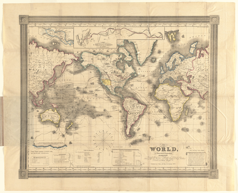
The world, on Mercator's projection : showing the different routes to California, and distance by each; routes of different navigators, route of the contemplated Pacific R. Road, distances to China, Europe, &c
The world, on Mercators projection
Item Information
Title:
The world, on Mercator's projection : showing the different routes to California, and distance by each; routes of different navigators, route of the contemplated Pacific R. Road, distances to China, Europe, &c
Description:
America Transformed: During the first half of the 19th century, it was not easy to travel from the East to the West Coast. This map, published after the discovery of gold in California, displays several possibilities. One route was the lengthy ocean voyage from the East Coast, around the southern tip of South America, to San Francisco. Quicker alternatives, lasting one to three months, combined ocean travel with a short land passage across Central America. Travelers could also cross North America via the Oregon Trail, which took four to six months. While this map appears to emphasize ocean navigation, it also promoted a proposed railroad route from Saint Louis to San Francisco.
Relief shown by abbreviated form lines.
Prime meridian: Washington and Greenwich.
"Entered according to Act of Congress, in the year 1850, by John Haven in the clerks office of the District Court of the state of Massachusetts."
Includes historical notes, illustrations of ships, tables of distances, "Nicaragua route" distances, and text on "Pacific Railroad."
Insets: Map of the Nicaragua route -- Map of the proposed rail road from St. Louis to the bay of St. Francisco.
Notes (exhibitions):
Exhibited: "America transformed. Part 1: the United States expands westward," organized by the Norman B. Leventhal Map & Education Center at the Boston Public Library, 2019.