Skip to search
Skip to main content
Digital Commonwealth
Sign Up / Log In
Search for
Search
Search
Search
Basic
Advanced
Explore
Map
Collections
Institutions
Formats
For Educators
Primary Source Sets
Lesson Plans
Using Primary Sources
Searching Digital Commonwealth
For Institutions
Join Digital Commonwealth
Conferences, Trainings, & Events
How to Contribute Collections
Digitization Services
Board & Committees
Frequently Asked Questions
About
About Digital Commonwealth
News & Announcements
Copyright & Terms of Use
Harmful Content Statement
Partners
API
Contact Us
Boston Public Library
Norman B. Leventhal Map & Education Center Collection
/
Urban Maps (Collection of Distinction)
/
Boston and New England Maps (Collection of Distinction)
Winchendon
Winchendon
×
Item Information
Title:
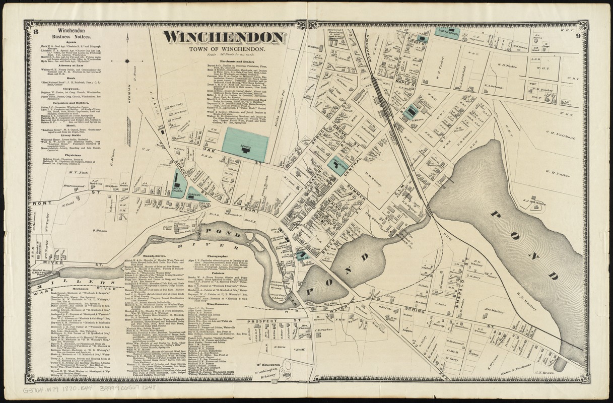
Winchendon
Title (alt.):
Town of Winchendon
Creator:
Beers, F. W. (Frederick W.)
Date:
[1870]
Format:
Maps/Atlases
Location:
Boston Public Library
Norman B. Leventhal Map & Education Center
Collection (local):
Norman B. Leventhal Map & Education Center Collection
Subjects:
Landowners--Massachusetts--Winchendon (Town)--Maps
Winchendon (Mass. : Town)--Maps
Places:
Massachusetts
>
Worcester (county)
>
Winchendon
Extent:
1 map : col. ; 36 x 56 cm.
Permalink:
https://ark.digitalcommonwealth.org/ark:/50959/cj82m662x
Terms of Use:
No known copyright restrictions.
No known restrictions on use.
Publisher:
New York : F.W. Beers & Co.
Scale:
Scale [1:3,960]. 20 rods to an inch
Language:
English
Notes:
Shows buildings and landowners.
Pages 8-9 from Beer's Atlas of the city of Worcester. 1870.
Includes Business notices.
Gift ; Robert Melzer ; 2012.
Notes (date):
This date is inferred.
Identifier:
06_01_010411
Call #:
G3764.W79 1870 .B44
Barcode:
39999065671248
show more...
View MODS XML
More Like This
Atlas of Winchendon Town, Massachusetts
Atlas of Winchendon town, Massachusetts
The 100th anniversary map of Abraham Lincoln's visit to ...
1630 shoreline
Find More Like This >>
Tools
Share
Facebook
Pinterest
X
Reddit
Tumblr
Email
Copy link
Add to Folder
Questions/Comments
Cite This Item
IIIF Manifest
Downloads
Primary (full resolution, uncompressed)
(TIF, 109 MB)
Large (full resolution)
(JPEG, 9.15 MB)
Medium
(JPEG, 394 KB)
GeoTIFF (georeferenced)
(TIF, 121 MB)