Skip to search
Skip to main content
Skip to first result
Digital Commonwealth
Folders
Sign Up / Log In
Search for
Search
Search
Search
Basic
Advanced
Explore
Map
Collections
Institutions
Formats
For Educators
Primary Source Sets
Lesson Plans
Using Primary Sources
Searching Digital Commonwealth
For Institutions
Join Digital Commonwealth
Conferences, Trainings, & Events
How to Contribute Collections
Digitization Services
Board & Committees
Frequently Asked Questions
About
About Digital Commonwealth
News & Announcements
Copyright & Terms of Use
Harmful Content Statement
Partners
API
Contact Us
Search
Search Constraints
Start Over
Save Search
Your search:
boston harbor ships
✖
Remove constraint boston harbor ships
« Prev.
|
101
-
200
of
12,419
|
Next »
Sort
by date (asc)
relevance
title
date (asc)
date (desc)
Number of results to display per page
100
per page
per page
10
per page
20
per page
50
per page
100
per page
View results as:
List
list view
Maps
map view
Gallery
grid view
Search Results
101.
Plans des isles, rades, et ports de plusieurs lieux de l'Amérique : tirés de la Carte angloise de Mr. Popple publiée en 1733...
102.
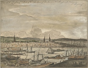
A south east view of the great town of Boston in New England America
103.
Contract
104.
A prospect of ye great town of Boston in New England in America
105.
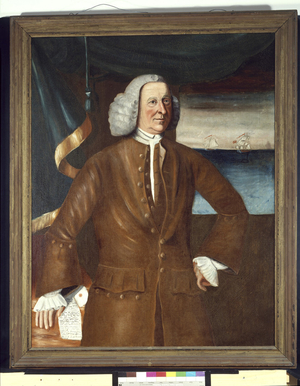
Portrait of Jonathan Sayward (1713-1797)
106.
Les principales forteresses, ports &c. de l'Amérique septentrionale
107.
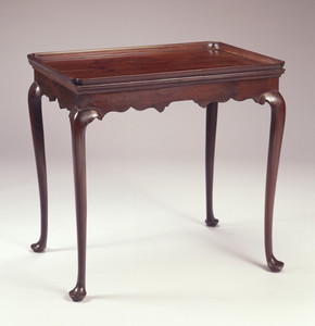
Tea Table
108.
Particular draughts and plans of some of the principal towns and harbours belonging to the English, French, and Spaniards, in...
109.
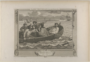
Pl. 5. The idle 'prentice turned away and sent to sea
110.
A large draught of New England, New York and Long Island
111.
A new suruey of the harbour of Boston in New England
112.
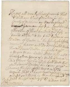
Deed signed by William Waitt to James Dalton acknowledging the sale of Peter (a slave), 29 July 1747
113.
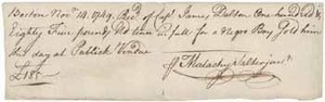
Bill of sale from Malachy Salter, Jr. to James Dalton for a slave, 14 November 1749
114.
Carte du havre de Chibucto avec le plan de la ville de Halifax sur la coste de l'Accadia ou Nova Scotia latitude 44° 31ʹ
115.
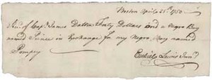
Receipt from Ezekiel Lewis Jr. to James Dalton for exchange of Prince (a slave) for Pompey (a slave), 25 April 1750
116.
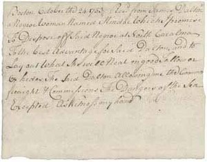
Receipt and agreement from James Dalton and signed by Thomas Prince relating to Mindoe (a slave), 24 October 1753
117.
A map of the most inhabited part of New England : containing the provinces of Massachusets Bay and New Hampshire, with the...
118.
Baye et port de Boston
119.
Map
120.
Vedvta della porzione di nave d travertini costruita, e pianata dinanzi alle sustruzioni che regevano il Tempio di Esculapio...
121.
Vindicibvs.et.protectoribvs bonarvm.artivm I.B.Piranesivs
122.
Carte reduite des costes orientales de l'Amerique septentrionale : 1re. feuille contenant L'Isle Royale, L'Accadie, La Baye...
123.
Plan de la ville de Boston et ses environs
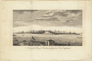
124.
A view of the City of Boston the capital of New England
125.
A view of the City of Boston the capital of New England, in North America = Vue de la ville de Boston, capitale de la Nouvelle...
126.
A view of the City of Boston the capital of New England, in North America
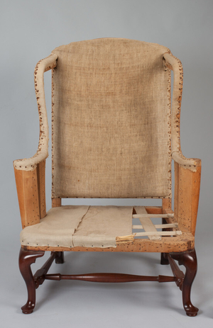
127.
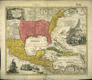
A view of the City of Boston the capital of New England, in North America
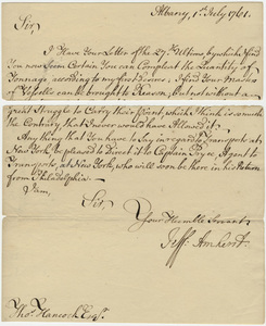
128.
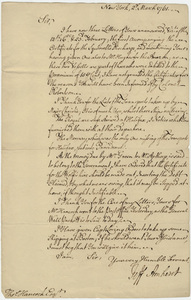
An actual survey of the sea coast from New York to the I. Cape Briton : with tables of the direct and thwart courses &...
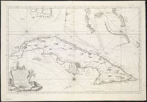
129.
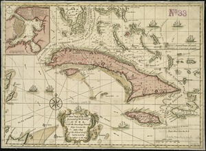
A correct map of the coast of New England
130.
A plan of the city & harbour of Louisburg : shewing that part of Gabarus Bay in which the English landed, also their encampment...
131.
Tucker family papers
132.
Easy Chair
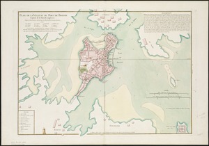
133.
Regni Mexicani seu Novae Hispaniae, Ludovicianae, N. Angliae, Carolinae, Virginae et Pensylvaniae necnon insularum archipelagi...
134.
Jeffery Amherst letter to Thomas Hancock, 1761 July 1
135.
Jeffery Amherst letter to Thomas Hancock, 1761 March 2
136.
Carte réduite de l'isle de Cube
137.
A new chart of the seas surrounding the island of Cuba, with the soundings, currents, ships, courses &c. and a map of the...
138.
Carta rappresentante il porto di Boston
139.
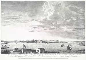
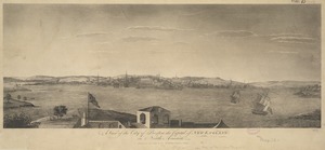
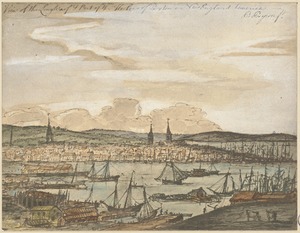
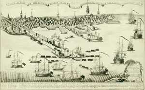
A map of the most inhabited part of New England : containing the provinces of Massachusets Bay and New Hampshire, with the...
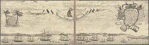
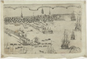
140.
A map of the most inhabited part of New England : containing the provinces of Massachusets Bay and New Hampshire, with the...
141.
A new map of North America : with the British, French, Spanish, Dutch & Danish dominions on that great continent, and the West...
142.
Receipt
143.
Carte de la Baye de Baston : située dans la Nouvelle Angleterre
144.
Plan de la ville et du port de Boston : capitale de la Nouvelle Angleterre : erigée prémierement en 1630, et en 1735 elle fut...
145.
Plan de la ville et du port de Boston : capitale de la Nouvelle Angleterre
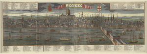
146.
Plan de la ville et du port de Boston : capitale de la Nouvelle Angleterre
147.
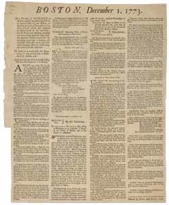
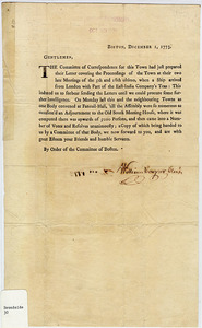
View of the Long Warf & port of the harbour of Boston in New England America
148.
View of the Long Warf & port of the harbour of Boston in New England America
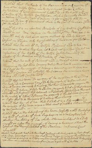
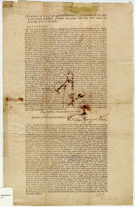
149.
A draught of the harbour of Hallifax and the adjacent coast in Nova Scotia
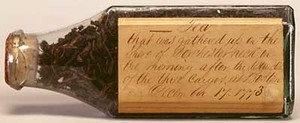
150.
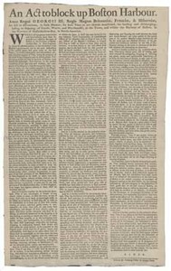
A new and correct chart of the sea coast of New-England from Cape Codd to Casco Bay
151.
Antigoa
152.
An authentic plan of the town and harbour of Cap-François in the isle of St. Domingo
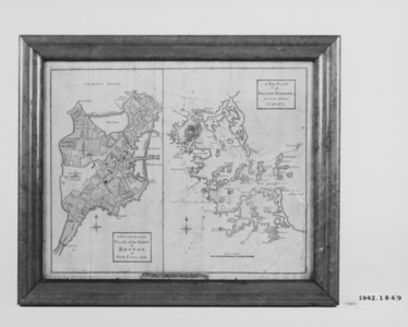
153.
Boston. Perspective. View of Boston Harbor and the British fleet, 1768
154.
A chart of the harbour of Halifax in Nova Scotia : with Jebucto Bay and Cape Sambro also the islands, ledges of rocks, shoals &...
155.
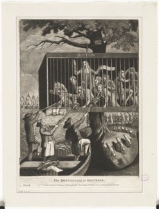
An exact chart of the river St. Laurence, from Fort Frontenac to the island of Anticosti shewing the soundings, rocks, shoals...
156.
Païs cedés, sheet IId, containing the Peninsula & Gulf of Florida, with the Bahama Islands
157.
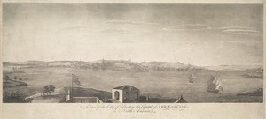
A Perspective View of the Blockad[e] of Boston Harbour
158.
Perspective View of the Blockade of Boston [Harbour]
159.
Plan of Guantanimo, called by the English Cumberland Harbor ; Plan of the city and harbour of St. Jago de Cuba
160.
Plan of the attack against Basseterre on the island of Guadeloupe by a squadron of his Majesty's ships of war commanded by...
161.
Plan of the attack against Fort Louis now Fort George, at Point à Pitre on the island of Guadaloupe : by a squadron of His...
162.
Plan of the city and harbour of the Havana ; Plan of Bahia de Matanzas
163.
Plan of the town and fort of Grenada
164.
St. Christophers
165.
View of part of the town in Boston and New England and British ships of war landing their troops 1768, engraved, printed and...
166.
Egmont Harbor
167.
Falmouth Harbour
168.
Falmouth Harbour
169.
Keppell Harbour : Knowles Harbour ; Tangier Harbour ; Saunder's Harbour ; Deane Harbour
170.
London
171.
The town of Boston in New England and Brittish ships of war landing their troops! 1768
172.
A new chart of the vast Atlantic or Western Ocean including the sea coast of Europe, Africa, America, and the West India...
173.
Boston, December 1, 1773. At a meeting of the people ...
174.
Boston, December 1, 1773. Gentlemen, the Committee of Correspondence for this town had just prepared their Letter covering the...
175.
Diary for 1773 to the end of 1774 of Mr. Thomas Newell, Boston
176.
Draft of the Newton Resolves, between 1773 and 1774
177.
In consequence of a conference with the committees of correspondence for the towns in the vicinity of Boston, November 23,...
178.
Tea leaves in glass bottle collected on the shore of Dorchester Neck the morning of 17 December 1773
179.
An Act to Block up Boston Harbour
180.
A map of the most inhabited part of New England : containing the provinces of Massachusets Bay and New Hampshire, with the...
181.
A map of the most inhabited part of New England : containing the provinces of Massachusets Bay and New Hampshire, with the...
182.
A map of the most inhabited part of New England : containing the provinces of Massachusets Bay and New Hampshire, with the...
183.
A map of the most inhabited part of New England : containing the provinces of Massachusets Bay and New Hampshire, with the...
184.
A Map of the Most Inhabited Part of New England... [bottom portion]
185.
A Map of the Most Inhabited Part of New England... [top portion]
186.
A new and accurate plan of the town of Boston in New England : A new plan of Boston Harbor from an actual survey
187.
White Haven
188.
Letter from John Andrews to William Barrell, 12 June 1774
189.
The Bostonians in distress, plate II.
190.
The Bostonians in distress, plate II.
191.
An accurate map of North and South Carolina with their Indian frontiers, shewing in a distinct manner all the mountains,...
192.
Canso Harbor
193.
[Chart of Boston Harbor and the surrounding areas]
194.
A chart of the harbour of Boston
195.
A chart of the harbour of Boston
196.
A chart of the harbour of Boston
197.
Crow Harbour : on the south shore of Chedabuctou Bay
198.
Curaçao
199.
An exact chart of the river St. Laurence, from Fort Frontenac to the island of Anticosti shewing the soundings, rocks, shoals...
200.
A front view of the lines taken from the advanced post near Browns house : A view of the harbour of Boston taken from Fort Hill...
« Previous
Next »
1
2
3
4
5
6
…
124
125
Limit your search
Subject
Ships
2,015
Harbors
1,661
Sailing ships
1,534
Boats
1,025
Piers & wharves
932
Naval yards & naval stations
853
Constitution (Frigate)
744
Boat & ship industry
488
more
Subject
»
Place
North and Central America
7,305
United States
6,977
Massachusetts
5,127
Suffolk (county)
2,917
Boston
2,637
Essex (county)
961
Boston Harbor
681
Newburyport
641
more
Place
»
Format
Photographs
8,390
Maps/Atlases
1,365
Postcards/Cards
982
Prints
798
Manuscripts
237
Letters/Correspondence
218
Ephemera
154
Documents
135
more
Format
»
Available to use
No known restrictions
3,584
Creative Commons license
2,043
Date
View distribution
Current results range from
1460
to
2019
Date range begin
Date range end
View larger »
Unknown
347
Collection
Leslie Jones Collection
3,104
Norman B. Leventhal Map Center Collection
821
Press Photography from the Brearley Collection
740
Tichnor Brothers Postcard Collection
739
Bill Lane Photograph Collection
634
Boston Pictorial Archive (Collection of Distinction)
480
Mass. Memories Road Show
470
Maritime Charts and Atlases (Collection of Distinction)
399
more
Collection
»
Institution
Boston Public Library
8,468
Newburyport Public Library
634
University of Massachusetts Boston, Joseph P. Healey Library
501
Historic New England
409
Northeastern University Library
406
Massachusetts Archives
337
National Archives at Boston
201
Griffin Museum of Photography
130
more
Institution
»


![A Perspective View of the Blockad[e] of Boston Harbour](https://bpldcassets.blob.core.windows.net/derivatives/metadata/commonwealth-oai:6q183z162/image_thumbnail_300.jpg)
![Perspective View of the Blockade of Boston [Harbour]](https://bpldcassets.blob.core.windows.net/derivatives/metadata/commonwealth-oai:fn108b15x/image_thumbnail_300.jpg)


![A Map of the Most Inhabited Part of New England... [bottom portion]](https://bpldcassets.blob.core.windows.net/derivatives/metadata/commonwealth-oai:b5645v47s/image_thumbnail_300.jpg)
![A Map of the Most Inhabited Part of New England... [top portion]](https://bpldcassets.blob.core.windows.net/derivatives/metadata/commonwealth-oai:0c484n457/image_thumbnail_300.jpg)


![[Chart of Boston Harbor and the surrounding areas]](https://bpldcassets.blob.core.windows.net/derivatives/images/commonwealth:6108vs71d/image_thumbnail_300.jpg)