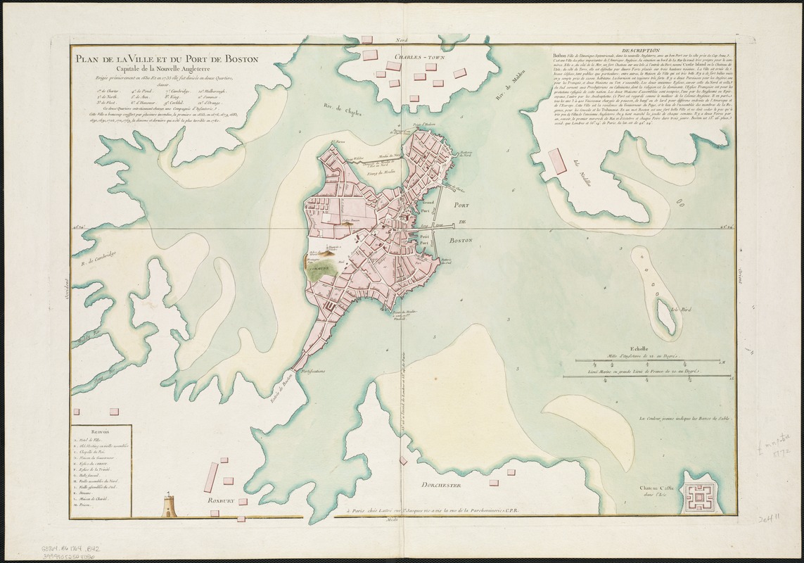
Plan de la ville et du port de Boston : capitale de la Nouvelle Angleterre
Plan de la ville et du port de Boston
Item Information
Title:
Plan de la ville et du port de Boston : capitale de la Nouvelle Angleterre
Description:
Displayed here is the first state of Lattre's plan of Boston. The plan here was also separately issued. Describing Boston in the years before the American Revolutionary war, the plan includes information on shoals, soundings in the harbor, and the surrounding countryside. Lattre was the Royal Engraver to Louis XVI from 1776 to 1782, and is most famous for his "Carte des Etats-Unis ..."
Hand colored.
Relief shown pictorially.
Attributed to Bellin in Boston Engineering Department's List of maps of Boston published between 1600 and 1903.
Includes text, ward index, and index to points of interest.