A large draught of New England, New York and Long Island
Item Information
- Title:
- A large draught of New England, New York and Long Island
- Description:
-
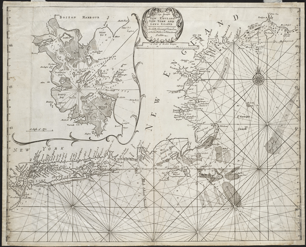
The 1749 pirated Dublin edition of The English Pilot, The Fourth Book included these two relatively rare charts showing the New England coast. Although the charts in the Dublin edition resemble those in the London edition of The English Pilot, they were entirely re-engraved. The chart displayed here focuses on the New England coast from the Hudson River to the Penobscot River. It also includes an inset of Boston Harbor. The other chart, which was drawn at a smaller scale, delineates the entire northeastern coast from the Chesapeake Bay north to the Gulf of Saint Lawrence and Newfoundland.
- Creator:
- Grierson, George, d. 1753
- Date:
-
[1749]
- Format:
-
Maps/Atlases
- Location:
- Private Collection
- Collection (local):
-
Mapping Boston Collection
- Subjects:
-
Nautical charts--Northeastern States--Early works to 1800
Northeastern States--Maps--Early works to 1800
Boston Harbor (Mass.)--Maps--Early works to 1800
Long Island (N.Y.)--Maps--Early works to 1800
- Places:
-
Boston Harbor
Northeastern United States (area)
Long Island (island)
- Extent:
- 1 chart ; 44 x 55 cm.
- Permalink:
- https://ark.digitalcommonwealth.org/ark:/50959/3f462v13t
- Terms of Use:
-
No known copyright restrictions.
This work is licensed for use under a Creative Commons Attribution Non-Commercial Share Alike License (CC BY-NC-SA).


