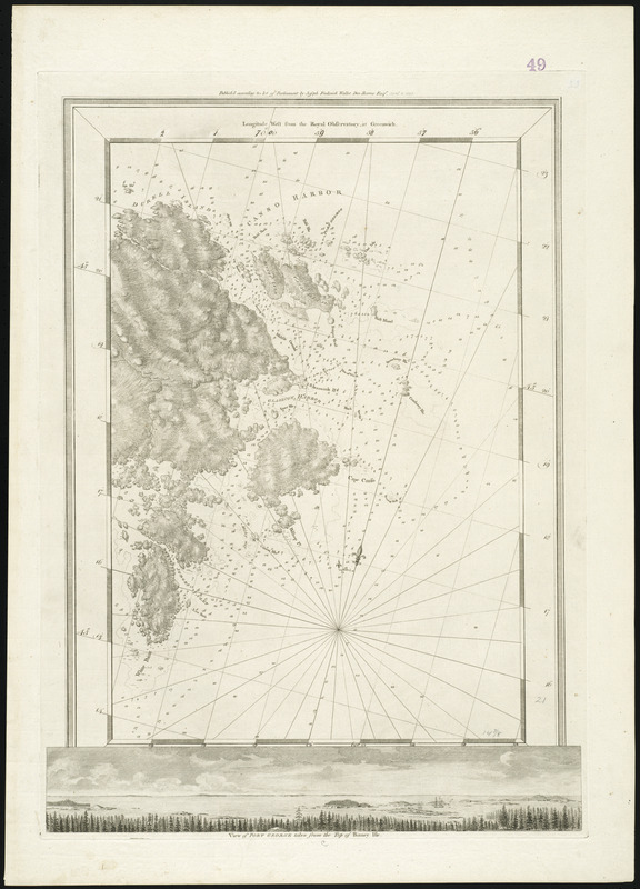
Chart of eastern Nova Scotia, from Durrell Island to Little Dover (White) Island.
Depths shown by soundings.
Oriented with north toward the upper right.
Inset: "View of Port George taken from the top of Binney Isle."
Longitude errors are erased and corrected in manuscript.
Manuscript longitude label above map incorrect.
Accompanied by sailing directions for Canso Harbour and St. Peter's Bay.
Appears in the author's Atlantic Neptune. London : J.F.W. Des Barres, 1777-[1781].