Skip to search
Skip to main content
Skip to first result
Digital Commonwealth
Folders
Sign Up / Log In
Search for
Search
Search
Search
Basic
Advanced
Explore
Map
Collections
Institutions
Formats
For Educators
Primary Source Sets
Lesson Plans
Using Primary Sources
Searching Digital Commonwealth
For Institutions
Join Digital Commonwealth
Conferences, Trainings, & Events
How to Contribute Collections
Digitization Services
Board & Committees
Frequently Asked Questions
About
About Digital Commonwealth
News & Announcements
Copyright & Terms of Use
Harmful Content Statement
Partners
API
Contact Us
Search
Search Constraints
Start Over
Save Search
Your search:
boston harbor ships
✖
Remove constraint boston harbor ships
« Prev.
|
201
-
300
of
12,392
|
Next »
Sort
by date (asc)
relevance
title
date (asc)
date (desc)
Number of results to display per page
100
per page
per page
10
per page
20
per page
50
per page
100
per page
View results as:
List
list view
Maps
map view
Gallery
grid view
Search Results
201.
Jamaica, from the latest surveys
202.
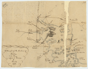
Manuscript map of the Boston Harbor, 1775
203.
Milford Haven : the head of ye Bay ... boats
204.
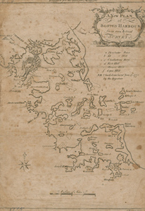
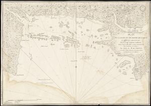
A New Plan of Boston Harbour from an Actual Survey
205.
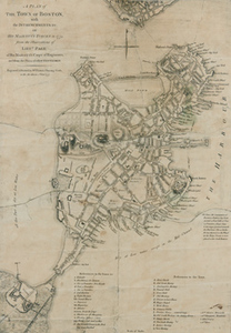
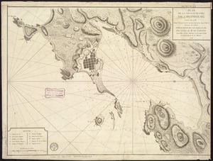
A plan of the town and chart of the harbour of Boston exhibiting a view of the islands, castle forts, and entrances into the...
206.
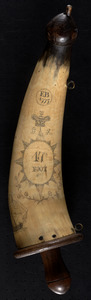
Powder horn with map of Boston and Charlestown, 1777
207.
Ruatan or Rattan
208.
The Seat of war, in New England
209.
The seat of war in New England, by an American volunteer : with the marches of the several corps sent by the Colonies towards...
210.
Situations plan der Englischen Armée vor und um Boston nebst der stellung der Americaner
211.
A sketch of the action between the British forces and the American provincials, on the heights of the peninsula of Charlestown,...
212.
A view of part of the town of Boston in New England and Brittish ships of war landing their troops, 1768
213.
Letter from Peter Brown to Sarah Brown, 25 June 1775
214.
[A chart of Boston Bay and vicinity]
215.
Barrington Bay
216.
Bowles's map of the seat of war in New England, comprehending the provinces of Massachusets Bay, and New Hampshire : with the...
217.
Carte du port et havre de Boston avec les côtes adjacentes, dans laquel on a tracée les camps et les retranchemens occupé,...
218.
Carte du port et havre de Boston avec les côtes adjacentes, dans laquel on a tracée les camps et les retranchemens occupé,...
219.
Carte von dem Hafen und der Stadt Boston : mit den umliegenden Gegenden und der Lägern sowohl der Americaner als auch des...
220.
A chart of Boston Bay and vicinity
221.
A chart of Boston Bay and vicinity
222.
A chart of Delaware Bay and River, containing a full and exact description of the shores, creeks, harbours, soundings, shoals,...
223.
Chart of the entrance of Hudson's River, from Sandy Hook to New York, with the banks, depths of water, sailing-marks, & ca
224.
A chart of the Harbour of Boston, with the soundings, sailing-marks, and other directions
225.
Coast of Maine from Frenchman Bay to Mosquito Harbor
226.
[Coast of Maine from Frenchman Bay to Mosquito Harbor]
227.
Coast of Maine from Rockland Harbor to Pemaquid Point
228.
Coast of Maine from Rockland Harbor to Pemaquid Point
229.
[Coast of New England from Chatham Harbor to Naragansett Bay]
230.
Frederick Bay ... : Ramsheg Harbour ... Pictou Harbour ... Port Luttrell
231.
Die gegend um Boston
232.
Halifax Harbour ... Catch Harbour ... small vessels only
233.
Manuscript map of Boston and Boston Harbor, 1776
234.
A map of the most inhabited part of New England, containing the provinces of Massachusets Bay and New Hampshire, with the...
235.
[Plan d'Amboy : vues de la rade de Charles-Town et de Fort Sulivan, mai 1780]
236.
A Plan of Boston, and its Environs shewing the true Situation of His Majesty's Army
237.
A plan of the attack of Fort Sulivan, near Charles Town in South Carolina : by a squadron of His Majesty's ships, on the 28th...
238.
Port Campbell
239.
Port Mills : Port Mansfield ; Gambier Harbour
240.
[Port Shediack and Cocagne]
241.
Sandwich Bay ... low water
242.
Spry Harbour : Port Pallisser ; Port North ; Port Parker ; Beaver Harbour ; Fleming River
243.
A view of Boston taken on the road to Dorchester
244.
White Islands Harbour : Port Stephen's ; Liscomb Harbour ; Houlton Harbour ; River St. Mary
245.
Account of damages done to Jonathan Green during the Siege, [7 May 1776]
246.
Estimate of damages done during the Siege, list by Jonathan Green, 7 May 1776
247.
News from America, or the patriots in the dumps
248.
Boston, its environs and harbour, with the rebel works raised against that town in 1775 : from the observations of Lieut. Page...
249.
Boston, seen between Castle Williams and Governor's Island, distant 4 miles : Appearance of the high lands of Agameticus, N.E....
250.
Carte des environs de Boston, capitale de la Nlle. Angleterre en Amerique
251.
A Chart of the Harbour of Boston, with the Soundings, Sailing-marks, and other Directions
252.
Liverpool Bay
253.
A map of the most inhabited part of New England containing the provinces of Massachusets Bay and New Hampshire with the...
254.
A Plan of the Town of Boston, with the Intrenchments &c. of His Majestys Forces in 1775
255.
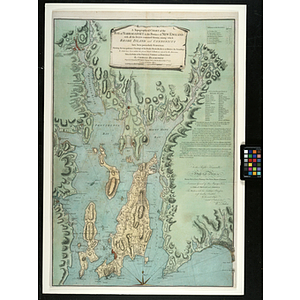
A Topographical Chart of the Bay of Narraganset in the Province of New England : with all the Isles contained therein, among...
256.
A view from the south eastward of Halifax Harbor : Appearance of the shore, (at three miles off,) four or five leagues to the...
257.
View of Cape Egmont and winter Rock from the eastward : Entrance of Egmont Harbor ; The entrance of Keppel Harbor, 10 leagues...
258.
A view of Port Hood, sailing into the harbor : A view of the Plaister Cliffs, in George's Bay
259.
Carte de la Baye et Riviere de Délaware : contenant une éxacte et entiére description des rivages, criques, havres, sondes,...
260.
Le Colonie Unite dell' America Settentr'le di nuova projezione a ss. ee. li signori riformatori dello studio di Padova : con...
261.
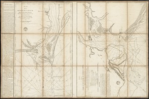
The course of Delaware River from Philadelphia to Chester, exhibiting the several works erected by the rebels to defend its...
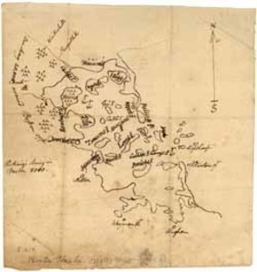
262.
The harbours of Rishibucto & Buctush : on the west shore of the Gulph of St. Lawrence
263.
Plan de Boston avec les sondes et les directions pour la navigation : traduit de l'anglais
264.
Plan de la rivière du Cap Fear depuis la barre jusques à Brunswick
265.
A plan of the action at Bunkers Hill, on the 17th. of June, 1775 : between His Majesty's troops under the command of Major...
266.
A plan of the action at Bunkers Hill, on the 17th. of June, 1775 : between His Majesty's troops under the command of Major...
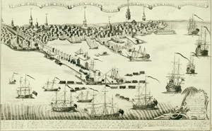
267.
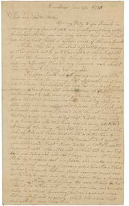
[Coast of New England from York Harbor to North Beach]
268.
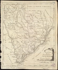
A New and accurate map of the province of South Carolina in North America
269.
Plan de la baie et du havre de Casco et des îles adjacentes
270.
Plan de la ville et du port de Louisbourg levé en 1756
271.
A plan of Quebec and environs, with its defences and the occasional entrenched camps of the French commanded by Marquis de...
272.
A view of Boston
273.
Boston et ses environs
274.
Carte particuliere du havre de Boston : avec les sondes les bancs de Sable, les rochers les Amaies et les autres directions...
275.
Carte particuliere du havre de Boston : avec les sondes les bancs de Sable, les rochers les Amaies et les autres directions...
276.
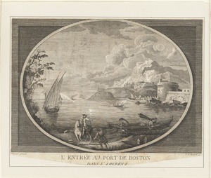
L'entrée au Port de Boston, dans L'Amérique
277.
Fish fags
278.
French prisoners on board an English ship
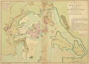
279.
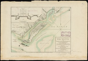
Hafen von Boston
280.
West Indies, : with the harbour & fort of Omoa. From the best authorities
281.
Appearance of the land from the White Islands to St. Marys River taken two leagues off shore : The entrance of Milford Haven at...
282.
Chart and plan of the harbour of New York & the couny. adjacent, from Sandy Hook to Kingsbridge, comprehending the whole of New...
283.
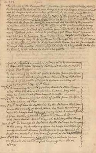
A chart of Port Royal and Kingston Harbours, in the island of Jamaica
284.
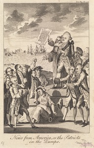
A chart of the harbour of Boston
285.
The coast of New England
286.
The coast of New England
287.
[Coast of New England from Chatham Harbor to Naragansett Bay]
288.
Coast of New Hampshire and Massachusetts from Great Boars Head to Marblehead Harbor
289.
Coast of New Hampshire and Massachusetts from Great Boars Head to Marblehead Harbor
290.
Halifax Harbour ... Catch Harbour ... small vessels only
291.
A plan of the town of Newport in the province of Rhode Island
292.
Port Mills : Port Mansfield ; Gambier Harbour
293.
A new and exact plan of the cities of London and Westminster & the borough of Southwark to this present year, exhibiting in a...
294.
Various plans and draughts of cities, towns, harbours &c. drawn from the latest authorities
295.
The West Indian atlas [frontispiece] : or, a general description of the West Indies
296.
Carte des Etats-Unis de l'Amerique suivant le Traité de Paix de 1783
297.
Commanders engaged at sea
298.
Remarques sur la navigation de terre-neuve à New-York afin d'eviter les courrants et les bas-fonds au sud de Nantuckett et du...
299.
Remarques sur la navigation de terre-neuve à New-York afin d'eviter les courrants et les bas-fonds au sud de Nantuckett et du...
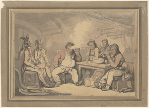
300.
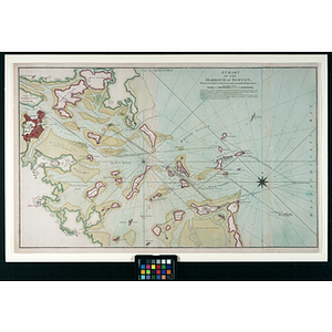
A sketch of Charleston Harbour : shewing the disposition of the British fleet under the command of Vice Adml. Mariot Arbuthnot...
« Previous
Next »
1
2
3
4
5
6
7
…
123
124
Limit your search
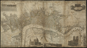
Subject
Ships
2,011
Harbors
1,652
Sailing ships
1,534
Boats
1,021
Piers & wharves
930
Naval yards & naval stations
853
Constitution (Frigate)
744
Boat & ship industry
487
more
Subject
»
Place
North and Central America
7,298
United States
6,941
Massachusetts
5,112
Suffolk (county)
2,915
Boston
2,635
Essex (county)
958
Boston Harbor
681
Newburyport
641
more
Place
»
Format
Photographs
8,378
Maps/Atlases
1,365
Postcards/Cards
981
Prints
796
Manuscripts
237
Letters/Correspondence
215
Ephemera
154
Paintings
134
more
Format
»
Available to use
No known restrictions
3,577
Creative Commons license
2,041
Date
View distribution
Current results range from
1460
to
2019
Date range begin
Date range end
View larger »
Unknown
344
Collection
Leslie Jones Collection
3,104
Norman B. Leventhal Map Center Collection
821
Press Photography from the Brearley Collection
740
Tichnor Brothers Postcard Collection
739
Bill Lane Photograph Collection
634
Boston Pictorial Archive (Collection of Distinction)
480
Mass. Memories Road Show
470
Maritime Charts and Atlases (Collection of Distinction)
399
more
Collection
»
Institution
Boston Public Library
8,468
Newburyport Public Library
634
University of Massachusetts Boston, Joseph P. Healey Library
501
Historic New England
409
Northeastern University Library
406
Massachusetts Archives
337
National Archives at Boston
201
Griffin Museum of Photography
130
more
Institution
»


![[A chart of Boston Bay and vicinity]](https://bpldcassets.blob.core.windows.net/derivatives/images/commonwealth:cj82m2976/image_thumbnail_300.jpg)


![[Coast of Maine from Frenchman Bay to Mosquito Harbor]](https://bpldcassets.blob.core.windows.net/derivatives/images/commonwealth:cj82m295n/image_thumbnail_300.jpg)


![[Coast of New England from Chatham Harbor to Naragansett Bay]](https://bpldcassets.blob.core.windows.net/derivatives/images/commonwealth:7h149x27g/image_thumbnail_300.jpg)


![[Port Shediack and Cocagne]](https://bpldcassets.blob.core.windows.net/derivatives/images/commonwealth:ws859h35r/image_thumbnail_300.jpg)


![Account of damages done to Jonathan Green during the Siege, [7 May 1776]](https://bpldcassets.blob.core.windows.net/derivatives/metadata/commonwealth-oai:2r36wb49q/image_thumbnail_300.jpg)


![A map of the most inhabited part of New England containing the provinces of Massachusets Bay and New Hampshire with the colonies of Connecticut and Rhode Island divided into counties and townships the w[h]ole composed from actual surveys and its situation adjusted by astronomical observations](https://bpldcassets.blob.core.windows.net/derivatives/images/commonwealth:6t053p316/image_thumbnail_300.jpg)


![[Coast of New England from York Harbor to North Beach]](https://bpldcassets.blob.core.windows.net/derivatives/images/commonwealth:7h149z874/image_thumbnail_300.jpg)


![[Coast of New England from Chatham Harbor to Naragansett Bay]](https://bpldcassets.blob.core.windows.net/derivatives/images/commonwealth:7h149z37x/image_thumbnail_300.jpg)


![The West Indian atlas [frontispiece]](https://bpldcassets.blob.core.windows.net/derivatives/images/commonwealth:3f462x83x/image_thumbnail_300.jpg)