A plan of the town of Newport in the province of Rhode Island
A plan of the town of Newport in the province of Rhode Island
Item Information
Title:
A plan of the town of Newport in the province of Rhode Island
Description:
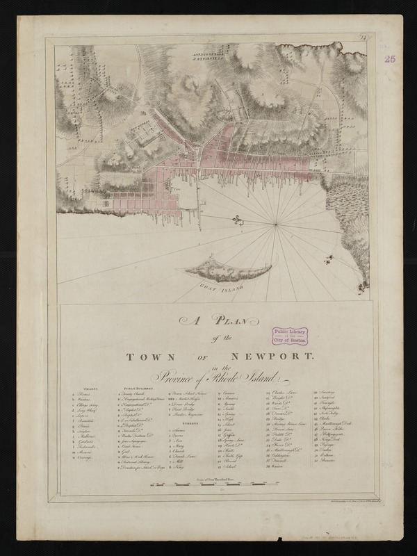
Unique among colonial settlements, Newport, R.I. embraced the notions of religious tolerance and social service, and became one of the five largest cities in British North America. An economy built upon shipbuilding, the maritime trades, and agriculture allowed the town to grow into an important harbor where raw materials entered and finished products were exported. This 1781 chart lists the numerous places of interest in the town, including wharves, public buildings, places of worship and streets. Newport merchants increasingly smuggled goods in and out of Narragansett Bay to evade paying taxes, and this lawlessness led to the stationing of the ship Gaspee II in the Bay, to monitor the flow of goods.
Relief shown by hachures and shading.
Includes indexes to wharfs, public buildings, and streets.
Plate number "*14" engraved in small oval in the upper right margin.
From the author's Atlantic Neptune.
Notes (exhibitions):
Exhibited: "Charting an Empire: The Atlantic Neptune" organized by the Norman B. Leventhal Map Center at the Boston Public Library, 2013.