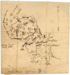
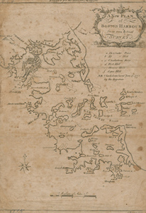
This manuscript map shows the shape of Boston, Boston Harbor, and the islands during the Siege. It also depicts the south shore to Hingham and includes the locations of ships, army encampments, and a lighthouse. A statement on the map conveys information about the size of the troops involved in the Siege of Boston: "The King's Army in Boston 8000. Our army 20,000 around Boston 1776."
Item from the collections of the Massachusetts Historical Society. Image use and licensing information: www.masshist.org/library/permissions
Contact host institution for more information.