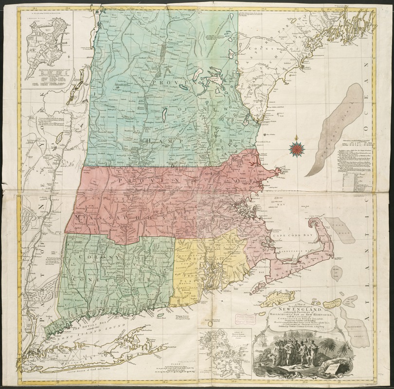
A map of the most inhabited part of New England, containing the provinces of Massachusets Bay and New Hampshire, with the colonies of Connecticut and Rhode Island, divided into counties and townships, the whole composed from actual surveys and its situation adjusted by astronomical observations
A map of the most inhabited part of New England, containing the provinces of Massachusets Bay and New Hampshire, with the colonies of Connecticut and Rhode Island, divided into counties and townships, the whole composed from actual surveys and its situation adjusted by astronomical observations
Item Information
Title:
A map of the most inhabited part of New England, containing the provinces of Massachusets Bay and New Hampshire, with the colonies of Connecticut and Rhode Island, divided into counties and townships, the whole composed from actual surveys and its situation adjusted by astronomical observations
Relief shown pictorially.
Hand colored.
Prime meridian: London and Ferro.
Includes compilation data and insets of "A plan of the town of Boston" and "A plan of Boston Harbor from an accurate survey," ca. 1:150,000.