Skip to search
Skip to main content
Skip to first result
Digital Commonwealth
Folders
Sign Up / Log In
Search for
Search
Search
Search
Basic
Advanced
Explore
Map
Collections
Institutions
Formats
For Educators
Primary Source Sets
Lesson Plans
Using Primary Sources
Searching Digital Commonwealth
For Institutions
Join Digital Commonwealth
Conferences, Trainings, & Events
How to Contribute Collections
Digitization Services
Board & Committees
Frequently Asked Questions
About
About Digital Commonwealth
News & Announcements
Copyright & Terms of Use
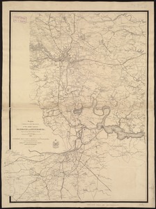
Harmful Content Statement
Partners
API
Contact Us
Search
Search Constraints
Start Over
Save Search
Your search:
More Like
commonwealth:ht2503558
✖
Remove constraint More Like: commonwealth:ht2503558
« Prev. |
1
-
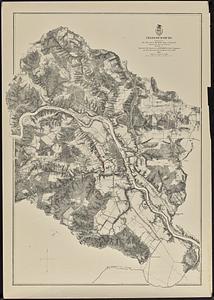
100
of
11,011
|
Next »
Sort
by relevance
relevance
title
date (asc)
date (desc)
Number of results to display per page
100
per page
per page
10
per page
20
per page
50
per page
100
per page
View results as:
List
list view
Maps
map view
Gallery
grid view
Search Results
1.
Bacon's Map of the seat of war in Virginia : showing minutely the interesting localities in the vicinity of Richmond
2.
Bacon's military map of the United States shewing the forts & fortifications
3.
Bacon's steel plate map of the American states north & south : showing the railways , forts, and fortifications
4.
Birds eye view of the Mississippi Valley from Cairo to the Gulf of Mexico
5.
Civil War centennial
6.
Colton's new railroad & county map of the United States, the Canadas &c
7.
The country round Washington : the Chesapeake and the Potomac
8.
Forbes' new and complete map of Richmond and its fortifications
9.
Frank Leslie's war maps and companion to the newspaper
10.
H.H. Lloyd & Co's campaign military charts showing the principal strategic places of interest
11.
Historical sketch of the rebellion
12.
The historical war map
13.
J.H. Colton's Topographical map of seat of war in Virginia, Maryland, &c
14.
Lloyd's new county map of the United States and Canadas showing battle fields, railroads, &c., compiled from the latest...
15.
Lloyd's new military map of the border & southern states
16.
Lloyd's new military map of the border & southern states
17.
Lloyd's new military map of the border & southern states
18.
Map illustrating the military operations in front of Atlanta, Ga : from the passage of Peach Tree Creek, July 19th, 1864, to...
19.
Map of southeastern portion of United States showing the location of battles in the Civil War 1861-1865
20.
Map of the seat of war : to accompany the American Conflict
21.
Map of the seat of war : containing a map of the vicinity of Washington, Baltimore, Harper's Ferry and Annapolis, with five...
22.
Map of the Southern States, showing the relative proportion of slaves in the different localities
23.
Military map of the middle and southern states showing the seat of war during the great rebellion in 1861
24.
Military map of the United States & territories showing the location of the military posts, arsenals, Navy yards, & ports of...
25.
Military map of the United States & territories showing the location of the military posts, arsenals, Navy Yards, & ports of...
26.
Military map showing the marches of the United States forces under command of Maj. Genl. W.T. Sherman, U.S.A. during the years...
27.
Military map showing the topographical features of the country adjacent to Harper's Ferry, Va : including Maryland, Loudoun,...
28.
The model war map giving the southern & middle states, with all their water & railroad connections
29.
Monitor map, showing the whole seacoast from Chesapeake Bay, down to Savannah harbor, and the whole country between Richmond &...
30.
Our Nation's Heroes
31.
Perrine's new topographical war map of the southern states : taken from the latest government surveys and official reports
32.
Plan of the western seat of war
33.
Region embraced in the operations of the armies against Richmond and Petersburg
34.
Richmond Petersburg and vicinity
35.
Richmond Petersburg and vicinity
36.
Route of the late expedition commanded by Act'g Rear Admiral D.D. Porter U.S.N. attempting to get into the Yazoo River by the...
37.
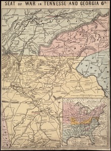
Seat of war in Tennesse and Georgia : 6D
38.
Seat of war in Virginia
39.
Seat of war in Virginia and Maryland
40.
Siege operations at Spanish Fort, Mobile Bay : by the U.S. forces under Maj. Gen. Canby. Captured by the Army of West Miss. on...
41.
War maps and diagrams
42.
What the administration has done : map showing the progress of the national armies during the years 1861, 1862, 1863, and 1864
43.
Wyld's military map of the United States, the northern states, and the southern Confederate states : with the forts, harbours,...
44.
Antietam
45.
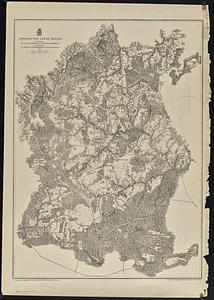
Appomattox Court House
46.
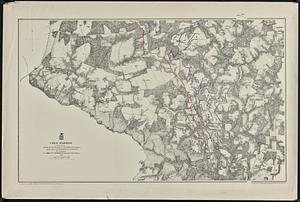
Cold Harbor
47.
Corinth, and the scene of the great Battle at Pittsburgh, Tenn. [graphic]
48.
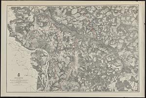
Fredericksburg
49.
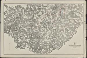
Harper's Ferry
50.
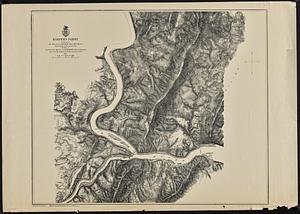
Petersburg and Five Forks
51.
Richmond
52.
Spottsylvania Court House
53.
Totopotomoy
54.
War telegram marking map
55.
The Wilderness
56.
The 100th anniversary map of Abraham Lincoln's visit to Massachusetts, September 11-23, 1848
57.
1630 shoreline
58.
1879. Progress map of the U.S. Geographical Surveys west of the 100th Meridian : prepared under the direction of 1st Lieut....
59.
1903 Map of Salem and surrounding places
60.
19th annual convention of the National Association of Real Estate Boards : at Tulsa, June 7 to June 11 in 1926
61.
2005 significant U.S. hurricane strikes
62.
227 Harzgerode
63.
305 Glatz
64.
38,000,000 escaped -- 10,000,000 died
65.
4 Kinten
66.
660 Wakulah St., Roxbury
67.
[A chart of Boston Bay and vicinity]
68.
[A chart of New York Island & North River : East River, passage through Hell Gate, Flushing Bay, Hampstead Bay, Oyster,...
69.
The A.A.A. key road map of continental Europe
70.
Aaron Bohrod's America, its history
71.
ABC pathfinder railway guide map : eastern division
72.
Aboriginal map of North America, denoting the boundaries and the locations of various Indian tribes
73.
Acapulco, México
74.
Accurata delineatio Castrorum Suecicorum, ut et Haffniae, Regni Daniae Metropolis
75.
Accurata delineatio oppugnatae a faederatis, Caesareis, Polonicis, Danicis, et Brandeburgicis copijs sub-ductu Seren: Electoris...
76.
Accurata delineatio regionis circa Nieburgum Fioniæ cum prælio ibi commisso inter Danorum et fæderatorum exercitum ab una et...
77.
Accurata Scaniae, Blekingiae et Hallandiae descriptio
78.
An accurate map of Cuba, and the adjacent islands
79.
An accurate map of Dorset Shire divided into hundreds
80.
An accurate map of Dorset Shire, divided into its hundreds
81.
An accurate map of England and Wales with the principal roads from the best authorities
82.
An accurate map of England and Wales with the principal roads from the best authorities
83.
An accurate map of Europe from the best authorities
84.
An accurate map of Hindostan or India, from the best authorities
85.
An accurate map of His Majesty's province of New-Hampshire in New England : taken from actual surveys of all the inhabited...
86.
An Accurate map of New Hampshire in New England, from a late survey
87.
An Accurate map of New York in North America, from a late survey
88.
An accurate map of North America : describing and distinguishing the British and Spanish dominions on this great continent :...
89.
An accurate map of North America : describing and distinguishing the British and Spanish dominions of this great continent;...
90.
An accurate map of North America : describing and distinguishing the British, Spanish and French dominions on this great...
91.
An accurate map of North and South Carolina with their Indian frontiers, shewing in a distinct manner all the mountains,...
92.
An accurate map of Rhode Island, part of Connecticut and Massachusets, shewing Admiral Arbuthnot's station in blocking up...
93.
An accurate map of the coast of Cape de Verde
94.
An accurate map of the Commonwealth of Massachusetts exclusive of the district of Maine : compiled pursuant to an Act of the...
95.
An accurate map of the country round Boston in New England from the best authorities
96.
An accurate map of the county of Essex, divided into its hundreds
97.
An accurate map of the district of Maine being part of the Commonwealth of Massachusetts : compiled pursuant to an act of the...
98.
An accurate map of the United States of America, with part of the surrounding provinces agreeable to the Treaty of Peace of 1783
99.
Accuratissima Brasiliae tabula
100.
Accuratissima Circuli Saxoniae tabula quae est pars septentrionalis Germaniae
« Previous
Next »
1
2
3
4
5
…
110
111
Limit your search
Subject
Real property--Massachusetts--Boston--Maps
2,278
Landowners--Massachusetts--Boston--Maps
2,117
Boston (Mass.)--Maps
1,966
Roxbury (Boston, Mass.)--Maps
351
Dorchester (Boston, Mass.)--Maps
317
Cambridge (Mass.)--Maps
266
Brookline (Mass.)--Maps
236
Real property--Massachusetts--Cambridge--Maps
216
more
Subject
»
Place
North and Central America
7,825
United States
6,444
Suffolk (county)
3,337
Boston
3,197
Massachusetts
3,167
Europe
963
Middlesex (county)
617
Canada
427
more
Place
»
Format
Maps/Atlases
10,951
Manuscripts
214
Prints
51
Books
35
Objects/Artifacts
10
Drawings/Illustrations
8
Posters
4
Documents
1
Available to use
No known restrictions
10,941
Creative Commons license
46
Date
View distribution
Current results range from
1482
to
2023
Date range begin
Date range end
View larger »
Collection
Norman B. Leventhal Map Center Collection
11,009
Boston and New England Maps (Collection of Distinction)
5,105
Urban Maps (Collection of Distinction)
4,846
Maritime Charts and Atlases (Collection of Distinction)
750
American Revolutionary War-Era Maps (Collection of Distinction)
615
Boston Redevelopment Authority Collection
86
David Judkins Weaver Papers
10
American Civil War Collection
1
more
Collection
»
Institution
Boston Public Library
11,009
Scottish Rite Masonic Museum and Library
1
State Library of Massachusetts
1


![Corinth, and the scene of the great Battle at Pittsburgh, Tenn. [graphic]](https://bpldcassets.blob.core.windows.net/derivatives/metadata/commonwealth-oai:6m3121658/image_thumbnail_300.jpg)


![[A chart of Boston Bay and vicinity]](https://bpldcassets.blob.core.windows.net/derivatives/images/commonwealth:cj82m2976/image_thumbnail_300.jpg)


