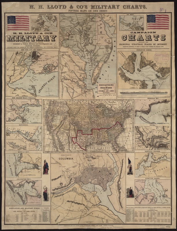
compiled from official data, by Egbert L. Viele and Charles Haskins ; Published under the auspices of the American Geographical and Statistical Society.
Annapolis Harbor
Key West
New York City and Vicinity
Chesapeake and Delaware Bays, Potomac and James rivers
Charleston Harbor
New Orleans
Mouth of Mississippi
Savannah
United States
Pensacola Bay
Cairo
Mobile Bay
Galveston Bay
District of Columbia
Norfolk Harbor
Hampton Roads.
Notes:
Relief shown by hachures.
In general, the maps indicate forts, towns, railroads, and rivers.
Includes population tables.