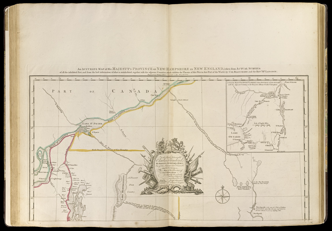
An accurate map of His Majesty's province of New-Hampshire in New England : taken from actual surveys of all the inhabited part, and from the best information of what is uninhabited, together with the adjacent countries, which exhibits the theatre of this war in that part of the world
An accurate map of His Majesty's province of New-Hampshire in New England : taken from actual surveys of all the inhabited part, and from the best information of what is uninhabited, together with the adjacent countries, which exhibits the theatre of this war in that part of the world
Shows counties and townships in New Hampshire, Vermont, and Maine.
Relief shown pictorially.
Prime meridian: London.
1st state.
Inset: A general map of the River St. Lawrence above Montreal to Lake Ontario with the adjacent country on the west from Albany & Lake Champlain.
In decorative cartouche: "Dedicated to the Right Honourable Charles Townshend, His Majesty's Secretary at War."
Appears in Jefferys' General topography of North America and the West Indies. London: Printed for Robert Sayer, ... and Thomas Jefferys, 1768.
Notes (citation):
LC Maps of North America, 870
McCorkle, Barbara. New England in early printed maps, N761.1
Wheat & Brun. Maps and Charts published in America before 1800 (2nd ed.), 181