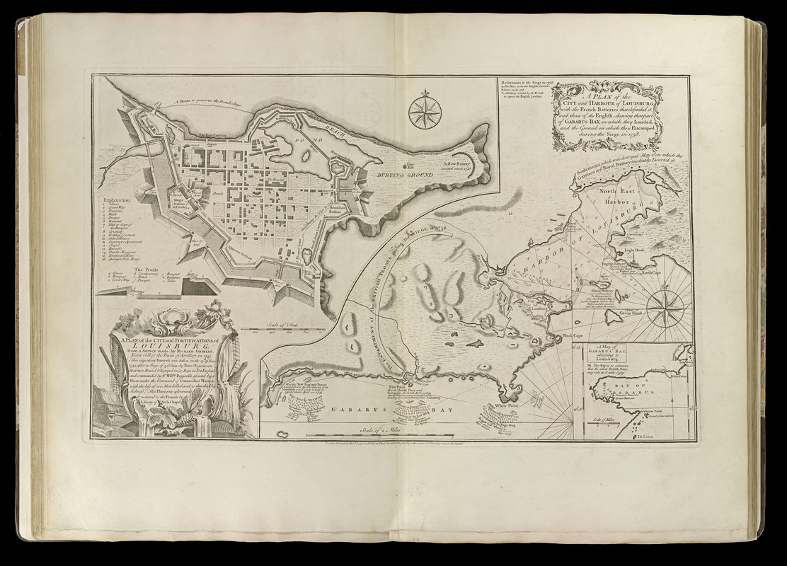
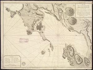
A plan of the city, and fortifications, of Louisburg : from a survey made by Richard Gridley, Lieut. Coll. of the Train of Artillery in 1745 ; a plan of the city and harbour of Louisburg, with the French batteries that defended it, and those of the English, shewing that part of Gabarus Bay, in which they landed, and the ground on which they encamped during the siege in 1758
A plan of the city, and fortifications, of Louisburg : from a survey made by Richard Gridley, Lieut. Coll. of the Train of Artillery in 1745 ; a plan of the city and harbour of Louisburg, with the French batteries that defended it, and those of the English, shewing that part of Gabarus Bay, in which they landed, and the ground on which they encamped during the siege in 1758
Item Information
Title:
A plan of the city, and fortifications, of Louisburg : from a survey made by Richard Gridley, Lieut. Coll. of the Train of Artillery in 1745 ; a plan of the city and harbour of Louisburg, with the French batteries that defended it, and those of the English, shewing that part of Gabarus Bay, in which they landed, and the ground on which they encamped during the siege in 1758
Title (alt.):
Plan of the city and harbour of Louisburg, with the French batteries that defended it, and those of the English, shewing that part of Gabarus Bay, in which they landed, and the ground on which they encamped during the siege in 1758
Relief shown by hachures. Depths shown by soundings.
Third state.
Inset: A map of Gabarus Bay, adjoyning to Louisburg.
Includes references, notes, and profile of a cross-section of the wall.
Appears in Jefferys' General topography of North America and the West Indies. London: Printed for Robert Sayer, ... and Thomas Jefferys, 1768.
Notes (date):
This date is inferred.
Notes (citation):
Stevens & Tree. Comparative cartography, 27c
Kershaw, K. Early printed maps of Canada, v. III, 908
Phillips, 1196