Skip to search
Skip to main content
Digital Commonwealth
Sign Up / Log In
Search for
Search
Search
Search
Basic
Advanced
Explore
Map
Collections
Institutions
Formats
For Educators
Primary Source Sets
Lesson Plans
Using Primary Sources
Searching Digital Commonwealth
For Institutions
Join Digital Commonwealth
Conferences, Trainings, & Events
How to Contribute Collections
Digitization Services
Board & Committees
Frequently Asked Questions
About
About Digital Commonwealth
News & Announcements
Copyright & Terms of Use
Harmful Content Statement
Partners
API
Contact Us
Boston Public Library
Norman B. Leventhal Map Center Collection
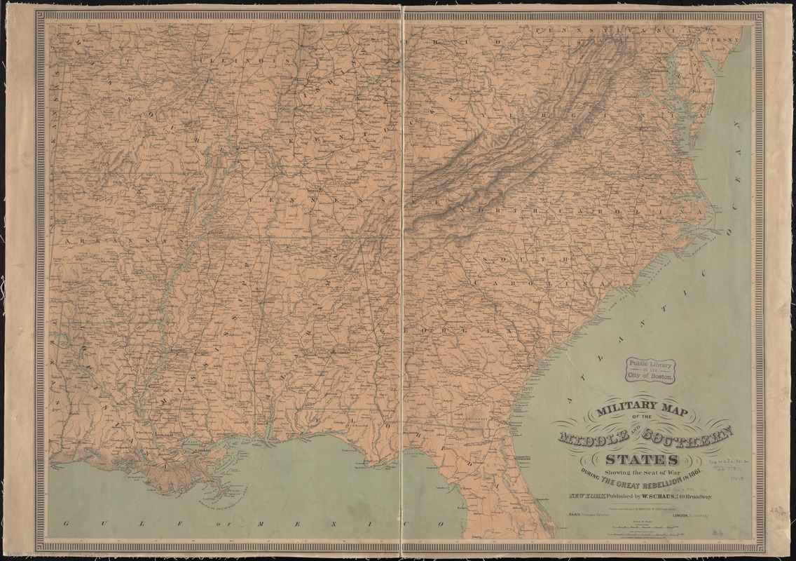
Military map of the middle and southern states showing the seat of war during the great rebellion in 1861
Military map of the middle and southern states showing the seat of war during the great rebellion in 1861
×
Item Information
Title:
Military map of the middle and southern states showing the seat of war during the great rebellion in 1861
Creator:
Schedler, J. (Joseph)
Name on Item:
drawn and engr. by J. Schedler.
Date:
[1860?–1869?]
Format:
Maps/Atlases
Location:
Boston Public Library
Norman B. Leventhal Map Center
Collection (local):
Norman B. Leventhal Map Center Collection
Subjects:
Southern States--Maps
United States--History--Civil War, 1861-1865--Maps
Places:
Southern United States
(area)
Extent:
1 map : col. ; 59 x 80 cm.
Permalink:
https://ark.digitalcommonwealth.org/ark:/50959/9s161c82r
Terms of Use:
No known copyright restrictions.
No known restrictions on use.
Publisher:
New York; Paris; London : W. Schaus; Francois Delarue; H. Graves & Co.
Scale:
Scale [ca. 1:2,370,000]
Language:
English
Notes:
General map of the southeastern states showing roads, railroads, cities and towns, rivers, state boundaries, and relief by hachures.
Description derived from published bibliography.
Identifier:
hdl:loc.gmd/g3701s.cw0017400
06_01_008753
Call #:
G3861.S5 1861 .S34
Barcode:
39999065656314
LCCN:
99447052
show more...
View MODS XML
More Like This
Lloyd's new military map of the border & southern states
Map of the Southern States, showing the relative proportion of ...
Perrine's new topographical war map of the southern states : taken ...
Colton's rail road and county map of the Southern States ...
Find More Like This >>
Tools
Share
Facebook
Pinterest
X
Reddit
Tumblr
Email
Copy link
Add to Folder
Questions/Comments
Cite This Item
IIIF Manifest
Downloads
Primary (full resolution, uncompressed)
(TIF, 90.6 MB)
Large (full resolution)
(JPEG, 7.61 MB)
Medium
(JPEG, 362 KB)
GeoTIFF (georeferenced)
(TIF, 108 MB)