Skip to search
Skip to main content
Skip to first result
Digital Commonwealth
Folders
Sign Up / Log In
Search for
Search
Search
Search
Basic
Advanced
Explore
Map
Collections
Institutions
Formats
For Educators
Primary Source Sets
Lesson Plans
Using Primary Sources
Searching Digital Commonwealth
For Institutions
Join Digital Commonwealth
Conferences, Trainings, & Events
How to Contribute Collections
Digitization Services
Board & Committees
Frequently Asked Questions
About
About Digital Commonwealth
News & Announcements
Copyright & Terms of Use
Harmful Content Statement
Partners
API
Contact Us
Search
Search Constraints
Start Over
Save Search
Your search:
More Like
commonwealth:x633fc32v
✖
Remove constraint More Like: commonwealth:x633fc32v
« Prev. |
1
-
100
of
11,002
|
Next »
Sort
by relevance
relevance
title
date (asc)
date (desc)
Number of results to display per page
100
per page
per page
10
per page
20
per page
50
per page
100
per page
View results as:
List
list view
Maps
map view
Gallery
grid view
Search Results
1.
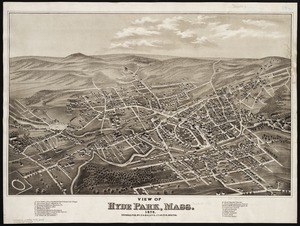
View of Hyde Park, Mass., 1879
2.
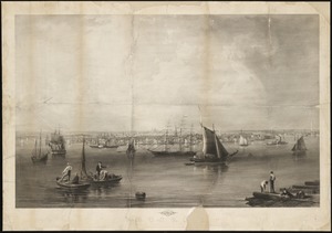
Ausicht von Boston : nach der natur aufgenommen
3.
Balloon view, Cape Ann to Boston
4.
Balloon view Provincetown to Boston
5.
Balloon view--Boston Harbor
6.
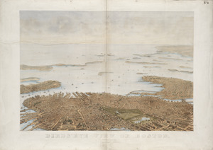
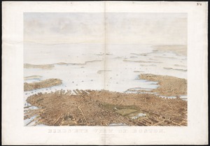
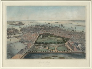
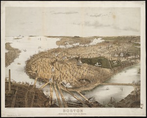
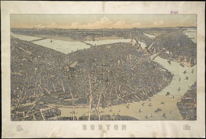
Bird's eye view of Boston
7.
Bird's eye view of Boston
8.
Bird's eye view of Boston
9.
Bird's eye view of Boston
10.
[Bird's-eye view of Boston]
11.
Bird's-eye view of Boston and its environs
12.
Birds-eye view of Boston and vicinity : showing the outlying towns and villages and railroad communications
13.
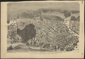
Bird's-eye view of Boston, showing the burned district
14.
Bird's-eye view of Boston, showing the burned district
15.
Bird's-eye view of Boston, United States
16.
Boston : bird's-eye view from the north
17.
Boston : 1899
18.
Boston
19.
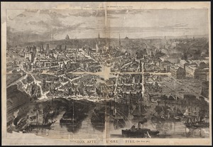
Boston after the great fire
20.
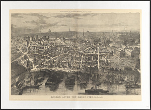
Boston after the great fire
21.
Boston Highlands, Massachusetts : Wards 19, 20, 21 & 22 of Boston
22.
Boston proper
23.
The City of Boston : 1879
24.
The city of Boston
25.
The City of Boston : 1879
26.
The city of Boston : 1879
27.
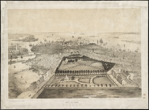
The embankment and park on Charles River Bay
28.
Environs of Boston, from Corey's Hill, Brookline, Mass
29.
General unsicht von Boston and der Bogelschau mit Bezeichnung des abgebrannten Stadttheiles : = Bird's eye view of Boston,...
30.
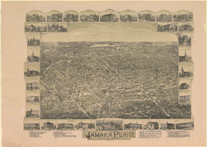
Jamaica Plain, Massachusetts : Ward 23, City of Boston, 1891
31.
Mattapan, Massachusetts, 1890
32.
New Boston and Charles River Bay
33.
Outline key to Richardson's view of the environs of Boston from Corey's Hill, Brookline
34.
Panoramic view from Bunker Hill Monument
35.
Perspective view of Bunker Hill Monument
36.
A Scott-Map of Boston, Massachusetts
37.
Twentieth century Boston
38.
View of Boston, July 4th 1870
39.
Boston Harbor : challenges and opportunities for the 1980's
40.
Jamaica Plain, Massachusetts: Ward 2, city of Boston
41.
View of Boston, July 4th 1870
42.
The 100th anniversary map of Abraham Lincoln's visit to Massachusetts, September 11-23, 1848
43.
1630 shoreline
44.
1879. Progress map of the U.S. Geographical Surveys west of the 100th Meridian : prepared under the direction of 1st Lieut....
45.
1903 Map of Salem and surrounding places
46.
19th annual convention of the National Association of Real Estate Boards : at Tulsa, June 7 to June 11 in 1926
47.
2005 significant U.S. hurricane strikes
48.
227 Harzgerode
49.
305 Glatz
50.
38,000,000 escaped -- 10,000,000 died
51.
4 Kinten
52.
660 Wakulah St., Roxbury
53.
[A chart of Boston Bay and vicinity]
54.
[A chart of New York Island & North River : East River, passage through Hell Gate, Flushing Bay, Hampstead Bay, Oyster,...
55.
The A.A.A. key road map of continental Europe
56.
Aaron Bohrod's America, its history
57.
ABC pathfinder railway guide map : eastern division
58.
Aboriginal map of North America, denoting the boundaries and the locations of various Indian tribes
59.
Acapulco, México
60.
Accurata delineatio Castrorum Suecicorum, ut et Haffniae, Regni Daniae Metropolis
61.
Accurata delineatio oppugnatae a faederatis, Caesareis, Polonicis, Danicis, et Brandeburgicis copijs sub-ductu Seren: Electoris...
62.
Accurata delineatio regionis circa Nieburgum Fioniæ cum prælio ibi commisso inter Danorum et fæderatorum exercitum ab una et...
63.
Accurata Scaniae, Blekingiae et Hallandiae descriptio
64.
An accurate map of Cuba, and the adjacent islands
65.
An accurate map of Dorset Shire divided into hundreds
66.
An accurate map of Dorset Shire, divided into its hundreds
67.
An accurate map of England and Wales with the principal roads from the best authorities
68.
An accurate map of England and Wales with the principal roads from the best authorities
69.
An accurate map of Europe from the best authorities
70.
An accurate map of Hindostan or India, from the best authorities
71.
An accurate map of His Majesty's province of New-Hampshire in New England : taken from actual surveys of all the inhabited...
72.
An Accurate map of New Hampshire in New England, from a late survey
73.
An Accurate map of New York in North America, from a late survey
74.
An accurate map of North America : describing and distinguishing the British and Spanish dominions on this great continent :...
75.
An accurate map of North America : describing and distinguishing the British and Spanish dominions of this great continent;...
76.
An accurate map of North America : describing and distinguishing the British, Spanish and French dominions on this great...
77.
An accurate map of North and South Carolina with their Indian frontiers, shewing in a distinct manner all the mountains,...
78.
An accurate map of Rhode Island, part of Connecticut and Massachusets, shewing Admiral Arbuthnot's station in blocking up...
79.
An accurate map of the coast of Cape de Verde
80.
An accurate map of the Commonwealth of Massachusetts exclusive of the district of Maine : compiled pursuant to an Act of the...
81.
An accurate map of the country round Boston in New England from the best authorities
82.
An accurate map of the county of Essex, divided into its hundreds
83.
An accurate map of the district of Maine being part of the Commonwealth of Massachusetts : compiled pursuant to an act of the...
84.
An accurate map of the United States of America, with part of the surrounding provinces agreeable to the Treaty of Peace of 1783
85.
Accuratissima Brasiliae tabula
86.
Accuratissima Circuli Saxoniae tabula quae est pars septentrionalis Germaniae
87.
Accuratissima Dominii Veneti in Italia, Ducatus Parmae, Placentiae, Modenae Regii Et Mantuae, Episcopatus Tridentini Tabula...
88.
Accuratissima et maxima totius Turcici Imperii tabula cum omnibus suis regionibus novissima delineatio
89.
Accuratissima principatus Cataloniae, et comitatuum Ruscinonis, et Cerretaniae descriptio
90.
An actual survey of the sea coast from New York to the I. Cape Briton : with tables of the direct and thwart courses &...
91.
Adams, Mass : 1882
92.
Adriatic
93.
The adventures of Mark Twain
94.
Aegyptus Antiqua
95.
Aerial photograph of South Boston
96.
Aerial photograph of South Boston
97.
An aerial view of New York City showing how easily the weary traveler may reach the Herald Square Hotel wherein he will find...
98.
Aero view of Canton, Mass. 1918
99.
Aero view of Lynn, Mass, 1916 : looking north
100.
Aeronautical view of the Panama Canal
« Previous
Next »
1
2
3
4
5
…
110
111
Limit your search
Subject
Real property--Massachusetts--Boston--Maps
2,278
Landowners--Massachusetts--Boston--Maps
2,117
Boston (Mass.)--Maps
1,966
Roxbury (Boston, Mass.)--Maps
351
Dorchester (Boston, Mass.)--Maps
317
Cambridge (Mass.)--Maps
266
Brookline (Mass.)--Maps
236
Real property--Massachusetts--Cambridge--Maps
216
more
Subject
»
Place
North and Central America
7,816
United States
6,435
Suffolk (county)
3,339
Boston
3,199
Massachusetts
3,167
Europe
963
Middlesex (county)
617
Canada
427
more
Place
»
Format
Maps/Atlases
10,943
Manuscripts
215
Prints
51
Books
35
Objects/Artifacts
10
Drawings/Illustrations
8
Posters
4
Available to use
No known restrictions
10,932
Creative Commons license
47
Date
View distribution
Current results range from
1482
to
2023
Date range begin
Date range end
View larger »
Collection
Norman B. Leventhal Map Center Collection
11,000
Boston and New England Maps (Collection of Distinction)
5,106
Urban Maps (Collection of Distinction)
4,847
Maritime Charts and Atlases (Collection of Distinction)
750
American Revolutionary War-Era Maps (Collection of Distinction)
615
Boston Redevelopment Authority Collection
87
Mapping Boston Collection
1
Other
1
Institution
Boston Public Library
11,000
Private Collection
1
State Library of Massachusetts
1


![[Bird's-eye view of Boston]](https://bpldcassets.blob.core.windows.net/derivatives/images/commonwealth:9s161d217/image_thumbnail_300.jpg)


![[A chart of Boston Bay and vicinity]](https://bpldcassets.blob.core.windows.net/derivatives/images/commonwealth:cj82m2976/image_thumbnail_300.jpg)


