Skip to search
Skip to main content
Digital Commonwealth
Sign Up / Log In
Search for
Search
Search
Search
Basic
Advanced
Explore
Map
Collections
Institutions
Formats
For Educators
Primary Source Sets
Lesson Plans
Using Primary Sources
Searching Digital Commonwealth
For Institutions
Join Digital Commonwealth
Conferences, Trainings, & Events
How to Contribute Collections
Digitization Services
Board & Committees
Frequently Asked Questions
About
About Digital Commonwealth
News & Announcements
Copyright & Terms of Use
Harmful Content Statement
Partners
API
Contact Us
Boston Public Library
Norman B. Leventhal Map Center Collection
/
Urban Maps (Collection of Distinction)
/
Boston and New England Maps (Collection of Distinction)
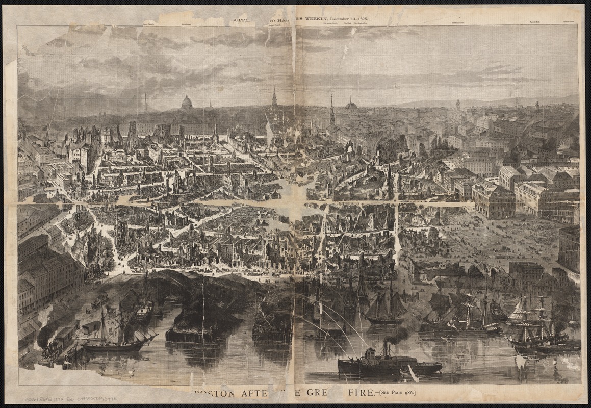
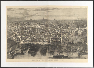
Boston after the great fire
Boston after the great fire
×
Item Information
Title:
Boston after the great fire
Date:
1872
Format:
Maps/Atlases
Location:
Boston Public Library
Norman B. Leventhal Map Center
Collection (local):
Norman B. Leventhal Map Center Collection
Subjects:
Great Fire, Boston, Mass., 1872--Aerial views
Boston (Mass.)--Aerial views
Places:
Suffolk (county)
>
Boston
Extent:
1 view ; 50 x 78 cm.
Permalink:
https://ark.digitalcommonwealth.org/ark:/50959/wd3764588
Terms of Use:
No known copyright restrictions.
No known restrictions on use.
Publisher:
S.l : [s.n.]
Scale:
Not drawn to scale.
Language:
English
Notes:
Bird's-eye view.
Appears in the Supplement to Harper's Weekly, December 14, 1872.
Identifier:
06_01_002461
Call #:
G3764.B6A3 1872 .B6
Barcode:
39999058996990
show more...
View MODS XML
More Like This
Bird's-eye view of Boston, showing the burned district
Bird's-eye view of Boston, showing the burned district
Boston after the great fire
L'incendie de Boston : plan montrant les ravages causés par ...
Find More Like This >>
Tools
Share
Facebook
Pinterest
X
Reddit
Tumblr
Email
Copy link
Add to Folder
Questions/Comments
Cite This Item
IIIF Manifest
Downloads
Primary (full resolution, uncompressed)
(TIF, 166 MB)
Large (full resolution)
(JPEG, 14 MB)
Medium
(JPEG, 405 KB)