Skip to search
Skip to main content
Skip to first result
Digital Commonwealth
Folders
Sign Up / Log In
Search for
Search
Search
Search
Basic
Advanced
Explore
Map
Collections
Institutions
Formats
For Educators
Primary Source Sets
Lesson Plans
Using Primary Sources
Searching Digital Commonwealth
For Institutions
Join Digital Commonwealth
Conferences, Trainings, & Events
How to Contribute Collections
Digitization Services
Board & Committees
Frequently Asked Questions
About
About Digital Commonwealth
News & Announcements
Copyright & Terms of Use
Harmful Content Statement
Partners
API
Contact Us
Search
Search Constraints
Start Over
Save Search
Your search:
More Like
commonwealth:hq37vv66t
✖
Remove constraint More Like: commonwealth:hq37vv66t
« Prev. |
1
-
100
of
165
|
Next »
Sort
by date (asc)
relevance
title
date (asc)
date (desc)
Number of results to display per page
100
per page
per page
10
per page
20
per page
50
per page
100
per page
View results as:
List
list view
Maps
map view
Gallery
grid view
Search Results
1.
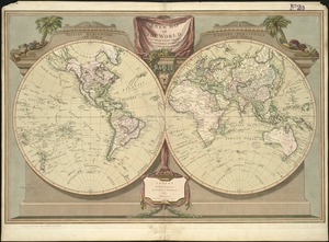
The world
2.
Unsigned and untitled T-O world map
3.
Garden of Eden
4.
Secunda etas mundi = Secunda etas mũdi
5.
Map of the Caribbean Area
6.
World map
7.
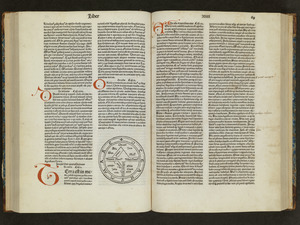
Generale Ptholemei
8.
Orbis typus uniuersalis iuxta hydrographorum traditionem
9.
Tipus orbis uniuersalis iuxta Ptolomei cosmographi traditionem et Americi Vespucii alior[um]que
10.
Praeclara Ferna[n]di Cortesii de Noua maris Oceani Hyspania Narratio . . .
11.
Small circular world map
12.
Oceani occidetalis seu terre nove tabula
13.
Oval map of the world
14.
Scandinavia
15.
Terra de Lavoratore
16.
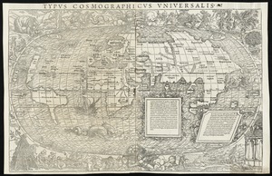
Typus cosmographicus uniuersalis
17.
Nova, et integra universi orbis descriptio
18.
Novae insulae XVII, nova tabula
19.
Carta marina nova tabula
20.
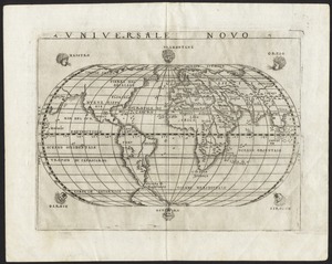
Universale novo
21.
Universalis de terrao orarium ex vera recen [...] traditione
22.
Atlantic Ocean
23.
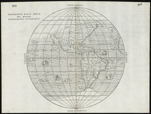
Universale della parte del mondo nuovamente ritrovata
24.
Herbipolis occidens Wurtzpurg
25.
Americae siue noui orbis, noua descriptio
26.
Quarte partie du monde
27.
La heroike enterprinse faict par le Signeur Draeck d'avoir cirquit toute la terre
28.
Pars Prima. Speculum Nauticum super navigatione maris Occidentalis confectum, continens omnes oras maritimas Gallia, Hispaniae...
29.
Americae siue noui orbis, noua descriptio
30.
Americae pars Borealis, Florida, Baccalaos, Canada, Corterealis
31.
America sive India Nova : ad magnae Gerardi Mercatoris aui universalis imitationem in compendium redacta
32.
America sive novvs orbis respectv Evropaeorvm inferior globi terrestris pars
33.
Orbis terrae compendiosa descriptio : quam ex magna universali Gerardi Mercatoris Domino Richardo Gartho, geographie ac...
34.
Typus orbis terrarum
35.
Maris Pacifici (quod vulgo Mar del Zur) cum regionibus circumiacentibus, insulisque in eodem passim sparsis, novissima descriptio
36.
Theatro del mondo di Abrahamo Ortelio : da lui poco inanzi la sua morte riueduto, & di tauole nuoue, et commenti adorno, &...
37.
Virginia et Nova Francia
38.
The north part of America : conteyning Newfoundland, new England, Virginia, Florida, new Spaine, and Noua Francia wth ye rich...
39.
America
40.
Septentrionalium terrarum descriptio
41.
New Englands prospect : A true, lively, and experimentall description of that part of America, commonly called New England:...
42.
L'Atlas de mer ou monde aquatique, remontrant toutes les côtes de la mer, a scavoir de la partie connuë de I'Univers, avec une...
43.
Costes et rivieres de Virginie, de Mariland, et de Nouvelle Angletere
44.
Pascaert van Nieu Nederland van Hendrick Christiaens Eijland tot staten hoeck of Cabo Cod
45.
A map of New-England, being the first that ever was here cut, and done by the best pattern that could be had, which being in...
46.
New England and New York
47.
Nouvelle Angleterre et Nouvel York
48.
Pas-caert van Nieu Nederland, Virginia, Nieu Engeland als mede Penn-silvania, met de stad Philadelfia van Baston tot Carrik = a...
49.
New England and New York
50.
A new map of the world according to Wrights alias Mercators projection &c : drawn from the newest and the most exact...
51.
A map of New England, New York, New Jersey and Pensilvania
52.
Recens edita totius Novi Belgii in America Septentrionali siti
53.
A new map of the most considerable plantations of the English in America
54.
An accurate map of the English colonies in North America, bordering on the river Ohio
55.
The English pilot. The fourth book. Describing the West-India navigation, from Hudson's-Bay to the River Amazones. Particulary...
56.
A map of the British and French dominions in North America with the roads, distances, limits, and extent of the settlements,...
57.
Porti della Nuova York e Perthamboy
58.
Baye et port d'Yorc, capitale de la Nouvelle Yorc
59.
Carte de la Nouvelle Angleterre, New York, Pensilvanie et Nouveau Jersay suivant les cartes angloises
60.
A chart of the gulf stream
61.
Part of east New Jarsey, New York, and Connecticut
62.
Partie de la carte du Capitaine Cluny, auteur d'un ouvrage anglois intitulé American Traveller publié à Londres en 1769
63.
A new and accurate map of the present seat of war in North America : from a late survey
64.
Bowles's new pocket map of the most inhabited part of New England : comprehending the provinces of Massachusets Bay and New...
65.
The American Atlas or, A Geographical Description of the whole continent of America : wherein are delineated at large, its...
66.
An accurate map of Rhode Island, part of Connecticut and Massachusets, shewing Admiral Arbuthnot's station in blocking up...
67.
A new and accurate map of the colony of Massachusets Bay, in North America, from a late survey
68.
[World map]
69.
Chart and plan of the harbour of New York & the couny. adjacent, from Sandy Hook to Kingsbridge, comprehending the whole of New...
70.
A map of the province of Massachusets Bay and colony of Rhode Island, with part of Connecticut, New Hampshire, and Vermont
71.
Carte de la Nouvelle Angleterre, Nouvelle York, Nouvelle Jersey et Pensilvanie
72.
Chart for the journal of Mr. le Mquis. de Chastellux
73.
Map of the northern, or, New England states of America, comprehending Vermont, New Hampshire, District of Main, Massachusetts,...
74.
A map of Massachusetts, from the best authorities
75.
Map of the world, shewing the tracks & discoveries of Captn. Cook
76.
The state of Massachusetts from the best information
77.
A chart of the world, according to Mercators projection, shewing the latest discoveries of Capt. Cook
78.
A map of the world from the best authorities
79.
Massachusetts
80.
Typo de la carta cosmographica de Gaspar Vopellio Medeburgense
81.
The American pilot : containing the navigation of the sea coat of North America . . .
82.
Map of Massachusetts, from the best authorities
83.
The World
84.
Orbis veteribus notus scilicet: Europe, Asia, Africa publici juris factus
85.
A new map of the world, with Captain Cook's tracks, his discoveries and those of the other circumnavigators
86.
A map of the world
87.
The state of Massachusetts
88.
Comparative view of the heights of the principal mountains &c. in the world
89.
Map of the northern part of New England : compiled for Pres't. Dwight's travels
90.
Map of the southern part of New England : compiled for Pres't. Dwights travels
91.
Chart of the world, on Mercator's projection : illustrative of the impolicy of slavery
92.
Geological map of Massachusetts
93.
Massachusetts
94.
Mappemonde projetée sur l'horizon d'Angers
95.
Massachusetts
96.
The World, on the globular projection with a graduation for the measurement of distances especially adapted for the use oe...
97.
[Map of the world]
98.
Map of the world, on Mercator's projection
99.
The harbor of Holmes' Hole
100.
[Map of the world on a polyconic projection]
« Previous
Next »
1
2
Limit your search
Subject
World maps
79
New England--Maps--Early works to 1800
15
World maps--Early works to 1800
13
America--Maps--Early works to 1800
9
Massachusetts--Maps
8
North America--Maps--Early works to 1800
8
Pictorial maps
8
Western Hemisphere--Maps--Early works to 1800
6
more
Subject
»
Place
World
76
North and Central America
47
United States
35
New England
20
Massachusetts
17
Rhode Island
8
New York
7
Connecticut
6
more
Place
»
Format
Maps/Atlases
164
Manuscripts
2
Books
1
Photographs
1
Available to use
No known restrictions
68
Creative Commons license
1
Date
View distribution
Current results range from
1482
to
2022
Date range begin
Date range end
View larger »
Collection
Sidney R. Knafel Map Collection at Phillips Academy
87
Norman B. Leventhal Map & Education Center Collection
77
American Revolutionary War-Era Maps (Collection of Distinction)
26
Boston and New England Maps (Collection of Distinction)
1
Chinese Progressive Association Records
1
Urban Maps (Collection of Distinction)
1
Institution
Phillips Academy
87
Boston Public Library
77
Northeastern University Library
1


![Tipus orbis uniuersalis iuxta Ptolomei cosmographi traditionem et Americi Vespucii alior[um]que](https://bpldcassets.blob.core.windows.net/derivatives/images/commonwealth:j3860806q/image_thumbnail_300.jpg)
![Praeclara Ferna[n]di Cortesii de Noua maris Oceani Hyspania Narratio . . .](https://bpldcassets.blob.core.windows.net/derivatives/images/commonwealth:zk51wc44m/image_thumbnail_300.jpg)


![Universalis de terrao orarium ex vera recen [...] traditione](https://bpldcassets.blob.core.windows.net/derivatives/images/commonwealth:hq37vv39x/image_thumbnail_300.jpg)


![[World map]](https://bpldcassets.blob.core.windows.net/derivatives/images/commonwealth:x059cd25x/image_thumbnail_300.jpg)


![The World, on the globular projection with a graduation for the measurement of distances especially adapted for the use oe [sic] schools, geographical & historical lectures, and missionary meetings](https://bpldcassets.blob.core.windows.net/derivatives/images/commonwealth:ww72bp12b/image_thumbnail_300.jpg)
![[Map of the world]](https://bpldcassets.blob.core.windows.net/derivatives/images/commonwealth:79408320r/image_thumbnail_300.jpg)


![[Map of the world on a polyconic projection]](https://bpldcassets.blob.core.windows.net/derivatives/images/commonwealth:x633f979b/image_thumbnail_300.jpg)