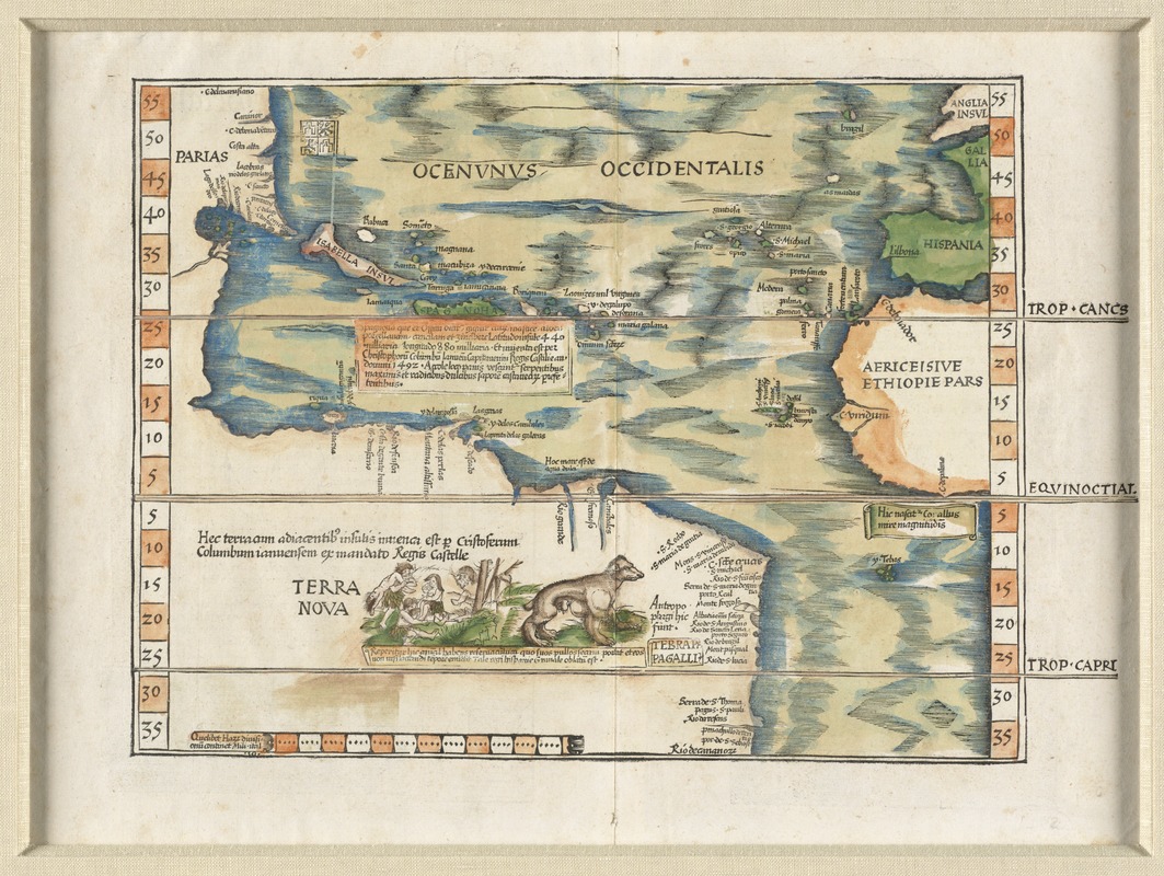
Map of the Atlantic Ocean and the New World. This map shows the newly discovered islands in the Caribbean and the northern coastline of South America, since the first voyage of Columbus some 40 or so years earlier.
Relief shown pictorially.
Includes names of places and natural features.
Descriptive text within ornamental borders on verso.
Appears in the author's Geographia, translated by Willibald Pirckheimer, with annotations by Joannes Regiomontanus. Argentoragi [i.e. Strasbourg] : Iohannes Grieningerus, communibus Iohannis Koberger impensis excudebat, anno a Christi Natiuitate 1525 tertio Kal[endas] Apriles.