Skip to search
Skip to main content
Digital Commonwealth
Sign Up / Log In
Search for
Search
Search
Search
Basic
Advanced
Explore
Map
Collections
Institutions
Formats
For Educators
Primary Source Sets
Lesson Plans
Using Primary Sources
Searching Digital Commonwealth
For Institutions
Join Digital Commonwealth
Conferences, Trainings, & Events
How to Contribute Collections
Digitization Services
Board & Committees
Frequently Asked Questions
About
About Digital Commonwealth
News & Announcements
Copyright & Terms of Use
Harmful Content Statement
Partners
API
Contact Us
Phillips Academy
American Revolutionary War-Era Maps (Collection of Distinction)
/
Sidney R. Knafel Map Collection at Phillips Academy
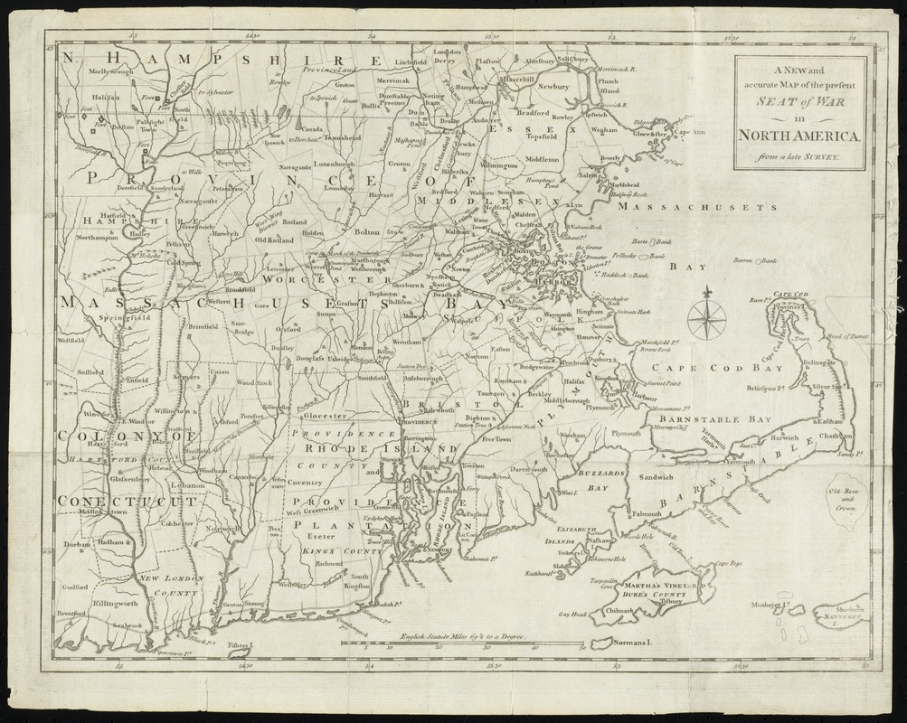
A new and accurate map of the present seat of war in North America : from a late survey
A new and accurate map of the present seat of war in North America
×
Item Information
Title:
A new and accurate map of the present seat of war in North America : from a late survey
Date:
[1775]
Format:
Maps/Atlases
Location:
Phillips Academy
Collection (local):
Sidney R. Knafel Map Collection at Phillips Academy, Andover MA
Subjects:
New Hampshire--Maps--Early works to 1800
Connecticut--Maps--Early works to 1800
Rhode Island--Maps--Early works to 1800
New England--Maps--Early works to 1800
United States--History--Revolution, 1775-1783--Maps--Early works to 1800
Places:
New Hampshire
Connecticut
Rhode Island
New England
(area)
Extent:
1 map ; 28 x 37 cm.
Permalink:
https://ark.digitalcommonwealth.org/ark:/50959/hq37vv48w
Terms of Use:
Rights status not evaluated.
Contact host institution for more information.
Publisher:
[London] : [s.n.]
Scale:
Scale [ca. 1:750,000]
Language:
English
Notes:
Relief shown pictorially.
From The universal magazine, Oct. 1755, vol. 57, p. 169.
Notes (date):
This date is inferred.
Identifier:
1322
show more...
View MODS XML
More Like This
An accurate map of Rhode Island, part of Connecticut and ...
An accurate map of Rhode Island, part of Connecticut and ...
A map of the colony of Rhode Island : with the adjacent parts of ...
A map of the province of Massachusets Bay and colony of Rhode ...
Find More Like This >>
Tools
Share
Facebook
Pinterest
X
Reddit
Tumblr
Email
Copy link
Add to Folder
Questions/Comments
Cite This Item
IIIF Manifest