Skip to search
Skip to main content
Digital Commonwealth
Sign Up / Log In
Search for
Search
Search
Search
Basic
Advanced
Explore
Map
Collections
Institutions
Formats
For Educators
Primary Source Sets
Lesson Plans
Using Primary Sources
Searching Digital Commonwealth
For Institutions
Join Digital Commonwealth
Conferences, Trainings, & Events
How to Contribute Collections
Digitization Services
Board & Committees
Frequently Asked Questions
About
About Digital Commonwealth
News & Announcements
Copyright & Terms of Use
Harmful Content Statement
Partners
API
Contact Us
Phillips Academy
American Revolutionary War-Era Maps (Collection of Distinction)
/
Sidney R. Knafel Map Collection at Phillips Academy
Part of east New Jarsey, New York, and Connecticut
Part of east New Jarsey, New York, and Connecticut
×
Item Information
Title:
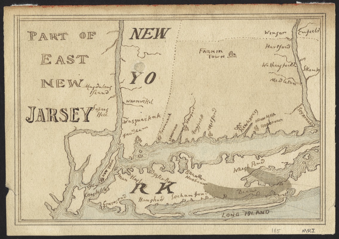
Part of east New Jarsey, New York, and Connecticut
Date:
[1770?]
Format:
Maps/Atlases
Location:
Phillips Academy
Collection (local):
Sidney R. Knafel Map Collection at Phillips Academy, Andover MA
Subjects:
Connecticut--Maps--Early works to 1800
New Jersey--Maps--Early works to 1800
New York--Maps--Early works to 1800
Places:
Connecticut
New Jersey
New York
Extent:
1 manuscript map : hand col. ; 13 x 19 cm.
Permalink:
https://ark.digitalcommonwealth.org/ark:/50959/hq37vv983
Terms of Use:
Rights status not evaluated.
Contact host institution for more information.
Scale:
Scale [ca. 1:1,200,000]
Language:
English
Notes:
Manuscript map showing cities and towns in northeastern New Jersey, southeastern New York, and western Connecticut.
Identifier:
1445
show more...
View MODS XML
More Like This
An accurate map of Rhode Island, part of Connecticut and ...
A map of the province of Massachusets Bay and colony of Rhode ...
A new and accurate map of the colony of Massachusets Bay, in North ...
A new and accurate map of the present seat of war in North America ...
Find More Like This >>
Tools
Share
Facebook
Pinterest
X
Reddit
Tumblr
Email
Copy link
Add to Folder
Questions/Comments
Cite This Item
IIIF Manifest