Skip to search
Skip to main content
Skip to first result
Digital Commonwealth
Folders
Sign Up / Log In
Search for
Search
Search
Search
Basic
Advanced
Explore
Map
Collections
Institutions
Formats
For Educators
Primary Source Sets
Lesson Plans
Using Primary Sources
Searching Digital Commonwealth
For Institutions
Join Digital Commonwealth
Conferences, Trainings, & Events
How to Contribute Collections
Digitization Services
Board & Committees
Frequently Asked Questions
About
About Digital Commonwealth
News & Announcements
Copyright & Terms of Use
Harmful Content Statement
Partners
API
Contact Us
Search
Search Constraints
Start Over
Save Search
Your search:
More Like
commonwealth:4m90fn27w
✖
Remove constraint More Like: commonwealth:4m90fn27w
« Prev. |
1
-
100
of
11,004
|
Next »
Sort
by relevance
relevance
title
date (asc)
date (desc)
Number of results to display per page
100
per page
per page
10
per page
20
per page
50
per page
100
per page
View results as:
List
list view
Maps
map view
Gallery
grid view
Search Results
1.
Citizens & travelers guide map in, to and from the city of New York and adjacent places
2.
Johnson's map of New York and the adjacent cities
3.
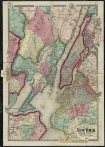
Map of New York and vicinity
4.
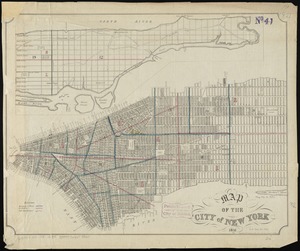
Map of northern part of New York City
5.
Map of the city & county of New York
6.
Map of the city & county of New York ; Upper part of the city and county of New York on a reduced scale
7.
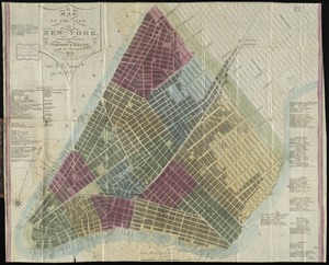
Map of the city of New York
8.
Map of the city of New York, with the latest improvements
9.
A map of the wondrous isle of Manhattan
10.
New map of New York City : from the latest authentic surveys, showing all ferries, and all steamship docks both foreign and...
11.
New York, 1695
12.
Topographical map of the City and County of New-York, and the adjacent country : with views in the border of the principal...
13.
Center of New York, first city of the world
14.
The city of New York as laid out by the Commissioners with the surrounding country
15.
City of New-York
16.
Downtown district of Manhattan
17.
Ground plan of the markets of the City of New-York
18.
Manhattan : first city of America
19.
Map of New York City showing concrete socialism in red, and private enterprises in white, 1895
20.
A map of New York which is published by the Washington Square Bookshop
21.
Map of New-York
22.
Map of the cities of New York, Brooklyn & Jersey City
23.
Map of the original grants of village lots from the Dutch West India Company to the inhabitants of New-Amsterdam (now New-York)...
24.
[New York City, from the Battery to 63rd street]
25.
New York City map
26.
A pictorial map of that portion of New York City known as Manhattan, also showing parts of the Bronx
27.
Plan of the city of New York
28.
A plan of the city of New York from an actual survey
29.
An aerial view of New York City showing how easily the weary traveler may reach the Herald Square Hotel wherein he will find...
30.
Carte générale des États-Unis de l'Amérique avec les plans des principales villes
31.
The Firemen's guide : a map of the City of New-York, showing the fire districts, fire limits, hydrants, public cisterns,...
32.
Grundriss des nördlichen Theils der Neujorks Insel nebst den am 16. Novbr. 1776. eroberten Fort Washington nun das Fort...
33.
Hammond's complete map of New York City
34.
Map of the cities of New York, Brooklyn, Jersey City, Hudson City and Hoboken
35.
Map of the city of New York and its vicinity
36.
A map of the history of New York state
37.
Map of the lands included in the Central Park, from a topographical survey, June 17th, 1856
38.
Map of the State of New-York exhibiting the several towns and counties together with the population as determined by the census...
39.
New York city map
40.
Plan for the improvement of the Central Park, adopted by the Commissioners, June 3rd, 1856
41.
Plan of the city of New York : showing the made and swamp land
42.
Rand McNally & Co.'s map of New York City, Brooklyn, Jersey City and vicinity
43.
The strangers mercantile guide map of the cities of New York, Brooklyn, Jersey City, Hoboken, etc
44.
Insurance maps of the city of New York
45.
[Plan of New York] : To the Honble. John Sullivan Esqr. Major Genl. in the army of the United States of America humbly...
46.
A Plan of the city of New York
47.
The provinces of New York, and New Jersey, : with part of Pensilvania [sic], and the province of Quebec
48.
Various plans and draughts of cities, towns, harbours &c. drawn from the latest authorities
49.
The 100th anniversary map of Abraham Lincoln's visit to Massachusetts, September 11-23, 1848
50.
1630 shoreline
51.
1879. Progress map of the U.S. Geographical Surveys west of the 100th Meridian : prepared under the direction of 1st Lieut....
52.
1903 Map of Salem and surrounding places
53.
19th annual convention of the National Association of Real Estate Boards : at Tulsa, June 7 to June 11 in 1926
54.
2005 significant U.S. hurricane strikes
55.
227 Harzgerode
56.
305 Glatz
57.
38,000,000 escaped -- 10,000,000 died
58.
4 Kinten
59.
660 Wakulah St., Roxbury
60.
[A chart of Boston Bay and vicinity]
61.
[A chart of New York Island & North River : East River, passage through Hell Gate, Flushing Bay, Hampstead Bay, Oyster,...
62.
The A.A.A. key road map of continental Europe
63.
Aaron Bohrod's America, its history
64.
ABC pathfinder railway guide map : eastern division
65.
Aboriginal map of North America, denoting the boundaries and the locations of various Indian tribes
66.
Acapulco, México
67.
Accurata delineatio Castrorum Suecicorum, ut et Haffniae, Regni Daniae Metropolis
68.
Accurata delineatio oppugnatae a faederatis, Caesareis, Polonicis, Danicis, et Brandeburgicis copijs sub-ductu Seren: Electoris...
69.
Accurata delineatio regionis circa Nieburgum Fioniæ cum prælio ibi commisso inter Danorum et fæderatorum exercitum ab una et...
70.
Accurata Scaniae, Blekingiae et Hallandiae descriptio
71.
An accurate map of Cuba, and the adjacent islands
72.
An accurate map of Dorset Shire divided into hundreds
73.
An accurate map of Dorset Shire, divided into its hundreds
74.
An accurate map of England and Wales with the principal roads from the best authorities
75.
An accurate map of England and Wales with the principal roads from the best authorities
76.
An accurate map of Europe from the best authorities
77.
An accurate map of Hindostan or India, from the best authorities
78.
An accurate map of His Majesty's province of New-Hampshire in New England : taken from actual surveys of all the inhabited...
79.
An Accurate map of New Hampshire in New England, from a late survey
80.
An Accurate map of New York in North America, from a late survey
81.
An accurate map of North America : describing and distinguishing the British and Spanish dominions on this great continent :...
82.
An accurate map of North America : describing and distinguishing the British and Spanish dominions of this great continent;...
83.
An accurate map of North America : describing and distinguishing the British, Spanish and French dominions on this great...
84.
An accurate map of North and South Carolina with their Indian frontiers, shewing in a distinct manner all the mountains,...
85.
An accurate map of Rhode Island, part of Connecticut and Massachusets, shewing Admiral Arbuthnot's station in blocking up...
86.
An accurate map of the coast of Cape de Verde
87.
An accurate map of the Commonwealth of Massachusetts exclusive of the district of Maine : compiled pursuant to an Act of the...
88.
An accurate map of the country round Boston in New England from the best authorities
89.
An accurate map of the county of Essex, divided into its hundreds
90.
An accurate map of the district of Maine being part of the Commonwealth of Massachusetts : compiled pursuant to an act of the...
91.
An accurate map of the United States of America, with part of the surrounding provinces agreeable to the Treaty of Peace of 1783
92.
Accuratissima Brasiliae tabula
93.
Accuratissima Circuli Saxoniae tabula quae est pars septentrionalis Germaniae
94.
Accuratissima Dominii Veneti in Italia, Ducatus Parmae, Placentiae, Modenae Regii Et Mantuae, Episcopatus Tridentini Tabula...
95.
Accuratissima et maxima totius Turcici Imperii tabula cum omnibus suis regionibus novissima delineatio
96.
Accuratissima principatus Cataloniae, et comitatuum Ruscinonis, et Cerretaniae descriptio
97.
An actual survey of the sea coast from New York to the I. Cape Briton : with tables of the direct and thwart courses &...
98.
Adams, Mass : 1882
99.
Adriatic
100.
The adventures of Mark Twain
« Previous
Next »
1
2
3
4
5
…
110
111
Limit your search
Subject
Real property--Massachusetts--Boston--Maps
2,278
Landowners--Massachusetts--Boston--Maps
2,117
Boston (Mass.)--Maps
1,967
Roxbury (Boston, Mass.)--Maps
351
Dorchester (Boston, Mass.)--Maps
317
Cambridge (Mass.)--Maps
266
Brookline (Mass.)--Maps
236
Real property--Massachusetts--Cambridge--Maps
216
more
Subject
»
Place
North and Central America
7,818
United States
6,437
Suffolk (county)
3,338
Boston
3,198
Massachusetts
3,166
Europe
963
Middlesex (county)
618
Canada
428
more
Place
»
Format
Maps/Atlases
10,945
Manuscripts
216
Prints
51
Books
35
Objects/Artifacts
10
Drawings/Illustrations
8
Posters
4
Available to use
No known restrictions
10,932
Creative Commons license
46
Date
View distribution
Current results range from
1482
to
2023
Date range begin
Date range end
View larger »
Collection
Norman B. Leventhal Map Center Collection
11,000
Boston and New England Maps (Collection of Distinction)
5,105
Urban Maps (Collection of Distinction)
4,846
Maritime Charts and Atlases (Collection of Distinction)
750
American Revolutionary War-Era Maps (Collection of Distinction)
619
Boston Redevelopment Authority Collection
86
American Antiquarian Society Collection
4
Institution
Boston Public Library
11,000
American Antiquarian Society
4


![[New York City, from the Battery to 63rd street]](https://bpldcassets.blob.core.windows.net/derivatives/images/commonwealth:4m90f274r/image_thumbnail_300.jpg)


![[Plan of New York]](https://bpldcassets.blob.core.windows.net/derivatives/images/commonwealth:6108vt38k/image_thumbnail_300.jpg)


![[A chart of Boston Bay and vicinity]](https://bpldcassets.blob.core.windows.net/derivatives/images/commonwealth:cj82m2976/image_thumbnail_300.jpg)


