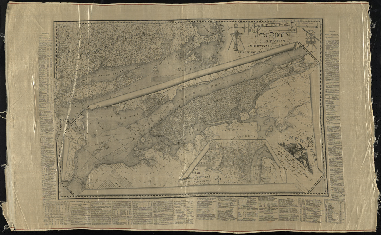
The city of New York as laid out by the Commissioners with the surrounding country
The city of New York as laid out by the Commissioners with the surrounding country
Item Information
Title:
The city of New York as laid out by the Commissioners with the surrounding country
Description:
Street planning map of Manhattan. Covers all of Manhattan Island (New York, N.Y.) and substantial parts of adjacent counties in New York and New Jersey. Shows existing and proposed streets; also buildings and other structures, streams and other wetlands, political boundaries.
A map of the states of Connecticut and Rho[de Islan]d with pa[rts of] New-York, Mas[ssachusetts and New Jers]ey
The city of New York as laid out by the Commissioners with the surrounding country / by their secretary and surveyor John Randel Junr.
The city of [P]hiladelphia with the surrounding country / by John Randel Junr.
Notes:
On silk.
3 plans superimposed upon each other. Maps of New York and Philadelphia appear as partially unrolled sheets on top of a map of southern New England.
Relief shown by hachures.
Prime meridian: New York City Hall.
Includes illustrations of surveying equipment used by the author.
Includes extensive text in left, right and lower margins outside neat line.
"This paper made by Morris & Kingsland."
In the collection of Lawrence Caldwell.