Search
Search Results
- Creator:
- Rand McNally and Company
- Format:
- Maps/Atlases
- Collection:
- Norman B. Leventhal Map Center Collection
- Date:
- [1917?]
- Institution:
- Boston Public Library
- Creator:
- United States. Army. Corps of Engineers
- Format:
- Maps/Atlases
- Collection:
- Norman B. Leventhal Map Center Collection
- Date:
- [1899]
- Institution:
- Boston Public Library
- Creator:
- Rand McNally and Company
- Format:
- Maps/Atlases
- Collection:
- Norman B. Leventhal Map Center Collection
- Date:
- [ca. 1888]
- Institution:
- Boston Public Library
- Creator:
- Young, J. H. (James Hamilton)
- Format:
- Maps/Atlases
- Collection:
- Norman B. Leventhal Map Center Collection
- Date:
- 1832
- Institution:
- Boston Public Library
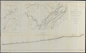
- Creator:
- Merrill, W. E. (William Emery), 1837-1891
- Format:
- Maps/Atlases
- Collection:
- Norman B. Leventhal Map Center Collection
- Date:
- 1864
- Institution:
- Boston Public Library
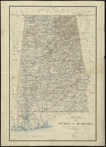
- Creator:
- United States. General Land Office
- Format:
- Maps/Atlases
- Collection:
- Norman B. Leventhal Map Center Collection
- Date:
- 1895
- Institution:
- Boston Public Library
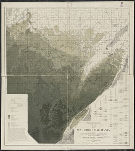
- Creator:
- McCalley, Henry, 1852-1904
- Format:
- Maps/Atlases
- Collection:
- Norman B. Leventhal Map Center Collection
- Date:
- 1898
- Institution:
- Boston Public Library
- Creator:
- Barker, W. (William), active 1795-1803, Carey, Mathew, 1760-1839, and Carey, Mathew, 1760-1839
- Format:
- Maps/Atlases
- Collection:
- Norman B. Leventhal Map Center Collection
- Date:
- 1806
- Institution:
- Boston Public Library
- Creator:
- Lindenkohl, A.
- Format:
- Maps/Atlases
- Collection:
- Norman B. Leventhal Map Center Collection
- Date:
- [1864]
- Institution:
- Boston Public Library
- Creator:
- Lindenkohl, A.
- Format:
- Maps/Atlases
- Collection:
- Norman B. Leventhal Map Center Collection
- Date:
- 1865
- Institution:
- Boston Public Library
- Creator:
- Lindenkohl, A.
- Format:
- Maps/Atlases
- Collection:
- Norman B. Leventhal Map Center Collection
- Date:
- 1864
- Institution:
- Boston Public Library
- Creator:
- United States. War Dept. Engineer Bureau
- Format:
- Maps/Atlases
- Collection:
- Norman B. Leventhal Map Center Collection
- Date:
- [1864]
- Institution:
- Boston Public Library
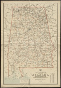
- Creator:
- United States. Post Office Dept
- Format:
- Maps/Atlases
- Collection:
- Norman B. Leventhal Map Center Collection
- Date:
- 1897
- Institution:
- Boston Public Library
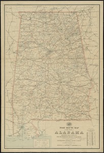
- Creator:
- United States. Post Office Dept
- Format:
- Maps/Atlases
- Collection:
- Norman B. Leventhal Map Center Collection
- Date:
- 1903
- Institution:
- Boston Public Library
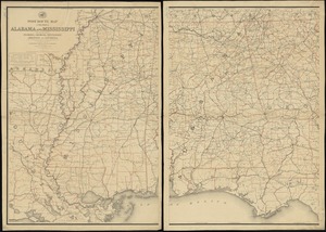
- Creator:
- United States. Post Office Dept
- Format:
- Maps/Atlases
- Collection:
- Norman B. Leventhal Map Center Collection
- Date:
- 1883
- Institution:
- Boston Public Library
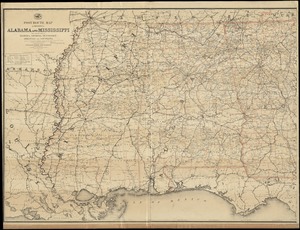
- Creator:
- United States. Post Office Dept
- Format:
- Maps/Atlases
- Collection:
- Norman B. Leventhal Map Center Collection
- Date:
- 1891
- Institution:
- Boston Public Library
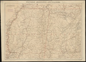
- Creator:
- United States. General Land Office
- Format:
- Maps/Atlases
- Collection:
- Norman B. Leventhal Map Center Collection
- Date:
- 1889
- Institution:
- Boston Public Library
- Creator:
- Alabama. State Highway Department; Salmon, F. A.
- Format:
- Maps/Atlases
- Collection:
- Norman B. Leventhal Map Center Collection
- Date:
- 1927
- Institution:
- Boston Public Library
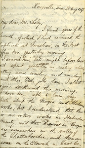
- Creator:
- Lyman, Benjamin Smith, 1835-1920; Lesley, J. P. (J. Peter), 1819-1903
- Format:
- Letters/Correspondence; Manuscripts
- Collection:
- Benjamin Smith Lyman Papers, 1831-1921 (Bulk: 1851-1915)
- Date:
- August 28, 1857
- Institution:
- University of Massachusetts Amherst Libraries Special Collections and University Archives
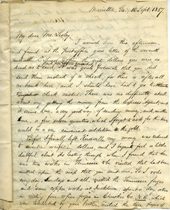
- Creator:
- Lyman, Benjamin Smith, 1835-1920; Lesley, J. P. (J. Peter), 1819-1903
- Format:
- Letters/Correspondence; Manuscripts
- Collection:
- Benjamin Smith Lyman Papers, 1831-1921 (Bulk: 1851-1915)
- Date:
- September 10, 1857
- Institution:
- University of Massachusetts Amherst Libraries Special Collections and University Archives
- Creator:
- Lufkin, Richard F. (Richard Friend)
- Format:
- Maps/Atlases
- Collection:
- Norman B. Leventhal Map Center Collection
- Date:
- 1948
- Institution:
- Boston Public Library
- Creator:
- Metropolitan Planning Organization (Mass.). Central Transportation Planning Staff
- Format:
- Maps/Atlases
- Collection:
- Norman B. Leventhal Map Center Collection
- Date:
- 2011
- Institution:
- Boston Public Library
- Creator:
- Geographical Surveys West of the 100th Meridian (U.S.)
- Format:
- Maps/Atlases
- Collection:
- Norman B. Leventhal Map Center Collection
- Date:
- [1879?]
- Institution:
- Boston Public Library
- Creator:
- Henry M. Meek Pub. Co. (Salem, Mass.)
- Format:
- Maps/Atlases
- Collection:
- Norman B. Leventhal Map Center Collection
- Date:
- 1903
- Institution:
- Boston Public Library
- Creator:
- National Association of Real Estate Boards, R.R. Donnelley and Sons Company, and Sahula-Dycke, Ignatz, 1900-1982
- Format:
- Maps/Atlases
- Collection:
- Norman B. Leventhal Map Center Collection
- Date:
- 1926
- Institution:
- Boston Public Library
- Creator:
- National Climatic Data Center (U.S.), National Climatic Data Center (U.S.), and United States. National Oceanic and Atmospheric Administration
- Format:
- Posters
- Collection:
- Norman B. Leventhal Map Center Collection
- Date:
- [2005]
- Institution:
- Boston Public Library
- Creator:
- Prussia (Kingdom). Armee. Grosser Generalstab, Meyer, A., and Ruzek
- Format:
- Maps/Atlases
- Collection:
- Norman B. Leventhal Map Center Collection
- Date:
- 1868
- Institution:
- Boston Public Library
- Creator:
- Prussia (Kingdom). Armee. Grosser Generalstab; Petters, H.
- Format:
- Maps/Atlases
- Collection:
- Norman B. Leventhal Map Center Collection
- Date:
- 1870
- Institution:
- Boston Public Library
- Creator:
- Russian War Relief, Inc.; Means, E.
- Format:
- Maps/Atlases
- Collection:
- Norman B. Leventhal Map Center Collection
- Date:
- [ca. 1940–1949]
- Institution:
- Boston Public Library
- Creator:
- Prussia (Kingdom). Armee. Grosser Generalstab; Siebert, Selmar
- Format:
- Maps/Atlases
- Collection:
- Norman B. Leventhal Map Center Collection
- Date:
- 1860
- Institution:
- Boston Public Library
- Creator:
- Boston Redevelopment Authority
- Format:
- Maps/Atlases
- Collection:
- Boston Redevelopment Authority Collection / Boston and New England Maps (Collection of Distinction) / Norman B. Leventhal Map Center Collection / Urban Maps (Collection of Distinction)
- Date:
- May 1989
- Institution:
- Boston Public Library
- Creator:
- Des Barres, Joseph F. W. (Joseph Frederick Wallet), 1722-1824
- Format:
- Maps/Atlases
- Collection:
- American Revolutionary War-Era Maps (Collection of Distinction) / Maritime Charts and Atlases (Collection of Distinction) / Norman B. Leventhal Map Center Collection
- Date:
- 1776
- Institution:
- Boston Public Library
- Creator:
- Des Barres, Joseph F. W. (Joseph Frederick Wallet), 1722-1824
- Format:
- Maps/Atlases
- Collection:
- American Revolutionary War-Era Maps (Collection of Distinction) / Norman B. Leventhal Map Center Collection
- Date:
- [1770–1779]
- Institution:
- Boston Public Library
- Creator:
- American Automobile Association
- Format:
- Maps/Atlases
- Collection:
- Norman B. Leventhal Map Center Collection
- Date:
- 1911
- Institution:
- Boston Public Library
- Creator:
- Bohrod, Aaron
- Format:
- Maps/Atlases
- Collection:
- Norman B. Leventhal Map Center Collection
- Date:
- 1946
- Institution:
- Boston Public Library
- Format:
- Maps/Atlases
- Collection:
- Boston and New England Maps (Collection of Distinction) / Norman B. Leventhal Map Center Collection
- Date:
- [1880?–1889?]
- Institution:
- Boston Public Library
- Creator:
- Arrowsmith, John, 1790-1873, Hansard Henry, -1904, and Great Britain. Parliament. House of Commons
- Format:
- Maps/Atlases
- Collection:
- Norman B. Leventhal Map Center Collection
- Date:
- 1857
- Institution:
- Boston Public Library
- Creator:
- Orozco, S.; Creative Marketing de Mexico
- Format:
- Maps/Atlases
- Collection:
- Norman B. Leventhal Map Center Collection
- Date:
- (c) 1980
- Institution:
- Boston Public Library
- Creator:
- Dahlbergh, Erik Jönsson, greve, 1625-1703, Pufendorf, Samuel, Freiherr von, 1632-1694, and Riegel, Christoph
- Format:
- Maps/Atlases
- Collection:
- Norman B. Leventhal Map Center Collection
- Date:
- [1696]
- Institution:
- Boston Public Library
- Creator:
- Dahlbergh, Erik Jönsson, greve, 1625-1703, Riegel, Christoph, Swidde, Willem, 1660 or 1661-1697, and Pufendorf, Samuel, Freiherr von, 1632-1694
- Format:
- Maps/Atlases
- Collection:
- Norman B. Leventhal Map Center Collection
- Date:
- [1696]
- Institution:
- Boston Public Library
- Creator:
- Riegel, Christoph, Swidde, Willem, 1660 or 1661-1697, Dahlbergh, Erik Jönsson, greve, 1625-1703, and Pufendorf, Samuel, Freiherr von, 1632-1694
- Format:
- Prints
- Collection:
- Norman B. Leventhal Map Center Collection
- Date:
- [1696]
- Institution:
- Boston Public Library
- Creator:
- Wit, Frederik de.
- Format:
- Maps/Atlases
- Collection:
- Norman B. Leventhal Map Center Collection
- Date:
- [1680]
- Institution:
- Boston Public Library
- Creator:
- Rollos, G., fl. 1754-1789
- Format:
- Maps/Atlases
- Collection:
- American Revolutionary War-Era Maps (Collection of Distinction) / Norman B. Leventhal Map Center Collection
- Date:
- [1762]
- Institution:
- Boston Public Library
- Creator:
- Bowen, Emanuel, d. 1767
- Format:
- Maps/Atlases
- Collection:
- Norman B. Leventhal Map Center Collection
- Date:
- 1777
- Institution:
- Boston Public Library
- Creator:
- Bowen, Emanuel, d. 1767, Bowles, John, 1701-1779, Bowles, Carington, 1724-1793, and Sayer, Robert, 1725-1794
- Format:
- Maps/Atlases
- Collection:
- Norman B. Leventhal Map Center Collection
- Date:
- [1764]
- Institution:
- Boston Public Library
- Creator:
- Doolittle, Amos, 1754-1832; Carey, Mathew, 1760-1839
- Format:
- Maps/Atlases
- Collection:
- Norman B. Leventhal Map Center Collection
- Date:
- [1800]
- Institution:
- Boston Public Library
- Creator:
- Carey, Mathew, 1760-1839
- Format:
- Maps/Atlases
- Collection:
- Norman B. Leventhal Map Center Collection
- Date:
- [1796–1800]
- Institution:
- Boston Public Library
- Creator:
- Carey, Mathew, 1760-1839; Hill, Samuel, approximately 1766-1804
- Format:
- Maps/Atlases
- Collection:
- Norman B. Leventhal Map Center Collection
- Date:
- [1800]
- Institution:
- Boston Public Library
- Creator:
- Scott, J. T. (Joseph T.); Carey, Mathew, 1760-1839
- Format:
- Maps/Atlases
- Collection:
- Norman B. Leventhal Map Center Collection
- Date:
- [1800]
- Institution:
- Boston Public Library
- Creator:
- Blanchard, Joseph, -1758, Langdon, Samuel, 1723-1797, and Jefferys, Thomas, -1771
- Format:
- Maps/Atlases
- Collection:
- American Revolutionary War-Era Maps (Collection of Distinction) / Boston and New England Maps (Collection of Distinction) / Norman B. Leventhal Map Center Collection
- Date:
- 1761
- Institution:
- Boston Public Library


![[A chart of Boston Bay and vicinity]](https://bpldcassets.blob.core.windows.net/derivatives/images/commonwealth:cj82m2976/image_thumbnail_300.jpg)


