Skip to search
Skip to main content
Skip to first result
Digital Commonwealth
Folders
Sign Up / Log In
Search for
Search
Search
Search
Basic
Advanced
Explore
Map
Collections
Institutions
Formats
For Educators
Primary Source Sets
Lesson Plans
Using Primary Sources
Searching Digital Commonwealth
For Institutions
Join Digital Commonwealth
Conferences, Trainings, & Events
How to Contribute Collections
Digitization Services
Board & Committees
Frequently Asked Questions
About
About Digital Commonwealth
News & Announcements
Copyright & Terms of Use
Harmful Content Statement
Partners
API
Contact Us
Search
Search Constraints
Start Over
Save Search
Your search:
More Like
commonwealth-oai:z029pk82v
✖
Remove constraint More Like: commonwealth-oai:z029pk82v
« Prev.
|
101
-
120
of
542
|
Next »
Sort
by relevance
relevance
title
date (asc)
date (desc)
Number of results to display per page
20
per page
per page
10
per page
20
per page
50
per page
100
per page
View results as:
List
list view
Maps
map view
Gallery
grid view
Search Results
101.
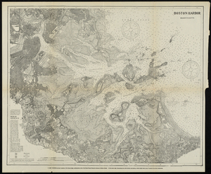
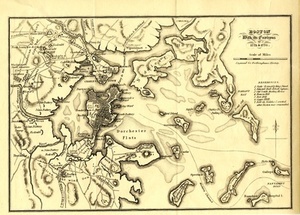
Boston Harbor, Massachusetts
102.
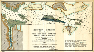
Boston Harbor, Massachusetts: The Main Ship Channel Above Lower Middle
103.
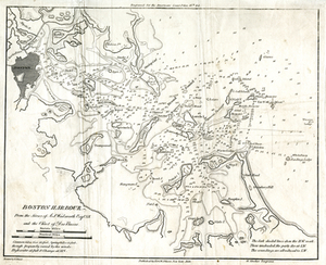
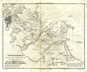
Boston Harbour: From the Survey of A.S. Wadsworth Esq., U.S.N, and the Survey of Des Barres.
104.
Boston Harbour: From the Survey of A.S. Wadsworth Esq., U.S.N, and the Survey of Des Barres.
105.
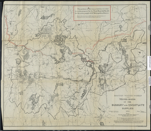
Boston Water Works: Water-sheds of the Sudbury and Cochituate Supplies
106.
Boston With its Environs, 1775 & 1776.
107.
Boston Y Sus Aldredores - Boston Et Ses Environs
108.
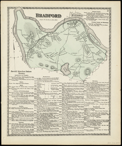
Bradford
109.
Bristol County
110.
Charles River Basin
111.
Charles River Basin: contour map of lower basin
112.
A Chart Exhibiting the Normal Course & Velocity of the Tidal Current at Ebb in Boston Harbor
113.
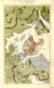
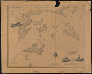
Chart of the Harbours of Salem, Marblehead, Beverly, and Manchester From a Survey Taken in the Years 1804, 5 & 6 by Nathl....
114.
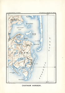
Chatham Harbor
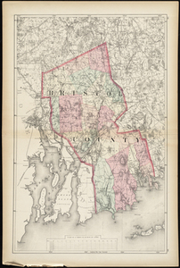
115.
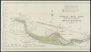
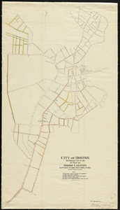
City of Boston
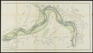
116.
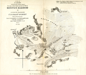
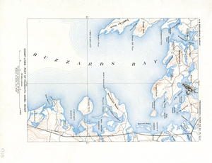
Coast Lines: Part of Falmouth (Mass.) Sheet
117.
Coast Lines: Part of Martha's Vineyard (Mass.) Sheet
118.
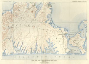
Coast Lines: Part of Provincetown and Wellfleet (Mass.) Sheets
119.
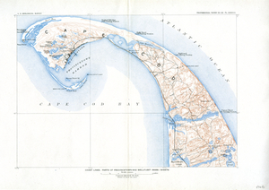
Colton's Map of Boston and Adjacent Cities.
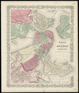
120.
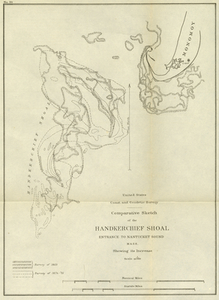
Comparative Sketch of the Handkerchief Shoal Entrance to Nantucket Sound, Mass. Showing its Increase
« Previous
Next »
1
2
3
4
5
6
7
8
9
10
…
27
28
Limit your search
Subject
Massachusetts
481
Pbs Newshour
116
Washington
108
Boston
98
Macneil Lehrer
97
Obama
97
Jeffrey Brown
87
New York
84
more
Subject
»
Place
North and Central America
297
United States
296
Massachusetts
285
Essex (county)
118
Suffolk (county)
72
Boston
71
Beverly
46
Newburyport
14
more
Place
»
Format
Maps/Atlases
296
Film/Video
167
Photographs
35
Documents
16
Albums/Scrapbooks
8
Objects/Artifacts
7
Letters/Correspondence
5
Posters
5
more
Format
»
Available to use
No known restrictions
13
Date
View distribution
Current results range from
1631
to
2019
Date range begin
Date range end
View larger »
Unknown
15
Collection
Historic Maps
278
American Archive of Public Broadcasting Collection
123
Oral Histories
42
Photographic Collection
17
Mass. Memories Road Show
12
Norman B. Leventhal Map & Education Center Collection
12
Boston and New England Maps (Collection of Distinction)
11
Arlington Historical Society Collection
9
more
Collection
»
Institution
Salem State University Archives and Special Collections
278
Internet Archive
123
Yiddish Book Center
42
Williams College
41
University of Massachusetts Boston, Joseph P. Healey Library
19
Boston Public Library
12
Arlington Historical Society
9
State Library of Massachusetts
6
more
Institution
»