Skip to search
Skip to main content
Digital Commonwealth
Sign Up / Log In
Search for
Search
Search
Search
Basic
Advanced
Explore
Map
Collections
Institutions
Formats
For Educators
Primary Source Sets
Lesson Plans
Using Primary Sources
Searching Digital Commonwealth
For Institutions
Join Digital Commonwealth
Conferences, Trainings, & Events
How to Contribute Collections
Digitization Services
Board & Committees
Frequently Asked Questions
About
About Digital Commonwealth
News & Announcements
Copyright & Terms of Use
Harmful Content Statement
Partners
API
Contact Us
Salem State University Archives and Special Collections
Historic Maps
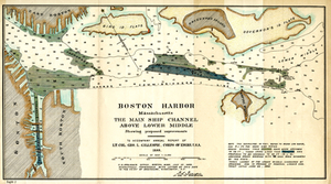
Boston Harbor, Massachusetts: The Main Ship Channel Above Lower Middle
View this item online at Salem State University Archives and Special Collections
Item Information
Title:
Boston Harbor, Massachusetts: The Main Ship Channel Above Lower Middle
Description:
Depths shown by soundings in feet at mean low water. "To accompany annual report of Lt. Col. Geo. L. Gillespie, Corps of Engrs. U.S.A. 1888."
Creator:
Gillespie, George L.
Creator:
United States Army Corps of Engineers
Date:
1888
Format:
Maps/Atlases
Location:
Salem State University Archives and Special Collections
Collection (local):
Historic Maps
Series:
Boston
Subjects:
Nautical charts--Boston Harbor (Mass.)
Boston Harbor (Mass.)--Maps
Boston
Coastal
Massachusetts
Places:
Massachusetts
>
Suffolk (county)
>
Boston
Link to Item:
http://digitalcommons.salemstate.edu/maps_boston/18
Terms of Use:
Rights status not evaluated.
Contact host institution for more information.
Identifier:
G 3764 .B65 1888 .B6
show more...
View MODS XML
More Like This
Boston Harbor
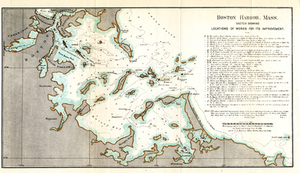
Boston Harbor, Mass.: Sketch Showing Locations of Works For Its ...
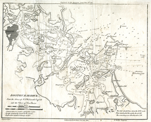
Boston Harbour: From the Survey of A.S. Wadsworth Esq., U.S.N, and ...
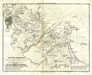
Boston Harbour: From the Survey of A.S. Wadsworth Esq., U.S.N, and ...
Find More Like This >>
Tools
Share
Facebook
Pinterest
X
Reddit
Tumblr
Email
Copy link
Add to Folder
Questions/Comments
Cite This Item