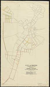
Reproduction in 1901 of map by Osgood Carleton supposed to have been made in 1803. The original plan was plotted on a scale of 5 rods to an inch. Plan of streets from Lynn Street in East Boston in the north to Bridge and Orange Streets in the south andf from Charles Street in the west to Long Wharf and Batterymarch Street in the east. 1 maps : col. ; 101 x 58 cm.