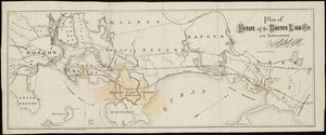
61. Plan of estate of the Boston Land Co. and surroundings Creator: Whitman & Breck Format: Maps/Atlases Collection: Norman B. Leventhal Map & Education Center Collection Date: [1880?–1889?] Institution: Boston Public Library
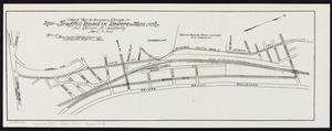
62. Sketch plan to accompany estimate for traffic road in Revere, Mass.: from Revere St. southerly Creator: Massachusetts. Highway Commission Format: Maps/Atlases Collection: Massachusetts Department of Transportation Date: April 8, 1913 Institution: State Library of Massachusetts
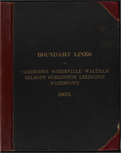
63. Atlas of the boundaries of the cities of Cambridge, Somerville, Waltham and towns of Belmont, Burlington, Lexington, Watertown, Middlesex County Creator: Board of Harbor and Land Commissioners of Massachusetts Format: Maps/Atlases Collection: Massachusetts Board of Harbor and Land Commissioners Date: 1903 Institution: State Library of Massachusetts
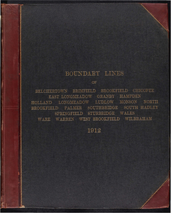
64. Atlas of the boundaries of the cities of Chicopee and Springfield and towns of Brimfield, East Longmeadow, Hampden, Holland, Longmeadow, Ludlow, Monson, Palmer, Wales,... Creator: Board of Harbor and Land Commissioners of Massachusetts Format: Maps/Atlases Collection: Massachusetts Board of Harbor and Land Commissioners Date: 1912 Institution: State Library of Massachusetts
65. Atlas of the boundaries of the cities of Fall River - New Bedford and towns of Acushnet, Berk[e]ley, Dartmouth, Dighton, Fairhaven, Freetown, Somerset, Swansea,... Creator: Board of Harbor and Land Commissioners of Massachusetts Format: Maps/Atlases Collection: Massachusetts Board of Harbor and Land Commissioners Date: 1904 Institution: State Library of Massachusetts
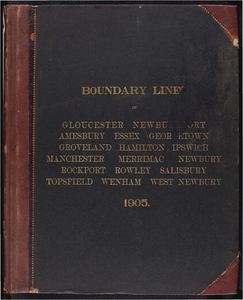
66. Atlas of the boundaries of the cities of Gloucester and Newburyport and towns of Amesbury, Essex, Georgetown, Groveland, Hamilton, Ipswich, Manchester, Merrimac,... Creator: Board of Harbor and Land Commissioners of Massachusetts Format: Maps/Atlases Collection: Massachusetts Board of Harbor and Land Commissioners Date: 1905 Institution: State Library of Massachusetts
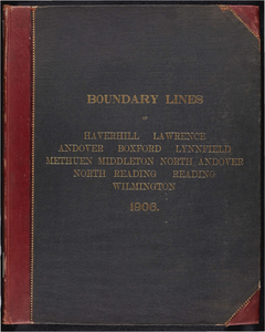
67. Atlas of the boundaries of the cities of Haverhill, Lawrence and towns of Andover, Boxford, Lynnfield, Methuen, Middleton, North Andover, Essex County North Reading,... Creator: Board of Harbor and Land Commissioners of Massachusetts Format: Maps/Atlases Collection: Massachusetts Board of Harbor and Land Commissioners Date: 1906 Institution: State Library of Massachusetts
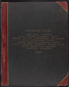
68. Atlas of the boundaries of the cities of North Adams and Pittsfield and towns of Adams, Cheshire, Clarksburg, Dalton, Florida, Hancock, Lanesborough, New Ashford,... Creator: Board of Harbor and Land Commissioners of Massachusetts Format: Maps/Atlases Collection: Massachusetts Board of Harbor and Land Commissioners Date: 1913 Institution: State Library of Massachusetts
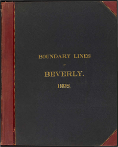
69. Atlas of the boundaries of the city of Beverly, Essex County Creator: Massachusetts. Topographical Survey Commission Format: Books Collection: Massachusetts Board of Harbor and Land Commissioners Date: 1898 Institution: State Library of Massachusetts
70. Atlas of the boundaries of the city of Boston, Suffolk County and town of Brookline, Norfolk County Creator: Board of Harbor and Land Commissioners of Massachusetts Format: Maps/Atlases Collection: Massachusetts Board of Harbor and Land Commissioners Date: 1902 Institution: State Library of Massachusetts
71. Atlas of the boundaries of the city of Brockton, Plymouth County Creator: Massachusetts. Topographical Survey Commission Format: Books Collection: Massachusetts Board of Harbor and Land Commissioners Date: 1898 Institution: State Library of Massachusetts
72. Atlas of the boundaries of the city of Chelsea, Suffolk County Creator: Massachusetts. Topographical Survey Commission Format: Books Collection: Massachusetts Board of Harbor and Land Commissioners Date: 1898 Institution: State Library of Massachusetts
73. Atlas of the boundaries of the city of Everett, Middlesex County Creator: Massachusetts. Topographical Survey Commission Format: Books Collection: Massachusetts Board of Harbor and Land Commissioners Date: 1898 Institution: State Library of Massachusetts
74. Atlas of the boundaries of the city of Fitchburg and towns of Ashburnham, Athol, Gardner, Leominster, Lunenburg, Phillipston, Royalston, Templeton, Westminster,... Creator: Board of Harbor and Land Commissioners of Massachusetts Format: Maps/Atlases Collection: Massachusetts Board of Harbor and Land Commissioners Date: 1909 Institution: State Library of Massachusetts
75. Atlas of the boundaries of the city of Holyoke and towns of Agawam, Blandford, Chester, Granville, Montgomery, Russell, Southwick, Tolland, Westfield, West... Creator: Board of Harbor and Land Commissioners of Massachusetts Format: Maps/Atlases Collection: Massachusetts Board of Harbor and Land Commissioners Date: 1914 Institution: State Library of Massachusetts
76. Atlas of the boundaries of the city of Lowell and towns of Ayer, Billerica, Carlisle, Chelmsford, Dracut, Dunstable, Groton, Littleton, Pepperell, Shirley, Tewksbury,... Creator: Board of Harbor and Land Commissioners of Massachusetts Format: Maps/Atlases Collection: Massachusetts Board of Harbor and Land Commissioners Date: 1907 Institution: State Library of Massachusetts
77. Atlas of the boundaries of the city of Lynn and towns of Nahant, Saugus, and Swampscott, Essex County and Wakefield, Middlesex County Creator: Board of Harbor and Land Commissioners of Massachusetts Format: Maps/Atlases Collection: Massachusetts Board of Harbor and Land Commissioners Date: 1902 Institution: State Library of Massachusetts
78. Atlas of the boundaries of the city of Malden, Middlesex County Creator: Massachusetts. Topographical Survey Commission Format: Books Collection: Massachusetts Board of Harbor and Land Commissioners Date: 1898 Institution: State Library of Massachusetts
79. Atlas of the boundaries of the city of Marlborough and towns of Boxborough, Hudson, Stow, Middlesex County Berlin, Bolton, Boylston, Clinton, Harvard, Holden,... Creator: Board of Harbor and Land Commissioners of Massachusetts Format: Maps/Atlases Collection: Massachusetts Board of Harbor and Land Commissioners Date: 1908 Institution: State Library of Massachusetts
80. Atlas of the boundaries of the city of Medford, Middlesex County Creator: Massachusetts. Topographical Survey Commission Format: Books Collection: Massachusetts Board of Harbor and Land Commissioners Date: 1898 Institution: State Library of Massachusetts
![Atlas of the boundaries of the cities of Fall River - New Bedford and towns of Acushnet, Berk[e]ley, Dartmouth, Dighton, Fairhaven, Freetown, Somerset, Swansea, Westport, Bristol County](https://bpldcassets.blob.core.windows.net/derivatives/metadata/commonwealth-oai:1r66jh22w/image_thumbnail_300.jpg)