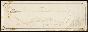
Atlas of the boundaries of the cities of Fall River - New Bedford and towns of Acushnet, Berk[e]ley, Dartmouth, Dighton, Fairhaven, Freetown, Somerset, Swansea, Westport, Bristol County
Atlas of the boundaries of the cities of Fall River - New Bedford and towns of Acushnet, Berk[e]ley, Dartmouth, Dighton, Fairhaven, Freetown, Somerset, Swansea, Westport, Bristol County
Title (alt.):
Boundary lines of Fall River, New Bedford, Acushnet, Berkeley, Dartmouth, Dighton, Fairhaven, Freetown, Somerset, Swansea, Westport
Rights status not evaluated.
Contact host institution for more information.
Publisher:
Commonwealth of Massachusetts, Harbor and Land Commission
Notes:
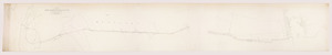
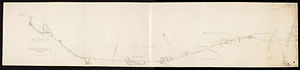
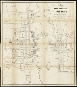
Pages lettered and numbered as folios. "One of 68 town boundary atlases produced by the Topographic Survey Commission (1898-1900) and the Harbor and Land Commission (1901-1915) of the Commonwealth of Massachusetts. Includes a summary of the history of the establishment of the city and towns by legislative enactment, a list of statutes establishing or altering the boundaries, extracts from the statutes, descriptions and positions of triangulation stations, a map of the boundaries, and plans of the city and town corners." Map scale (from bar graph) ca. 1:79,000.
![Atlas of the boundaries of the cities of Fall River - New Bedford and towns of Acushnet, Berk[e]ley, Dartmouth, Dighton, Fairhaven, Freetown, Somerset, Swansea, Westport, Bristol County](https://bpldcassets.blob.core.windows.net/derivatives/metadata/commonwealth-oai:1r66jh22w/image_thumbnail_300.jpg)