Rights status not evaluated.
Contact host institution for more information.
Publisher:
Commonwealth of Massachusetts, Harbor and Land Commission
Notes:
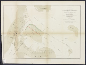
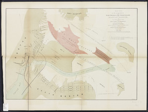
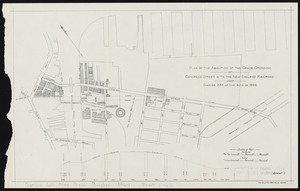
Leaves lettered and numbered as sheets . Sheet 1 double. Sheets 14 and 24 printed on both sides; versos numbered 14a and 24a. "One of 68 town boundary atlases produced by the Topographic Survey Commission (1898-1900) and the Harbor and Land Commission (1901-1915) of the Commonwealth of Massachusetts. Includes a summary of the history of the establishment of the city and towns by legislative enactment, a list of statutes establishing or altering the boundaries, extracts from the statutes, descriptions and positions of triangulation stations, a map of the boundaries, and plans of the city and town corners." Map scale (from bar graph) ca. 1:32,000.