Skip to search
Skip to main content
Digital Commonwealth
Sign Up / Log In
Search for
Search
Search
Search
Basic
Advanced
Explore
Map
Collections
Institutions
Formats
For Educators
Primary Source Sets
Lesson Plans
Using Primary Sources
Searching Digital Commonwealth
For Institutions
Join Digital Commonwealth
Conferences, Trainings, & Events
How to Contribute Collections
Digitization Services
Board & Committees
Frequently Asked Questions
About
About Digital Commonwealth
News & Announcements
Copyright & Terms of Use
Harmful Content Statement
Partners
API
Contact Us
State Library of Massachusetts
Massachusetts Department of Transportation
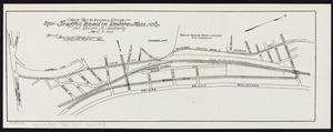
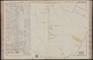
Sketch plan to accompany estimate for traffic road in Revere, Mass.: from Revere St. southerly
View this item online at State Library of Massachusetts
Item Information
Title:
Sketch plan to accompany estimate for traffic road in Revere, Mass.: from Revere St. southerly
Creator:
Massachusetts. Highway Commission
Date:
April 8, 1913
Format:
Maps/Atlases
Location:
State Library of Massachusetts
Collection (local):
Massachusetts Department of Transportation
Series:
Highway Division
>
Maps
Subjects:
Revere (Mass.)--Maps
Places:
Massachusetts
>
Suffolk (county)
>
Revere
Link to Item:
http://archives.lib.state.ma.us/handle/2452/106254
Terms of Use:
Rights status not evaluated.
Contact host institution for more information.
Publisher:
Commonwealth of Massachusetts, Highway Commission
Identifier:
ocm32418171
show more...
View MODS XML
More Like This
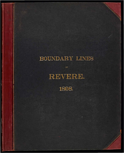
Atlas of the boundaries of the town of Revere, Suffolk County
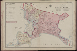
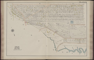
Atlas of the city of Chelsea and the towns of Revere & Winthrop, ...
Atlas of the city of Chelsea and the towns of Revere & Winthrop, ...
Atlas of the city of Chelsea and the towns of Revere & Winthrop, ...
Find More Like This >>
Tools
Share
Facebook
Pinterest
X
Reddit
Tumblr
Email
Copy link
Add to Folder
Questions/Comments
Cite This Item