Skip to search
Skip to main content
Skip to first result
Digital Commonwealth
Folders
Sign Up / Log In
Search for
Search
Search
Search
Basic
Advanced
Explore
Map
Collections
Institutions
Formats
For Educators
Primary Source Sets
Lesson Plans
Using Primary Sources
Searching Digital Commonwealth
For Institutions
Join Digital Commonwealth
Conferences, Trainings, & Events
How to Contribute Collections
Digitization Services
Board & Committees
Frequently Asked Questions
About
About Digital Commonwealth
News & Announcements
Copyright & Terms of Use
Harmful Content Statement
Partners
API
Contact Us
Search
Search Constraints
Start Over
Save Search
Your search:
More Like
commonwealth:7h149x134
✖
Remove constraint More Like: commonwealth:7h149x134
« Prev. |
1
-
100
of
11,046
|
Next »
Sort
by relevance
relevance
title
date (asc)
date (desc)
Number of results to display per page
100
per page
per page
10
per page
20
per page
50
per page
100
per page
View results as:
List
list view
Maps
map view
Gallery
grid view
Search Results
1.
Colton's map of the United States of America, the British provinces, Mexico and the West Indies : showing the country from the...
2.
Diagram of the United States of America, Mexico, the West India Islands and Isthmus of Darien : showing proposed routes of the...
3.
Karte von Nord-America für den schul- und privatgebrauch
4.
A Map exhibiting the frontiers of Canada and the United States : intended to illustrate the operations of the British &...
5.
Map of North America : showing all routes to Alaska and Klondike country
6.
Map of the United States : intending chiefly to exhibit the post roads & distances
7.
Map of the United States of America, the British Provinces, Mexico, the West Indies and Central America, with part of New...
8.
Map of the United States, the British provinces, Mexico, &c : showing the routes of the U.S. Mail steam packets to California,...
9.
Staaten am Atlantischen Ocean
10.
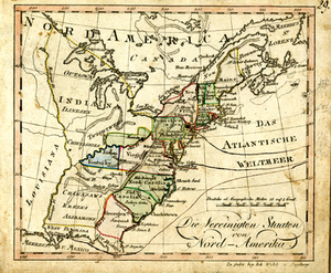
Die Vereinigten Staaten von Nord-Amerika.
11.
America settle
12.
Amerikanisch-Spanischer kriegsschauplatz
13.
British possessions in North America
14.
Carta universal en que se contiene todo lo que del mundo se ha descubierto fasta agora
15.
Carte de l'Amérique Septentrionale
16.
Carte du Mexique et des pays limitrophes situés au nord et à l'est : dressée d'après la grande carte de la Nouvelle Espagne...
17.
Illustrated Times map of North America
18.
Johnson's North America
19.
Linguistic families of American Indians north of Mexico
20.
Map of North America : to illustrate facts of geographical distribution
21.
Map of North America : reduced from map on scale of 1:5,000,000
22.
Map of North America
23.
Map of North America
24.
A map of North America, denoting the boundaries of the yearly meetings of Friends and the locations of the various Indian tribes
25.
Map of the provinces of upper & lower Canada with the adjacent parts of the United States of America, &c
26.
Map of the United States of America, the British provinces, Mexico, the West Indies and Central America, with part of New...
27.
Map showing the overland and overseas flights of Charles A. Lindbergh
28.
Mills map of the several routes proposed to the Pacific Ocean from the head waters of the Missouri, to the Isthmus of Darien
29.
Nord America
30.
Nord-America
31.
Nord-Amerika
32.
Nord-u. Mittel-Amerika
33.
North America
34.
North America
35.
North America
36.
North America
37.
North America
38.
Official map of American and Canadian airways and aerial mail routes
39.
A pictorial map of North America
40.
19th annual convention of the National Association of Real Estate Boards : at Tulsa, June 7 to June 11 in 1926
41.
2005 significant U.S. hurricane strikes
42.
38,000,000 escaped -- 10,000,000 died
43.
Aboriginal map of North America, denoting the boundaries and the locations of various Indian tribes
44.
The adventures of Mark Twain
45.
Alden's pictorial map of the United States of North America
46.
America : beauty, wonders, inspiration, progress, without end
47.
America the wonderland : a pictorial map of the United States
48.
Amérique Septentrionale
49.
Appletons' railway map of the United States and Canada
50.
Appletons' railway map of the United States and the Canadas : representing railways in actual operation, and those in the...
51.
Armour food source map
52.
Base-map of the United States
53.
Being a map of the United States in the year 1831 when the Country Gentleman first made its appearance as the Genesee Farmer
54.
Broadway of America an all year ... all weather comfortable route from coast to coast
55.
Carte des Etats-Unis
56.
Carte des Etats-Unis de l'Amérique-Nord : pour servir aux observations géologiqueir
57.
Carte générale des États-Unis de l'Amérique avec les plans des principales villes
58.
Case's map of the United States, the British provinces, Mexico, and part of the West Indies : compiled from the latest...
59.
Catholic America : a pictorial map portraying the contribution of Catholics in the development of the United States of America...
60.
Civil airways of the United States as designated in Civil Air Regulations - chapter 60
61.
Clemens' silent teacher, dissected map of the United States and of each state in counties
62.
Colton's general map of the United States : showing the railroad routes across the continent
63.
Colton's new railroad map of the United States & Canada
64.
Colton's plans of U.S. harbors : showing the position & vicinities of the most important fortifications on the sea-board and in...
65.
Complete map of the rail roads and water courses in the United States & Canada
66.
Dinsmore's complete map of the railroads & canals in the United States & Canada
67.
Dinsmore's complete map of the railroads & canals in the United States & Canada
68.
Dinsmore's new railroad map of the United States and the Canadas, showing all the railroads completed and in progress,...
69.
Disturnell's new map of the United States and Canada showing all the canals, rail roads, telegraph lines and principal stage...
70.
The Dominion of Canada from the latest surveys and data
71.
The eagle map of the United States
72.
Election map of the United States with 49 novel diagrams
73.
Electoral votes for President in 1916 and for Congress in 1918 : make your guess for 1920
74.
Ensign, Bridgman & Fanning's rail road map of the United States, showing the depots & stations
75.
États Unis
76.
The facts of prohibition in the United States
77.
The fifth column menaces America on a thousand fronts
78.
Fredonia or the United States of North-America : including also Cabotia, or the Canadian provinces; the Western Territory to...
79.
F.T. Neely's new commercial map of the United States, Canada, British Columbia, and Northern Mexico, showing all the railroads,...
80.
G. Woolworth Colton's new guide map of the United States & Canada : with railroads, counties etc
81.
Gay days around America : a pleasure map of festivals, pageants, and special events best reached by Greyhound ... the...
82.
General railway map engraved expressly for the Official guide of the railways and steam navigation lines of the United States,...
83.
Growth of the Commonwealth (A)
84.
Hammond's comprehensive map of the United States with portions of Canada and Mexico
85.
Illustrated map of the route of Transcontinental Air Transport, Inc.
86.
Illustrierte karte der Vereinigten Staaten von Amerika : mit darstellung der regionalen bodenschätze, produkte und...
87.
An improved map of the United States
88.
In flight with United Air Lines
89.
Indians of the U.S.A.
90.
Landing facilities and proposed airway system in the United States, 1923
91.
Lewis' free soil, slavery, and territorial map of the United States
92.
Lloyd's American railroad map
93.
Lloyd's American railroad map
94.
Lloyd's military maps : showing the principal places of interest
95.
Lloyd's new county map of the United States and Canadas showing battle fields, railroads, &c., compiled from the latest...
96.
Lloyd's new map of the United States, the Canadas, and New Brunswick, from the latest surveys showing every railroad & station...
97.
Makers of the U.S.A. : a friendship map
98.
Manuscript map of the United States
99.
Map in commemoration of the travels of Charles A. Lindbergh
100.
Map of all the railroads in the United States in operation and progress
« Previous
Next »
1
2
3
4
5
…
110
111
Limit your search
Subject
Real property--Massachusetts--Boston--Maps
2,278
Landowners--Massachusetts--Boston--Maps
2,117
Boston (Mass.)--Maps
1,966
Roxbury (Boston, Mass.)--Maps
351
Dorchester (Boston, Mass.)--Maps
317
Cambridge (Mass.)--Maps
266
Brookline (Mass.)--Maps
236
United States--Maps
226
more
Subject
»
Place
North and Central America
7,837
United States
6,455
Suffolk (county)
3,337
Boston
3,197
Massachusetts
3,166
Europe
963
Middlesex (county)
617
Canada
438
more
Place
»
Format
Maps/Atlases
10,987
Manuscripts
215
Prints
52
Books
35
Objects/Artifacts
10
Drawings/Illustrations
8
Posters
4
Available to use
No known restrictions
10,938
Creative Commons license
49
Date
View distribution
Current results range from
1482
to
2023
Date range begin
Date range end
View larger »
Collection
Norman B. Leventhal Map Center Collection
11,008
Boston and New England Maps (Collection of Distinction)
5,105
Urban Maps (Collection of Distinction)
4,846
Maritime Charts and Atlases (Collection of Distinction)
750
American Revolutionary War-Era Maps (Collection of Distinction)
652
Boston Redevelopment Authority Collection
86
American Antiquarian Society Collection
37
David Judkins Weaver Papers
2
more
Collection
»
Institution
Boston Public Library
11,005
American Antiquarian Society
37
Private Collection
3
Salem State University Archives and Special Collections
1