Carte des Etats-Unis de l'Amérique-Nord : pour servir aux observations géologiqueir
Carte des Etats-Unis de lAmérique-Nord
Item Information
Title:
Carte des Etats-Unis de l'Amérique-Nord : pour servir aux observations géologiqueir
Description:
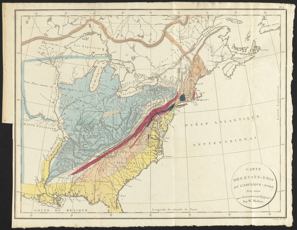
Geologic maps originated in Europe during the first half of the 18th century, but it wasn’t until the 19th century that they were more frequently produced. American geologists, following European advancements, were also producing maps. William Maclure ̶ Scottish-born but based in the United States ̶ was a pioneer in the field of American geology. His first map on the subject was issued in 1809. The 1811 French edition of the map is displayed here. Using color, Maclure indicates different rock units according to their ages over large swaths of the country, although the map lacks a legend and specific details.
Relief shown by hachures.
Prime meridian: Paris.
Removed from Suite des observations sur la géologie des États-Unis servant a l'explication de la carte ci-jointe.
In upper right corner: Pl. 1.
Notes (exhibitions):
Exhibited: "Beneath Our Feet: Mapping the World Below" organized by the Norman B. Leventhal Map Center at the Boston Public Library, 2017-2018.
Exhibited: "Beneath Our Feet" organized by the Norman B. Leventhal Map Center at the Boston Public Library, 2017.