Skip to search
Skip to main content
Skip to first result
Digital Commonwealth
Folders
Sign Up / Log In
Search for
Search
Search
Search
Basic
Advanced
Explore
Map
Collections
Institutions
Formats
For Educators
Primary Source Sets
Lesson Plans
Using Primary Sources
Searching Digital Commonwealth
For Institutions
Join Digital Commonwealth
Conferences, Trainings, & Events
How to Contribute Collections
Digitization Services
Board & Committees
Frequently Asked Questions
About
About Digital Commonwealth
News & Announcements
Copyright & Terms of Use
Harmful Content Statement
Partners
API
Contact Us
Search
Search Constraints
Start Over
Save Search
Your search:
norman leventhal
✖
Remove constraint norman leventhal
« Prev.
|
101
-
200
of
11,737
|
Next »
Sort
by relevance
relevance
title
date (asc)
date (desc)
Number of results to display per page
100
per page
per page
10
per page
20
per page
50
per page
100
per page
View results as:
List
list view
Maps
map view
Gallery
grid view
Search Results
101.
Urban Maps (Collection of Distinction)
102.
Chart from New York to Timber Island including Nantucket Shoals
103.
Chart from New York to Timber Island including Nantucket shoals
104.
View of Westerly, R.I : 1877
105.
A chart of the world upon Mercator's projection : describing the tracks of Capt. Cook in the year 1768, 69, 70, 71, and in...
106.
A new map of Ireland divided into provinces, counties, &c
107.
North Britain or Scotland divided into its counties : corrected from the best surveys & astronomical observations
108.
Le Royaume de Hongrie, divisé en Haute et Basse Hongrie, Transilvanie, Esclavonie et Croatie
109.
Turquie d'Europe
110.
Royaume de Danemarck : qui comprend le Nort-Jutland divisé en ses quatre dioceses, le Sud-Jutland divisé en ses deux duchés...
111.
Map New England
112.
A chart of the British Channel and the Bay of Biscay, with a part of the North Sea, and the entrance of St. George's Channel
113.
The kingdoms of Spain and Portugal, divided into their great provinces
114.
L'Afrique divisée en ses principaux états
115.
The Catholic Netherlands, divided into their several provinces with the roads
116.
Johnson's Massachusetts Connecticut and Rhode Island
117.
Boston with Charlestown and Roxbury
118.
Carte de l'Asie divisée en ses principaux etats
119.
The Dutch colony of the Cape of Good Hope
120.
Egypte nommée dans le pays Missir
121.
Hindoostan
122.
The kingdom of Poland and Great Dutchy of Lithuania with all their divisions
123.
L'Amérique divisée en ses principaux états
124.
Amérique méridionale : publiée sous les auspices de Monseigneur le Duc d'Orleans prémier prince du Sang
125.
Carte de l'Europe divisée en ses principaux états
126.
Constantinople, or Stambol
127.
La France divisée par généralités
128.
A map of the King of Great Britains dominions in Germany, or, the Electorate of Brunswick-Luneburg, with its dependencies :...
129.
The seven United Provinces, with their roads and divisions
130.
South Britain or England & Wales : drawn from several surveys &c. on the new projection ; corrected from astronomical...
131.
The province of Maine, from the best authorities
132.
L'Italie : publiée sous les auspices de Monseigneur le Duc d'Orleans, Prémier Prince du Sang
133.
A map of part of Rhode Island shewing the positions of the American and British armies at the Siege of Newport, and the...
134.
Plan of the bay, rock and town of Gibraltar, from an actual survey by an officer who was at Gibraltar from 1769 to 1775
135.
The United States of North America : with the British & Spanish territories according to the treaty
136.
A new and accurate plan of London, Westminster and the Borough of Southwark, with all the additional streets, squares, &c :...
137.
Plan of Boston
138.
Atlas to Marshall's life of Washington
139.
Walling and Gray's map of the United States and territories
140.
Rhode Island
141.
Carte générale des états du Roi de Sardaigne, reduite d'après la grande carte : pour trouver facilement ce qu'on a envie de...
142.
To his excellency the Count of Czernichew, Commander in Chief of her Majesty the Empress, of all the Russia's fleet and...
143.
Nouvelle carte de la Suisse dans laquelle sont exactement distingués les treize cantons, leurs alliés, et leurs sujets :...
144.
Boston's top 6 foreign languages spoken at home, 2010
145.
Map of the Empire of Germany : including all the states comprehended under that name : with the Kingdom of Prussia, &c
146.
Boston
147.
Illustrated map of the route of Transcontinental Air Transport, Inc.
148.
Carte geographique de la Nouvelle Franse
149.
Oil and gas producing areas in Oklahoma
150.
Structure map of northeastern Oklahoma
151.
An anciente mappe of Fairyland : newly discovered and set forth
152.
Carte des Etats-Unis de l'Amérique-Nord : pour servir aux observations géologiqueir
153.
Nuova pianta degli scavi di Pompei
154.
Plan des catacombes de Syracuse ; intérieur d'une des chambres sépulcrales des catacombes
155.
Systema ideale quo exprimitur, aquarum per canales hydragogos subterraneos ex mari et in montium hydrophylacia protrusio,...
156.
The world
157.
North Atlantic Ocean, southeast coast of North America, including the Bahamas and Greater Antilles
158.
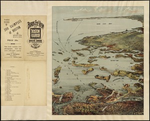
Porto Rico and Virgin Isles : Haiti, Hispaniola or St. Domingo
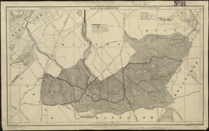
159.
Map of Arnold Arboretum showing location of the trees and shrubs
160.
A chart of Canada River : from ye island of Anticosty as far up as Quebeck, ye islands, locks, shoals, & soundings as they...
161.
A comprehensive atlas geographical, historical & commercial [title page]
162.
Eight views of the world
163.
Peters World map
164.
[Universal map of China]
165.
The cotton kingdom
166.
The eagle map of the United States
167.
Fitz globe
168.
Lloyd's map of the lower Mississippi River from St. Louis to the Gulf of Mexico
169.
Twentieth century Boston
170.
Aegyptus Antiqua
171.
Alas, poor Yorick!--from the painting by Horace Fisher
172.
The Bear Garden, the Globe Theatre
173.
Daniae regni typum potentissimo Invictissimoque D. Christiano, Daniae, Norvegiae, Gotthorum Vandalorum Regi lubens offert
174.
Europae
175.
Graeciae antiquae
176.
Hispaniae veteris descriptio
177.
Illustrations of Charlecote Hall, Church of the Holy Trinity, and New Place
178.
Illustrations of Shakespeare's house and school
179.
Magnifica illa civitas Verona ; Colonia augusta Verona nova gallieniana
180.
Map of the countries near to the land of Oz
181.
Map of the island of Tangerina and Wild Island
182.
A new map of Italy distinguishing all the sovereignties in it, whether states, kingdoms, dutchies, principalities, republicks,...
183.
A new mapp of England Scotland and Ireland
184.
Normandia ducatus
185.
Nuova pianta di Venezia = Neuer plan von Venedig
186.
Plan of ancient Rome
187.
Plan of Shakspeare's birth-place
188.
Regni Navarrae accurata tabula
189.
Repræsentatio scenographica Arcis Cronenburg auspiciis S.R. M. Sueciæ. ductu vero Exell. Dn. Com. C.G. Wrangelij reg. Sue....
190.
Title page of Theatrum Orbis Terrarum
191.
Typus orbis terrarum
192.
Yggdrasill, the mundane tree
193.
Map of the United States and territories with adjacent parts of Canada and Mexico, also part of the West India Islands :...
194.
Angling in troubled waters = der fischfang im truben = la peche en eau trouble = la pesca nelle acque turbes : a serio-comic...
195.
Bird's eye view of Boston Harbor and south shore to Provincetown showing steamboat routes
196.
Blue Hills Reservation
197.
Carte du Mexique et des pays limitrophes situés au nord et à l'est : dressée d'après la grande carte de la Nouvelle Espagne...
198.
Charles River : carries shown by red lines
199.
Citta di Venezia
200.
The facts of prohibition in the United States
« Previous
Next »
1
2
3
4
5
6
…
117
118
Limit your search
Subject
Real property--Massachusetts--Boston--Maps
2,278
Landowners--Massachusetts--Boston--Maps
2,117
Boston (Mass.)--Maps
1,995
Roxbury (Boston, Mass.)--Maps
352
Dorchester (Boston, Mass.)--Maps
317
Cambridge (Mass.)--Maps
267
Brookline (Mass.)--Maps
236
Real property--Massachusetts--Cambridge--Maps
216
more
Subject
»
Place
North and Central America
8,273
United States
6,908
Suffolk (county)
3,417
Massachusetts
3,336
Boston
3,278
Europe
1,009
Middlesex (county)
622
Canada
456
more
Place
»
Format
Maps/Atlases
11,645
Manuscripts
222
Prints
62
Books
39
Photographs
17
Objects/Artifacts
11
Drawings/Illustrations
10
Collections
6
more
Format
»
Available to use
No known restrictions
11,505
Creative Commons license
186
Date
View distribution
Current results range from
1482
to
2023
Date range begin
Date range end
View larger »
Unknown
6
Collection
Norman B. Leventhal Map Center Collection
11,713
Boston and New England Maps (Collection of Distinction)
5,290
Urban Maps (Collection of Distinction)
4,891
Maritime Charts and Atlases (Collection of Distinction)
1,109
American Revolutionary War-Era Maps (Collection of Distinction)
657
Mapping Boston Collection
140
David Judkins Weaver Papers
97
Boston Redevelopment Authority Collection
88
more
Collection
»
Institution
Boston Public Library
11,577
Private Collection
142
Salem Public Library
10
Jones Library, Amherst
3
Massachusetts Historical Society
2
Boston Athenaeum
1
Boston City Archives
1
Phillips Academy
1


![Systema ideale quo exprimitur, aquarum per canales hydragogos subterraneos ex mari et in montium hydrophylacia protrusio, aquarumq[ue] subterrestrium per pyragogos canales concoctus](https://bpldcassets.blob.core.windows.net/derivatives/images/commonwealth:n8710p89m/image_thumbnail_300.jpg)


![A comprehensive atlas geographical, historical & commercial [title page]](https://bpldcassets.blob.core.windows.net/derivatives/images/commonwealth:3f463182f/image_thumbnail_300.jpg)


![[Universal map of China]](https://bpldcassets.blob.core.windows.net/derivatives/images/commonwealth:qb98n8079/image_thumbnail_300.jpg)