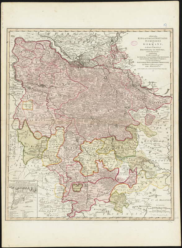
A map of the King of Great Britains dominions in Germany, or, the Electorate of Brunswick-Luneburg, with its dependencies : containing the dutchies of Luneburg, Calenberg, Grunbenhagen, Lauenburg, Bremen & Verden : and the counties of Danneberg, Hoya, Diepholt & Hohenstein
A map of the King of Great Britains dominions in Germany, or, the Electorate of Brunswick-Luneburg, with its dependencies
Item Information
Title:
A map of the King of Great Britains dominions in Germany, or, the Electorate of Brunswick-Luneburg, with its dependencies : containing the dutchies of Luneburg, Calenberg, Grunbenhagen, Lauenburg, Bremen & Verden : and the counties of Danneberg, Hoya, Diepholt & Hohenstein
Title (alt.):
Electorate of Brunswick-Luneburg with its dependencies
Relief shown pictorially.
Prime meridians: Ferro and London.
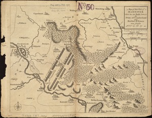
Inset: Plan of the battle of Minden on the 1st. of August 1759.
Conservation of this piece was funded by Alan and Sherry Leventhal in memory of his father, Norman B. Leventhal whose vision to create this Map Center will inspire generations to come.
Map 19 in a composite atlas with the title "Atlas of the world."
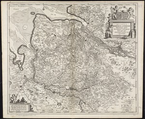
![Ducatus Brunsvicensis fere[que] Lunaeburgensis, cum adjacentibus Episcopatibus, Comit. Domin. etc., descriptio geographica](https://bpldcassets.blob.core.windows.net/derivatives/images/commonwealth:cj82kr74v/image_thumbnail_300.jpg)