Map of the United States and territories with adjacent parts of Canada and Mexico, also part of the West India Islands : showing the extent of public surveys, indian and military reservations, rail roads, canals and other details
Map of the United States and territories with adjacent parts of Canada and Mexico, also part of the West India Islands
Item Information
Title:
Map of the United States and territories with adjacent parts of Canada and Mexico, also part of the West India Islands : showing the extent of public surveys, indian and military reservations, rail roads, canals and other details
Description:
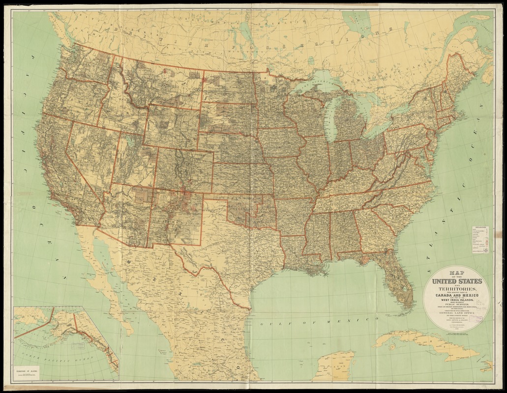
America Transformed: This map highlights the federal government's impact on transforming the American landscape by the end of the 19th century. Designed primarily to show the extent of township surveys, it uses a black grid pattern to represent lands that had been surveyed and open to settlement, which included all or most of the area in the public land states. The map shows the extent of Indian reservations (solid grey), military reservations (solid pink), and private land claims (pink cross hatch or pink outline). The latter, which represent Spanish land grants adjudicated during the 19th century, are most prevalent in Florida, New Mexico, Arizona, Colorado and California.
America Transformed: Viewpoint: As the U.S. government took over territory, it introduced the English concept of "land ownership" to lands that were never governed that way under Native stewardship. U.S. land acquisition literally meant that the land in question went from being perceived as "sustaining life" to "sustaining means or income." It was a big change and it was harsh on Native people. This dynamic overturned the power structure. Systematically Native peoples' life ways and cultures came under threat. Loss of access to land meant loss of true freedom. This process of dispossession repeats itself over and over, forcing Native peoples to begin adopting a foreign way of life as a matter of survival. –Chris Newell (Passamaquoddy), endawnis Spears (Navajo, Ojibwe, Chickasaw, Choctaw), Dr. Jason Mancini Ph.D., Akomawt Educational Initiative
compiled from the official surveys of the General Land Office and other authentic sources under the direction of the Hon. Lewis A. Grove ; A. F. Dinsmore.
Relief shown by hachures.
Prime meridians: Washington and Greenwich.
Inset: Territory of Alaska.
Notes (exhibitions):
Exhibited: "Back to School: Geography in the Classroom" organized by the Norman B. Leventhal Map Center at the Boston Public Library, 2014-2015.
Exhibited: "America Transformed. Part 2: Homesteads to Modern Cities," organized by the Norman B. Leventhal Map & Education Center at the Boston Public Library, 2019-2020.