Skip to search
Skip to main content
Skip to first result
Digital Commonwealth
Folders
Sign Up / Log In
Search for
Search
Search
Search
Basic
Advanced
Explore
Map
Collections
Institutions
Formats
For Educators
Primary Source Sets
Lesson Plans
Using Primary Sources
Searching Digital Commonwealth
For Institutions
Join Digital Commonwealth
Conferences, Trainings, & Events
How to Contribute Collections
Digitization Services
Board & Committees
Frequently Asked Questions
About
About Digital Commonwealth
News & Announcements
Copyright & Terms of Use
Harmful Content Statement
Partners
API
Contact Us
Search
Search Constraints
Start Over
Save Search
Your search:
More Like
commonwealth:q524n353r
✖
Remove constraint More Like: commonwealth:q524n353r
« Prev.
|
101
-
150
of
11,007
|
Next »
Sort
by relevance
relevance
title
date (asc)
date (desc)
Number of results to display per page
50
per page
per page
10
per page
20
per page
50
per page
100
per page
View results as:
List
list view
Maps
map view
Gallery
grid view
Search Results
101.
What's up? South! : world map
102.
The world
103.
The World
104.
[World map]
105.
The world, on Mercator's projection : showing the different routes to California, and distance by each; routes of different...
106.
The World, on the globular projection with a graduation for the measurement of distances especially adapted for the use oe...
107.
The world turned upside down
108.
The world upon globular projection and with a gazetteer of information
109.
Boston urban wilds
110.
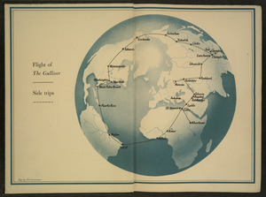
Flight of "The Gulliver"
111.
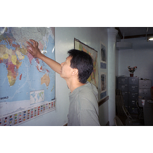
Man looking at wall map
112.
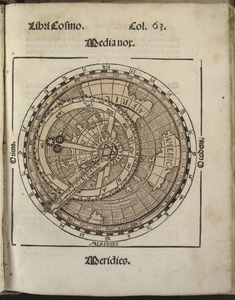
Small circular world map
113.
Typus orbis terrarum
114.
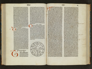
Unsigned and untitled T-O world map
115.
The world
116.
The world according to Standard (N.J.)
117.
The 100th anniversary map of Abraham Lincoln's visit to Massachusetts, September 11-23, 1848
118.
1630 shoreline
119.
1879. Progress map of the U.S. Geographical Surveys west of the 100th Meridian : prepared under the direction of 1st Lieut....
120.
1903 Map of Salem and surrounding places
121.
2005 significant U.S. hurricane strikes
122.
227 Harzgerode
123.
305 Glatz
124.
38,000,000 escaped -- 10,000,000 died
125.
4 Kinten
126.
660 Wakulah St., Roxbury
127.
[A chart of Boston Bay and vicinity]
128.
[A chart of New York Island & North River : East River, passage through Hell Gate, Flushing Bay, Hampstead Bay, Oyster,...
129.
The A.A.A. key road map of continental Europe
130.
Aaron Bohrod's America, its history
131.
ABC pathfinder railway guide map : eastern division
132.
Aboriginal map of North America, denoting the boundaries and the locations of various Indian tribes
133.
Accurata delineatio Castrorum Suecicorum, ut et Haffniae, Regni Daniae Metropolis
134.
Accurata delineatio oppugnatae a faederatis, Caesareis, Polonicis, Danicis, et Brandeburgicis copijs sub-ductu Seren: Electoris...
135.
Accurata delineatio regionis circa Nieburgum Fioniæ cum prælio ibi commisso inter Danorum et fæderatorum exercitum ab una et...
136.
Accurata Scaniae, Blekingiae et Hallandiae descriptio
137.
An accurate map of Cuba, and the adjacent islands
138.
An accurate map of Dorset Shire divided into hundreds
139.
An accurate map of Dorset Shire, divided into its hundreds
140.
An accurate map of England and Wales with the principal roads from the best authorities
141.
An accurate map of England and Wales with the principal roads from the best authorities
142.
An accurate map of Europe from the best authorities
143.
An accurate map of Hindostan or India, from the best authorities
144.
An accurate map of His Majesty's province of New-Hampshire in New England : taken from actual surveys of all the inhabited...
145.
An Accurate map of New Hampshire in New England, from a late survey
146.
An Accurate map of New York in North America, from a late survey
147.
An accurate map of North America : describing and distinguishing the British and Spanish dominions on this great continent :...
148.
An accurate map of North America : describing and distinguishing the British and Spanish dominions of this great continent;...
149.
An accurate map of North America : describing and distinguishing the British, Spanish and French dominions on this great...
150.
An accurate map of North and South Carolina with their Indian frontiers, shewing in a distinct manner all the mountains,...
« Previous
Next »
1
2
3
4
5
6
7
…
220
221
Limit your search
Subject
Real property--Massachusetts--Boston--Maps
2,278
Landowners--Massachusetts--Boston--Maps
2,117
Boston (Mass.)--Maps
1,967
Roxbury (Boston, Mass.)--Maps
351
Dorchester (Boston, Mass.)--Maps
317
Cambridge (Mass.)--Maps
266
Brookline (Mass.)--Maps
236
Real property--Massachusetts--Cambridge--Maps
216
more
Subject
»
Place
North and Central America
7,816
United States
6,435
Suffolk (county)
3,339
Boston
3,199
Massachusetts
3,167
Europe
963
Middlesex (county)
617
Canada
427
more
Place
»
Format
Maps/Atlases
10,947
Manuscripts
215
Prints
51
Books
35
Objects/Artifacts
10
Drawings/Illustrations
8
Posters
4
Photographs
1
Available to use
No known restrictions
10,934
Creative Commons license
46
Date
View distribution
Current results range from
1482
to
2023
Date range begin
Date range end
View larger »
Collection
Norman B. Leventhal Map Center Collection
11,003
Boston and New England Maps (Collection of Distinction)
5,107
Urban Maps (Collection of Distinction)
4,847
Maritime Charts and Atlases (Collection of Distinction)
750
American Revolutionary War-Era Maps (Collection of Distinction)
615
Boston Redevelopment Authority Collection
87
Sidney R. Knafel Map Collection at Phillips Academy
2
Chinese Progressive Association Records
1
Institution
Boston Public Library
11,004
Phillips Academy
2
Northeastern University Library
1


![[World map]](https://bpldcassets.blob.core.windows.net/derivatives/images/commonwealth:x059cd25x/image_thumbnail_300.jpg)

![The World, on the globular projection with a graduation for the measurement of distances especially adapted for the use oe [sic] schools, geographical & historical lectures, and missionary meetings](https://bpldcassets.blob.core.windows.net/derivatives/images/commonwealth:ww72bp12b/image_thumbnail_300.jpg)


![[A chart of Boston Bay and vicinity]](https://bpldcassets.blob.core.windows.net/derivatives/images/commonwealth:cj82m2976/image_thumbnail_300.jpg)


