Search


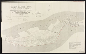
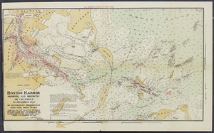
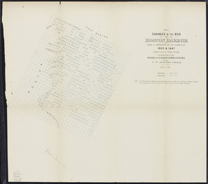
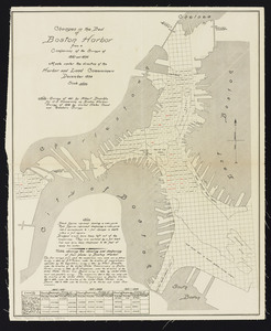
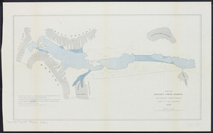
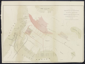
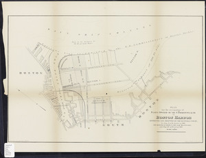
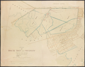
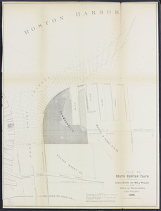
![[Plan of channels and flats as they were before the 200 feet outside of the Mill Dam was filled up]](https://bpldcassets.blob.core.windows.net/derivatives/images/commonwealth:b8516207x/image_thumbnail_300.jpg)


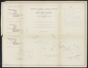
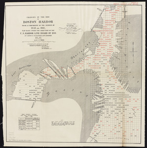
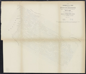
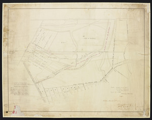
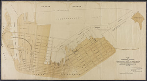
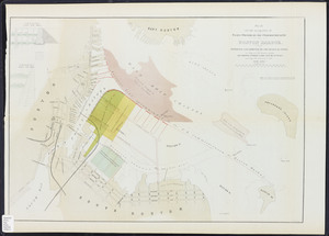
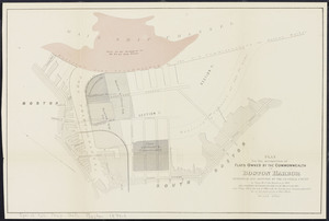
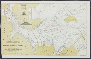
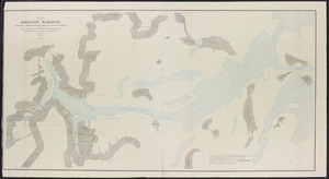
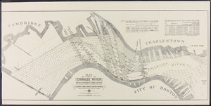
![Copy of a plan of the Harbour of Boston [Charles River] made by Commissioners January 27, 1837 ; shewing the harbour line recommended by Commissioners in 1839](https://bpldcassets.blob.core.windows.net/derivatives/metadata/commonwealth-oai:0c484161w/image_thumbnail_300.jpg)
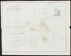
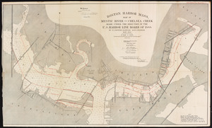
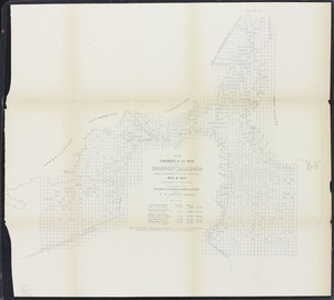
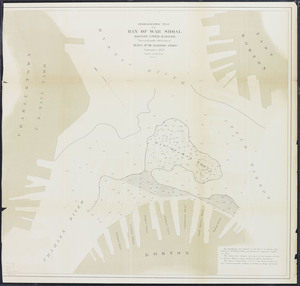
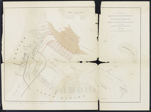
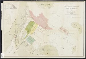
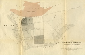
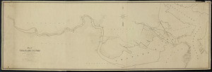
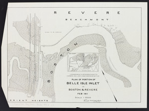
![Copy of a plan of the Harbour of Boston [Chelsea Creek]](https://bpldcassets.blob.core.windows.net/derivatives/metadata/commonwealth-oai:jd473c44m/image_thumbnail_300.jpg)
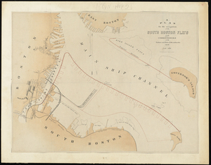
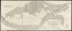
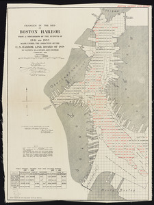
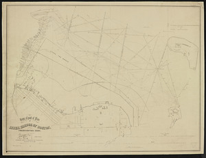
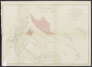
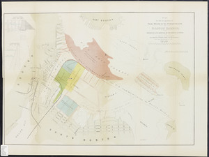
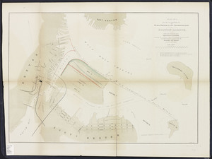
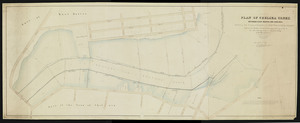
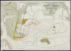
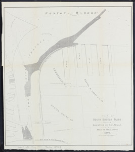
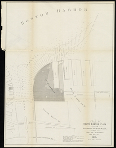
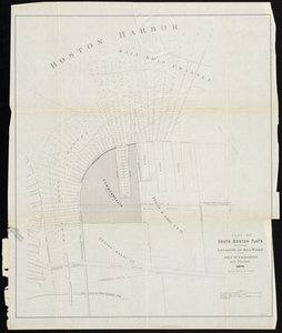
![Copy of a plan of the Harbour of Boston [South Boston]](https://bpldcassets.blob.core.windows.net/derivatives/metadata/commonwealth-oai:8336hj18z/image_thumbnail_300.jpg)


Limit your search
- North and Central America7,908
- United States6,527
- Suffolk (county)3,422
- Boston3,282
- Massachusetts3,247
- Europe963
- Middlesex (county)617
- Canada427
- Norman B. Leventhal Map Center Collection11,011
- Boston and New England Maps (Collection of Distinction)5,119
- Urban Maps (Collection of Distinction)4,852
- Maritime Charts and Atlases (Collection of Distinction)754
- American Revolutionary War-Era Maps (Collection of Distinction)616
- Boston Redevelopment Authority Collection89
- Massachusetts Board of Harbor and Land Commissioners66
- Historic Maps13