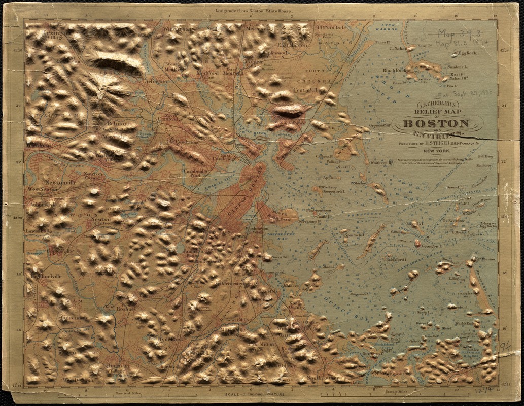
Three-dimensional relief maps are visual aids that assist schoolchildren in understanding physical terrain. The first relief maps were created in China, and appeared in Europe in the late 18th century. This map of Boston and vicinity demonstrates the hilly character of the suburbs and harbor islands.