Skip to search
Skip to main content
Skip to first result
Digital Commonwealth
Folders
Sign Up / Log In
Search for
Search
Search
Search
Basic
Advanced
Explore
Map
Collections
Institutions
Formats
For Educators
Primary Source Sets
Lesson Plans
Using Primary Sources
Searching Digital Commonwealth
For Institutions
Join Digital Commonwealth
Conferences, Trainings, & Events
How to Contribute Collections
Digitization Services
Board & Committees
Frequently Asked Questions
About
About Digital Commonwealth
News & Announcements
Copyright & Terms of Use
Harmful Content Statement
Partners
API
Contact Us
Search
Search Constraints
Start Over
Save Search
Your search:
More Like
commonwealth:1257bw35v
✖
Remove constraint More Like: commonwealth:1257bw35v
« Prev.
|
1,101
-
1,200
of
11,688
|
Next »
Sort
by date (desc)
relevance
title
date (asc)
date (desc)
Number of results to display per page
100
per page
per page
10
per page
20
per page
50
per page
100
per page
View results as:
List
list view
Maps
map view
Gallery
grid view
Search Results
1101.
Franklin Park general plan for zoological garden
1102.
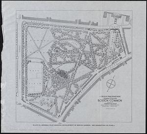
General plan for Boston Common
1103.
General plan for Columbus Park, Strandway, South Boston
1104.
General plan of Mt. Hope cemetery showing surrounding streets and the general scheme of interior roads, paths, and arrangement...
1105.
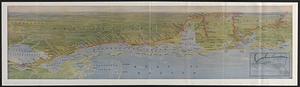
The Gulf Coast
1106.
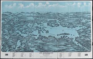
Lake Winnipesaukee, New Hampshire
1107.
The League of Nations, 1925
1108.
Location of public open spaces
1109.
Map of Alaska
1110.
Map of Cambridge roads, about 1807
1111.
A map of New York which is published by the Washington Square Bookshop
1112.
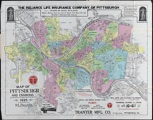
Map of Pittsburgh and environs : from official records, original plats, and actual surveys
1113.
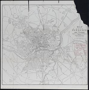
Map of the city of Lawrence and vicinity
1114.
Map of the Metropolitan District of Boston showing local public reservations and holdings of the Metropolitan District...
1115.
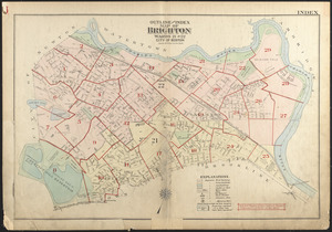
Outline and index map of Brighton, wards 21 and 22, city of Boston
1116.
Pittsburgh district
1117.
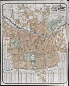
Plano jeneral de la ciudad de Santiago e inmediaciones : con el nuevo límite urbano de la ciudad, creacion de nuevas comunas,...
1118.
The Price & Lee Co's map of the city of Springfield Mass.
1119.
Rand McNally standard map of Alaska
1120.
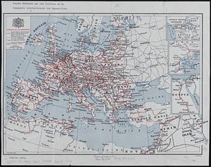
Reseau parcouru par les voitures de la Compagnie Internationale des Wagons-lits
1121.
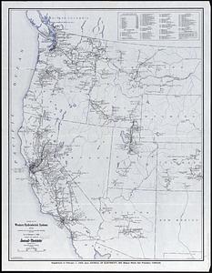
Revised map of western hydroelectric systems showing transmission lines, power plants and some major undeveloped power sites as...
1122.
Soil reconnoissance, Montana 1925 : Chouteau County
1123.
South western districts
1124.
Southeast States road map
1125.
Standard railway map of South Africa = Standaard spoorwegkaart van Suidafrika
1126.
State of Virginia : stations and transmission lines used in public service in 1925 and gaging stations
1127.
Structure map of northeastern Oklahoma
1128.
City of Boston zoning map
1129.
The Alaska Railroad
1130.
Artarias karte der Russischen sozialistischen förderativen Sowjet-Republik (R.S.F.S.R.)
1131.
Atlas of the city of Boston : West Roxbury
1132.
Atlas of the city of Boston : West Roxbury : from actual surveys and official plans
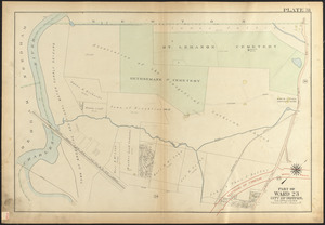
1133.
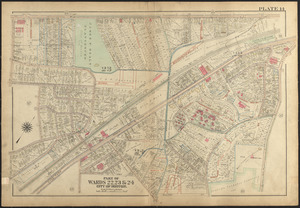
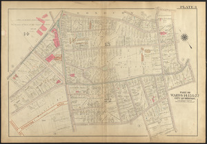
Atlas of the city of Boston, West Roxbury : plate 14
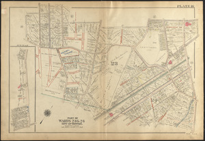
1134.
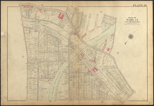
Atlas of the city of Boston, West Roxbury : plate 20
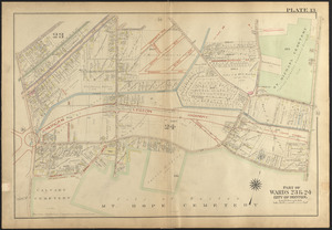
1135.
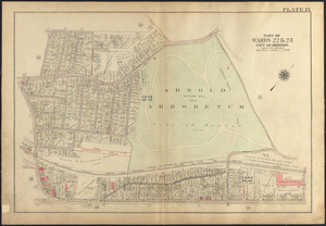
Atlas of the city of Boston, West Roxbury : plate 15
1136.
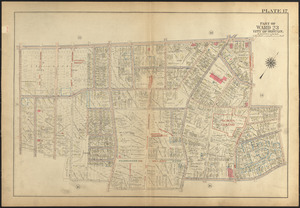
Atlas of the city of Boston, West Roxbury : plate 17
1137.
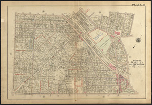
Atlas of the city of Boston, West Roxbury : plate 18
1138.
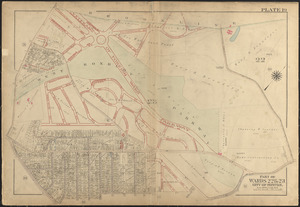
Atlas of the city of Boston, West Roxbury : plate 21
1139.
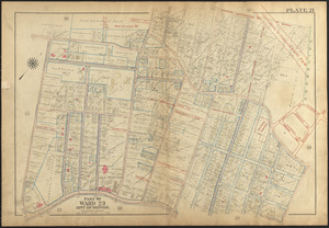
Atlas of the city of Boston, West Roxbury : plate 19
1140.
Atlas of the city of Boston, West Roxbury : plate 16
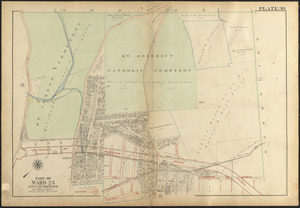
1141.
Atlas of the city of Boston, West Roxbury : plate 13
1142.
Atlas of the city of Boston, West Roxbury : plate 30
1143.
Atlas of the city of Boston, West Roxbury : plate 31
1144.
Atlas of the city of Boston, West Roxbury : plate 11
1145.
Atlas of the city of Boston, West Roxbury : plate 9
1146.
Atlas of the city of Boston, West Roxbury : plate 8
1147.
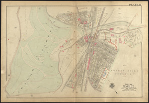
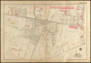
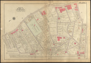
Atlas of the city of Boston, West Roxbury : plate 7
1148.
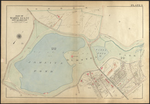
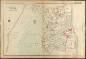
Atlas of the city of Boston, West Roxbury : plate 6
1149.
Atlas of the city of Boston, West Roxbury : [plate 4.5]
1150.
Atlas of the city of Boston, West Roxbury : plate 10
1151.
Atlas of the city of Boston, West Roxbury : plate 12
1152.
Atlas of the city of Boston, West Roxbury : plate 3
1153.
Atlas of the city of Boston, West Roxbury : plate 2
1154.
Atlas of the city of Boston, West Roxbury : plate 1
1155.
Atlas of the city of Boston, West Roxbury : plate 4
1156.
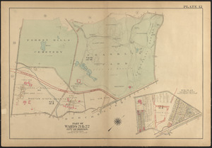
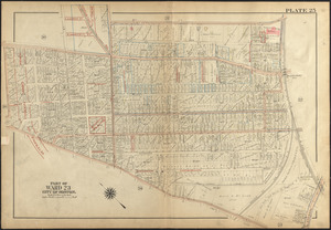
Atlas of the city of Boston, West Roxbury : plate 25
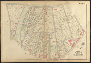
1157.
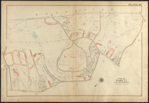
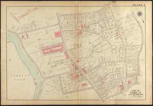
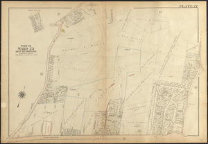
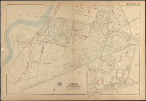
Atlas of the city of Boston, West Roxbury : plate 27
1158.
Atlas of the city of Boston, West Roxbury : plate 5
1159.
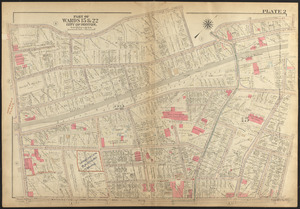
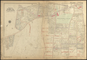
Atlas of the city of Boston, West Roxbury : plate 22
1160.
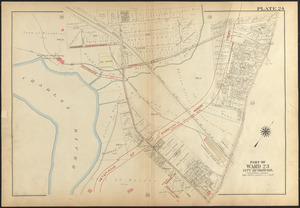
Atlas of the city of Boston, West Roxbury : plate 24
1161.
Atlas of the city of Boston, West Roxbury : plate 26
1162.
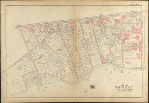
Atlas of the city of Boston, West Roxbury : plate 23
1163.
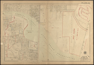
Atlas of the city of Boston, West Roxbury : plate 28
1164.
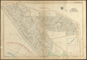
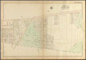
Atlas of the city of Boston, West Roxbury : plate 29
1165.
Base map of Illinois
1166.
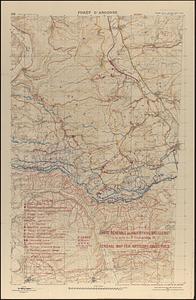
Carte générale des objectifs d'artillerie a la date du 24 Août 1918 = General map for artillery objectives up to the of 24th...
1167.
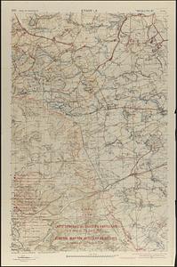
Carte générale des objectifs d'artillerie à la date du 9 Septembre 18 = General map for artillery objectives up to the 9th...
1168.
Carte générale des objectifs d'artillerie à la date du 9 Septembre 1918 = General map for artillery objectives up to the 9th...
1169.
Carte générale des objectifs d'artillerie à la date du 9 Septembre 1918 = General map for artillery objectives up to the 9th...
1170.
China
1171.
[Chippewa] National Forest, Minnesota
1172.
City of Boston zoning map
1173.
Electric transmission systems of the United States, showing all transmission lines and interconnections above 11,000 volts also...
1174.
Erez Israel = Erets Yiśraʼel : adamah ʻIvrit
1175.
Kootenai National Forest, Montana
1176.
Landing facilities and proposed airway system in the United States, 1924
1177.
Map of a part of the City of Nashua, New Hampshire
1178.
Map of central Boston and Cambridge
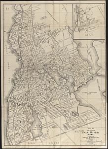
1179.
Map of the city of Fall River, Mass.
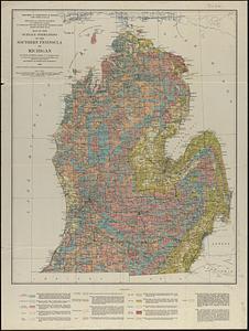
1180.
Map of the surface formations of the southern peninsula of Michigan
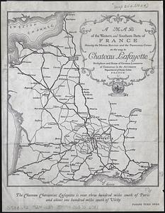
1181.
A map of the western and southern parts of France showing the motor routes and the principal cities on the way to Chateau...
1182.
North America
1183.
Official highway map of the state of Vermont
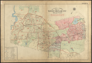
1184.
Outline and index map of West Roxbury, city of Boston
1185.
Plan of land at Buzzards Bay, Mass., belonging to the N.E. Telephone & Telegraph Co.
1186.
Rand McNally official 1924 auto trails map Maine ; Rand McNally official 1924 auto trails map New Hampshire, Vermont
1187.
Rand McNally standard map of Toronto and environs
1188.
Rand McNally standard map of Washington D.C.
1189.
Richards standard atlas of the city of Lynn and the towns of Swampscott, Saugus and Nahant, Massachusetts : from official...
1190.
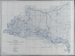
Sitgreaves National Forest, Arizona
1191.
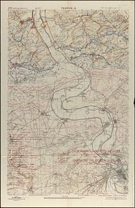
St. Mihiel - B
1192.
Zhongguo di zhi tu = General geological map of China : Peking-Tsinan Sheet
1193.
Boston Harbor
1194.
Diagram showing the Changuinola Railroad lines
1195.
Drake's silver map : British Museum
1196.
Greater Macon
1197.
Landing facilities and proposed airway system in the United States, 1923
1198.
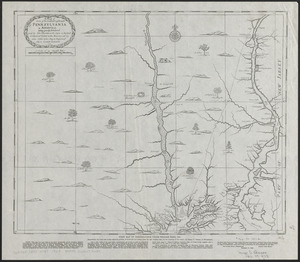
A map of some of the south and east bounds of Pennsylvania in America, being partly inhabited
1199.
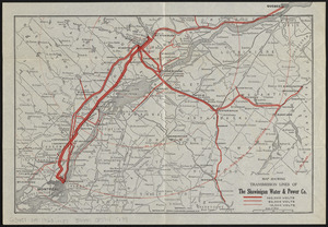
Map showing transmission lines of the Shawinigan Water & Power Co.
1200.
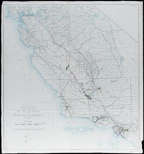
Oil and gas fields of the state of California
« Previous
Next »
1
2
…
8
9
10
11
12
13
14
15
16
…
116
117
Limit your search
Subject
Real property--Massachusetts--Boston--Maps
2,355
Boston (Mass.)--Maps
2,181
Landowners--Massachusetts--Boston--Maps
2,153
Roxbury (Boston, Mass.)--Maps
363
Dorchester (Boston, Mass.)--Maps
325
Cambridge (Mass.)--Maps
268
Brookline (Mass.)--Maps
237
Real property--Massachusetts--Cambridge--Maps
216
more
Subject
»
Place
North and Central America
8,977
United States
7,899
Massachusetts
5,060
Suffolk (county)
3,642
Boston
3,502
Europe
1,359
Middlesex (county)
620
Canada
448
more
Place
»
Format
Maps/Atlases
11,629
Manuscripts
215
Prints
56
Books
35
Objects/Artifacts
10
Drawings/Illustrations
8
Posters
4
Available to use
No known restrictions
11,489
Creative Commons license
67
Date
View distribution
Current results range from
1482
to
2023
Date range begin
Date range end
View larger »
Unknown
4
Collection
Norman B. Leventhal Map & Education Center Collection
11,412
Boston and New England Maps (Collection of Distinction)
5,307
Urban Maps (Collection of Distinction)
5,037
Maritime Charts and Atlases (Collection of Distinction)
1,081
American Revolutionary War-Era Maps (Collection of Distinction)
625
Boston Redevelopment Authority Collection
253
Historic Maps
49
Massachusetts Real Estate Atlases
38
more
Collection
»
Institution
Boston Public Library
11,557
State Library of Massachusetts
52
Salem State University Archives and Special Collections
49
Private Collection
20
American Antiquarian Society
9
Boston Athenaeum
1


![[Chippewa] National Forest, Minnesota](https://bpldcassets.blob.core.windows.net/derivatives/images/commonwealth:th83pg40d/image_thumbnail_300.jpg)