Skip to search
Skip to main content
Skip to first result
Digital Commonwealth
Folders
Sign Up / Log In
Search for
Search
Search
Search
Basic
Advanced
Explore
Map
Collections
Institutions
Formats
For Educators
Primary Source Sets
Lesson Plans
Using Primary Sources
Searching Digital Commonwealth
For Institutions
Join Digital Commonwealth
Conferences, Trainings, & Events
How to Contribute Collections
Digitization Services
Board & Committees
Frequently Asked Questions
About
About Digital Commonwealth
News & Announcements
Copyright & Terms of Use
Harmful Content Statement
Partners
API
Contact Us
Search
Search Constraints
Start Over
Save Search
Your search:
map
✖
Remove constraint map
« Prev.
|
301
-
350
of
34,085
|
Next »
Sort
by relevance
relevance
title
date (asc)
date (desc)
Number of results to display per page
50
per page
per page
10
per page
20
per page
50
per page
100
per page
View results as:
List
list view
Maps
map view
Gallery
grid view
Search Results
301.
Map of eastern Virginia
302.
Orographical map of Scotland
303.
[Map of the world]
304.
Relief map of Palestine
305.
The map of Europe
306.
Cape Cod Seaplanes map
307.
Route map of Massachusetts
308.
County Map of Texas
309.
Map of Boston Common : with surrounding streets & adjacent parts of Beacon Hill
310.
Map of the Antarctic
311.
Tourist's map of Scotland : reduced by permission from the Ordnance Survey by John Bartholomew, F.R.G.S.
312.
Topographical map of Meekatharra
313.
Automobile map of Massachusetts : central section
314.
Commercial map of China : showing treaty ports, ports of foreign control, railways, telegraphs, waterways, etc., 1899
315.
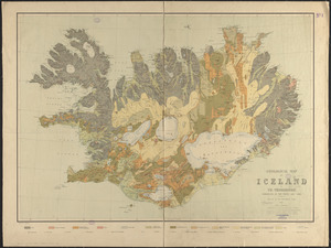
Geological map of Iceland
316.
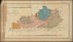
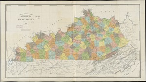
Preliminary map of Kentucky
317.
Scarborough's map of Ontario : with an index of all cities, villages, post-offices and railway stations and population...
318.
Map of Connecticut River
319.
Map of Ireland Parish
320.
Map of South Hadley
321.
Bicycle map of Massachusetts
322.
Map of Boston Harbor
323.
Geologic map of Kentucky : showing oil and gas pools and pipelines and the eastern and western coalfields
324.
Preliminary map of Kentucky
325.
Map of Oklahoma Territory
326.
Map of Fresh Pond : showing the division lines of the proprietors extended into the pond and defining their right to the same...
327.
Pictorial map of Mexico
328.
Geological map of Massachusetts
329.
Metropolitan Boston transportation map : subway, bus, rail
330.
Metropolitan Boston transportation map : subway, bus, rail
331.
Metropolitan Boston transportation map : subway, bus, rail
332.
Lloyd's American railroad map
333.
Lloyd's American railroad map
334.
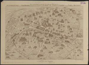
Illustrated map of Paris : or stranger's guide to the public buildings, theatres, and all places of amusement
335.
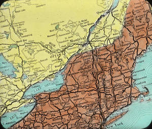
Map of New England
336.
Map of North America
337.
Military map of Pennsylvania
338.
Map of the world
339.
Map of Whitley County
340.
Transportation map of Manchoukuo
341.
A map of Chicago : incorporated as a town August 5, 1833
342.
1879 Map, Halifax, Massachusetts
343.
Map of Charleston, S.C
344.
Map of Haverhill, Massachusetts
345.
Map of Newport, R.I
346.
Map of Boston 1862 : photographically reduced from the plans of James Slade, City Engineer : with all the latest improvements :...
347.
Map of Arizona Territory
348.
Map of Massachusetts proper
349.
Russell's map of Massachusetts
350.
Base map of Illinois
« Previous
Next »
1
2
3
4
5
6
7
8
9
10
11
…
681
682
Limit your search
Subject
Land use--Massachusetts
10,047
Maps--Massachusetts
10,047
Real property--Massachusetts--Boston--Maps
2,356
Boston (Mass.)--Maps
2,182
Landowners--Massachusetts--Boston--Maps
2,154
Roads
1,693
Cities and towns
1,683
Land use mapping
1,680
more
Subject
»
Place
North and Central America
28,494
United States
26,997
Massachusetts
21,501
Suffolk (county)
4,782
Boston
4,621
Essex (county)
2,471
Massachusetts--Worcester County
1,926
Middlesex (county)
1,638
more
Place
»
Format
Maps/Atlases
20,389
Photographs
11,591
Prints
8,861
Manuscripts
2,432
Documents
448
Books
391
Drawings/Illustrations
333
Letters/Correspondence
331
more
Format
»
Available to use
No known restrictions
17,200
Creative Commons license
2,115
Date
View distribution
Current results range from
1482
to
2023
Date range begin
Date range end
View larger »
Unknown
594
Collection
Norman B. Leventhal Map Center Collection
11,713
William P. MacConnell Aerial Photograph Collection, ca. 1950-2000
10,047
Boston and New England Maps (Collection of Distinction)
5,680
Urban Maps (Collection of Distinction)
5,273
Land study maps, 1936-1937
1,680
Maritime Charts and Atlases (Collection of Distinction)
1,110
American Revolutionary War-Era Maps (Collection of Distinction)
848
Lawrence, Mass. Engineering Department. City Sewers
717
more
Collection
»
Institution
Boston Public Library
12,670
Special Collections and University Archives, University of Massachusetts Amherst Libraries
10,535
Massachusetts Archives
2,659
Lawrence Public Library
1,496
Harvard University
724
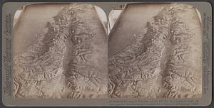
State Library of Massachusetts
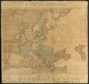
719
New Bedford Free Public Library
487
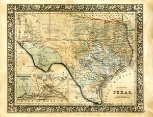
Historic New England
354
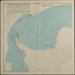
more
Institution
»

![[Map of the world]](https://bpldcassets.blob.core.windows.net/derivatives/images/commonwealth:79408320r/image_thumbnail_300.jpg)