Skip to search
Skip to main content
Digital Commonwealth
Folders
Sign Up / Log In
Search for
Search
Search
Search
Basic
Advanced
Explore
Map
Collections
Institutions
Formats
For Educators
Primary Source Sets
Lesson Plans
Using Primary Sources
Searching Digital Commonwealth
For Institutions
Join Digital Commonwealth
Conferences, Trainings, & Events
How to Contribute Collections
Digitization Services
Board & Committees
Frequently Asked Questions
About
About Digital Commonwealth
News & Announcements
Copyright & Terms of Use
Harmful Content Statement
Partners
API
Contact Us
Boston Public Library
Norman B. Leventhal Map & Education Center Collection
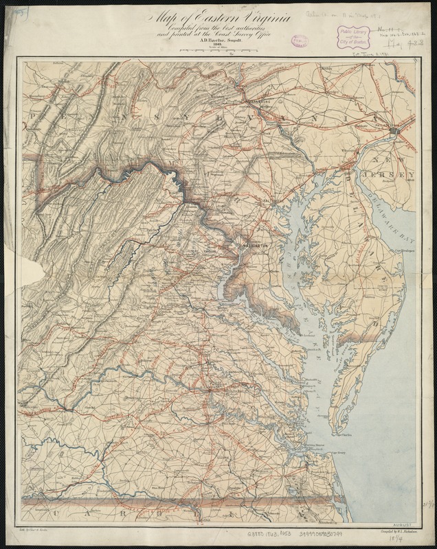
Map of eastern Virginia
Map of eastern Virginia
×
Item Information
Title:
Map of eastern Virginia
Title (alt.):
Eastern Virginia
Creator:
Nicholson, W. L.
Name on Item:
compiled from the best authorities and printed at the Coast Survey Office, A.D. Bache, supdt. ; compiled by W.L. Nicholson ; lith. by Chas. G. Krebs.
Date:
1863
Format:
Maps/Atlases
Location:
Boston Public Library
Norman B. Leventhal Map & Education Center
Collection (local):
Norman B. Leventhal Map & Education Center Collection
Subjects:
Virginia--Maps
Maryland--Maps
Places:
Virginia
Maryland
Extent:
1 map : col. ; 56 x 48 cm.
Permalink:
https://ark.digitalcommonwealth.org/ark:/50959/kk91fr80j
Terms of Use:
No known copyright restrictions.
No known restrictions on use.
Publisher:
[Washington] : The Office
Scale:
Scale ca. 1:875,000.
Language:
English
Notes:
Relief shown by hachures.
Also covers Maryland, and southeastern Pennsylvania.
Shows radial distances from Richmond and Washington, D.C.
In right lower corner: August.
Identifier:
06_01_007381
Call #:
G3880 1863 .N53
Barcode:
39999059030799
show more...
View MODS XML
More Like This
Colton's new topographical map of the states of Virginia, Maryland ...
Colton's new topographical map of the states of Virginia, West ...
Johnson's Virginia, Delaware, Maryland & West Virginia
Map of eastern Virginia
Find More Like This >>
Tools
Share
Facebook
Pinterest
X
Reddit
Tumblr
Email
Copy link
Add to Folder
Questions/Comments
Cite This Item
IIIF Manifest
Downloads
Primary (full resolution, uncompressed)
(TIF, 206 MB)
Large (full resolution)
(JPEG, 17.3 MB)
Medium
(JPEG, 252 KB)
GeoTIFF (georeferenced)
(TIF, 306 MB)