Skip to search
Skip to main content
Digital Commonwealth
Sign Up / Log In
Search for
Search
Search
Search
Basic
Advanced
Explore
Map
Collections
Institutions
Formats
For Educators
Primary Source Sets
Lesson Plans
Using Primary Sources
Searching Digital Commonwealth
For Institutions
Join Digital Commonwealth
Conferences, Trainings, & Events
How to Contribute Collections
Digitization Services
Board & Committees
Frequently Asked Questions
About
About Digital Commonwealth
News & Announcements
Copyright & Terms of Use
Harmful Content Statement
Partners
API
Contact Us
Boston Public Library
Norman B. Leventhal Map & Education Center Collection
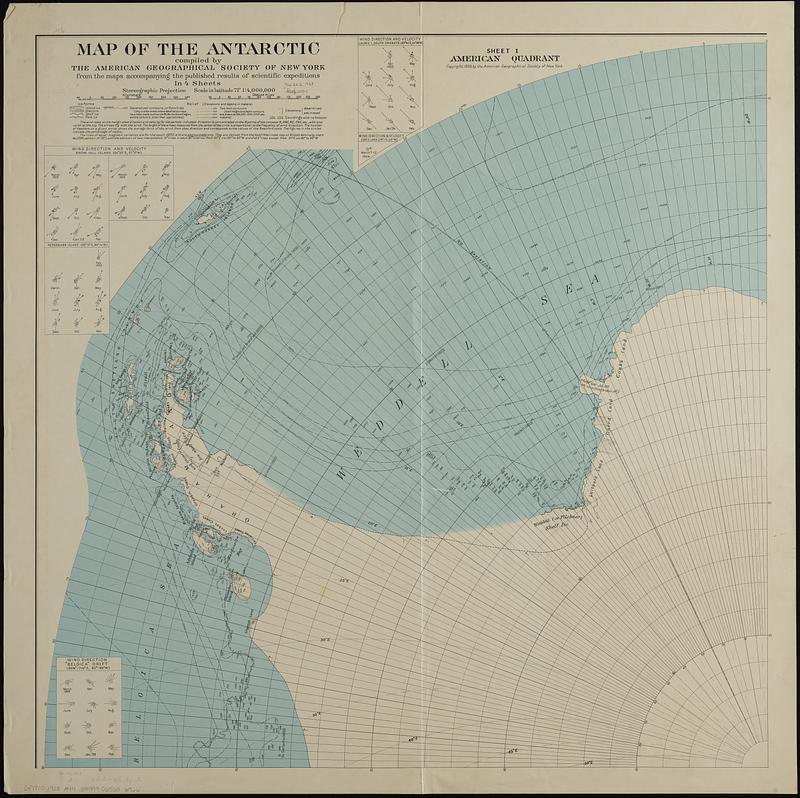
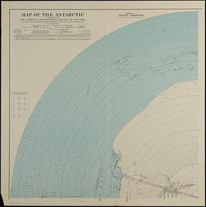
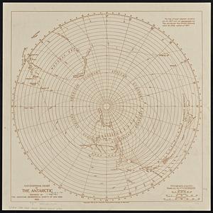
Map of the Antarctic
Viewing image 1 of 4
Next >
Map of the Antarctic
×
Next
Item Information
Title:
Map of the Antarctic
Publisher:
American Geographical Society of New York
Name on Item:
compiled by the American Geographical Society of New York from the maps accompanying the published results of scientific expeditions
Date:
1928
Format:
Maps/Atlases
Location:
Boston Public Library
Norman B. Leventhal Map & Education Center
Collection (local):
Norman B. Leventhal Map & Education Center Collection
Subjects:
Antarctica--Maps
Places:
Antarctica
Extent:
1 map on 4 sheets : col. ; sheets 81 x 81 cm. + explanatory note (8 p. ; 16 cm.)
Permalink:
https://ark.digitalcommonwealth.org/ark:/50959/jh3484468
Terms of Use:
No known copyright restrictions.
No known restrictions on use.
Publisher:
New York : The Society
Scale:
Scale 1:4,000,000
Language:
English
Table of Contents:
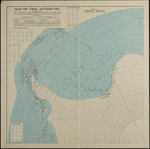
Sheet 1: America quadrant
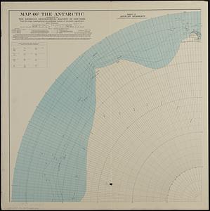
sheet 2: African quadrant
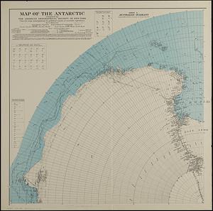
sheet 3: Australian quadrant
sheet 4: Pacific quadrant.
Notes:
Relief shown by contours and spot heights. Depth shown by soundings and isolines.
Wind direction and velocity shown for each quadrant.
Identifier:
06_01_018935A
06_01_018935B
06_01_018935C
06_01_018935D
Call #:
G9800 1928 .A44
Barcode:
39999065686766
show more...
View MODS XML
More Like This
Navigational chart of the Antarctic
Nord-Polar-karte
The 100th anniversary map of Abraham Lincoln's visit to ...
1630 shoreline
Find More Like This >>
Tools
Share
Facebook
Pinterest
X
Reddit
Tumblr
Email
Copy link
Add to Folder
Questions/Comments
Cite This Item
IIIF Manifest
Downloads
Primary (full resolution, uncompressed)
(TIF, multi-file ZIP, 1.1 GB)
Large (full resolution)
(JPEG, multi-file ZIP, 9.97 MB)
Medium
(JPEG, multi-file ZIP, 478 KB)