Skip to search
Skip to main content
Skip to first result
Digital Commonwealth
Folders
Sign Up / Log In
Search for
Search
Search
Search
Basic
Advanced
Explore
Map
Collections
Institutions
Formats
For Educators
Primary Source Sets
Lesson Plans
Using Primary Sources
Searching Digital Commonwealth
For Institutions
Join Digital Commonwealth
Conferences, Trainings, & Events
How to Contribute Collections
Digitization Services
Board & Committees
Frequently Asked Questions
About
About Digital Commonwealth
News & Announcements
Copyright & Terms of Use
Harmful Content Statement
Partners
API
Contact Us
Search
Search Constraints
Start Over
Save Search
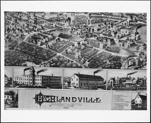
Your search:
map
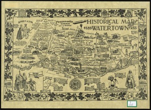
✖
Remove constraint map
« Prev. |
1
-
50
of
34,085
|
Next »
Sort
by relevance
relevance
title
date (asc)
date (desc)
Number of results to display per page
50
per page
per page
10
per page
20
per page
50
per page
100
per page
View results as:
List
list view
Maps
map view
Gallery
grid view
Search Results
1.
Map
2.
Map
3.
Map
4.
Map
5.
Map
6.
Map
7.
Map
8.
Map
9.
Map
10.
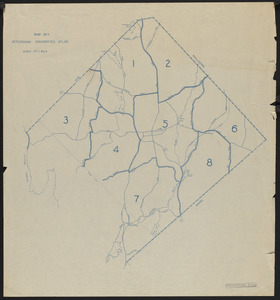
Petersham Property Map Atlas - Map Key
11.
Campaign maps : Army of the Potomac : Map no. 2. Williamsburg to White House
12.
Campaign maps : Army of the Potomac : Map no. 3. White House to Harrison's Landing
13.
Map making
14.
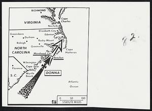
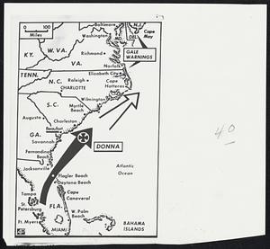
Donna Map
15.
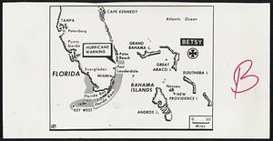
Map + Betsy.
16.
Map + Cleo
17.
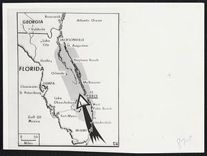
Map + Donna.
18.
World map
19.
World map
20.
[World map]
21.
[World map]
22.
MBTA map : 1977-1978
23.
Victory map
24.
Annexation map
25.
[World map]
26.
Map Holyoke
27.
Map Holyoke
28.
World map
29.
Locality map
30.
Historical maps
31.
Miscellaneous maps
32.
Campus Map
33.
Topsfield Maps
34.
Topographical map
35.
Political map
36.
Salem Maps
37.
Historic Maps
38.
Map Collections
39.
Surveyor's map
40.
[topo. map]
41.
"Highlandville" map
42.
The map
43.
Watertown Maps
44.
Africa, maps
45.
Maps & Globes
46.
Maps & globes
47.
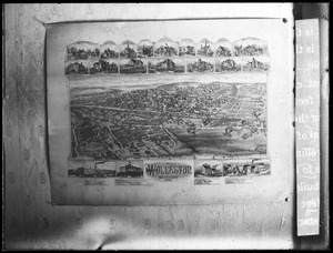
Wollaston map
48.
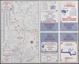
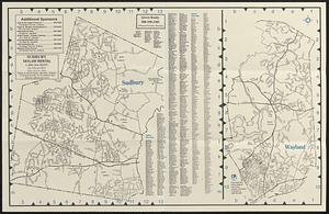
Map of Wayland & map of Sudbury, 1986
49.
Map of Wayland and map of Sudbury, 2000
50.
Map no. I
« Previous
Next »
1
2
3
4
5
…
681
682
Limit your search
Subject
Land use--Massachusetts
10,047
Maps--Massachusetts
10,047
Real property--Massachusetts--Boston--Maps
2,356
Boston (Mass.)--Maps
2,182
Landowners--Massachusetts--Boston--Maps
2,154
Roads
1,693
Cities and towns
1,683
Land use mapping
1,680
more
Subject
»
Place
North and Central America
28,494
United States
26,997
Massachusetts
21,501
Suffolk (county)
4,782
Boston
4,621
Essex (county)
2,471
Massachusetts--Worcester County
1,926
Middlesex (county)
1,638
more
Place
»
Format
Maps/Atlases
20,389
Photographs
11,591
Prints
8,861
Manuscripts
2,432
Documents
448
Books
391
Drawings/Illustrations
333
Letters/Correspondence
331
more
Format
»
Available to use
No known restrictions
17,200
Creative Commons license
2,115
Date
View distribution
Current results range from
1482
to
2023
Date range begin
Date range end
View larger »
Unknown
594
Collection
Norman B. Leventhal Map Center Collection
11,713
William P. MacConnell Aerial Photograph Collection, ca. 1950-2000
10,047
Boston and New England Maps (Collection of Distinction)
5,680
Urban Maps (Collection of Distinction)
5,273
Land study maps, 1936-1937
1,680
Maritime Charts and Atlases (Collection of Distinction)
1,110
American Revolutionary War-Era Maps (Collection of Distinction)
848
Lawrence, Mass. Engineering Department. City Sewers
717
more
Collection
»
Institution
Boston Public Library
12,670
Special Collections and University Archives, University of Massachusetts Amherst Libraries
10,535
Massachusetts Archives
2,659
Lawrence Public Library
1,496
Harvard University
724
State Library of Massachusetts
719
New Bedford Free Public Library
487
Historic New England
354
more
Institution
»


![[World map]](https://bpldcassets.blob.core.windows.net/derivatives/images/commonwealth:wd3762879/image_thumbnail_300.jpg)
![[World map]](https://bpldcassets.blob.core.windows.net/derivatives/images/commonwealth:st74cz00d/image_thumbnail_300.jpg)


![[World map]](https://bpldcassets.blob.core.windows.net/derivatives/images/commonwealth:x059cd25x/image_thumbnail_300.jpg)


![[topo. map]](https://bpldcassets.blob.core.windows.net/derivatives/images/commonwealth:pg15bx26w/image_thumbnail_300.jpg)