Skip to search
Skip to main content
Digital Commonwealth
Folders
Sign Up / Log In
Search for
Search
Search
Search
Basic
Advanced
Explore
Map
Collections
Institutions
Formats
For Educators
Primary Source Sets
Lesson Plans
Using Primary Sources
Searching Digital Commonwealth
For Institutions
Join Digital Commonwealth
Conferences, Trainings, & Events
How to Contribute Collections
Digitization Services
Board & Committees
Frequently Asked Questions
About
About Digital Commonwealth
News & Announcements
Copyright & Terms of Use
Harmful Content Statement
Partners
API
Contact Us
SAILS Library Network
West Bridgewater History
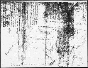
Surveyor's map
View this item online at SAILS Library Network
Item Information
Title:
Surveyor's map
Date:
[ca. 1800]
Format:
Documents
Location:
West Bridgewater Public Library
Collection (local):
West Bridgewater History
SAILS Digital History Collection
Subjects:
Matfield River (West Bridgewater, Mass.)
West Bridgewater (Mass.)--History
Places:
Massachusetts
>
Plymouth (county)
>
East Bridgewater
Massachusetts
>
Plymouth (county)
>
West Bridgewater
Link to Item:
https://sailsinc.omeka.net/items/show/1515
Terms of Use:
Rights status not evaluated.
Contact host institution for more information.
Notes:
Copy of surveyor's map of area showing Matfield River; from Mass Archives Maps & Plans #1230
Identifier:
0239
show more...
View MODS XML
More Like This
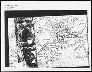
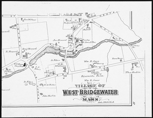
Center of West Bridgewater
Center of West Bridgewater
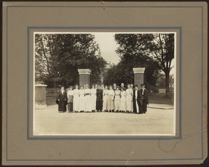
Champs, Howard High School
Howard High graduating class
Find More Like This >>
Tools
Share
Facebook
Pinterest
X
Reddit
Tumblr
Email
Copy link
Add to Folder
Questions/Comments
Cite This Item