1. Atlas of the boundaries of the cities of Cambridge, Somerville, Waltham and towns of Belmont, Burlington, Lexington, Watertown, Middlesex County Creator: Board of Harbor and Land Commissioners of Massachusetts Format: Maps/Atlases Collection: Massachusetts Board of Harbor and Land Commissioners Date: 1903 Institution: State Library of Massachusetts
2. Atlas of the boundaries of the cities of Chicopee and Springfield and towns of Brimfield, East Longmeadow, Hampden, Holland, Longmeadow, Ludlow, Monson, Palmer, Wales,... Creator: Board of Harbor and Land Commissioners of Massachusetts Format: Maps/Atlases Collection: Massachusetts Board of Harbor and Land Commissioners Date: 1912 Institution: State Library of Massachusetts
3. Atlas of the boundaries of the cities of Fall River - New Bedford and towns of Acushnet, Berk[e]ley, Dartmouth, Dighton, Fairhaven, Freetown, Somerset, Swansea,... Creator: Board of Harbor and Land Commissioners of Massachusetts Format: Maps/Atlases Collection: Massachusetts Board of Harbor and Land Commissioners Date: 1904 Institution: State Library of Massachusetts
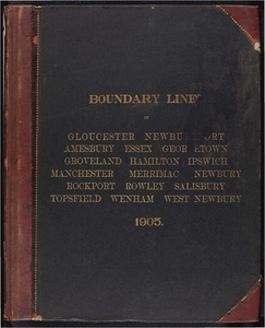
4. Atlas of the boundaries of the cities of Gloucester and Newburyport and towns of Amesbury, Essex, Georgetown, Groveland, Hamilton, Ipswich, Manchester, Merrimac,... Creator: Board of Harbor and Land Commissioners of Massachusetts Format: Maps/Atlases Collection: Massachusetts Board of Harbor and Land Commissioners Date: 1905 Institution: State Library of Massachusetts
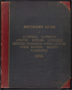
5. Atlas of the boundaries of the cities of Haverhill, Lawrence and towns of Andover, Boxford, Lynnfield, Methuen, Middleton, North Andover, Essex County North Reading,... Creator: Board of Harbor and Land Commissioners of Massachusetts Format: Maps/Atlases Collection: Massachusetts Board of Harbor and Land Commissioners Date: 1906 Institution: State Library of Massachusetts
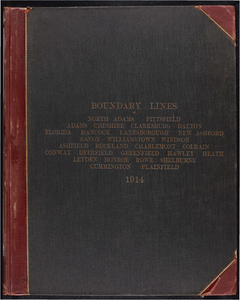
6. Atlas of the boundaries of the cities of North Adams and Pittsfield and towns of Adams, Cheshire, Clarksburg, Dalton, Florida, Hancock, Lanesborough, New Ashford,... Creator: Board of Harbor and Land Commissioners of Massachusetts Format: Maps/Atlases Collection: Massachusetts Board of Harbor and Land Commissioners Date: 1913 Institution: State Library of Massachusetts
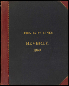
7. Atlas of the boundaries of the city of Beverly, Essex County Creator: Massachusetts. Topographical Survey Commission Format: Books Collection: Massachusetts Board of Harbor and Land Commissioners Date: 1898 Institution: State Library of Massachusetts
8. Atlas of the boundaries of the city of Boston, Suffolk County and town of Brookline, Norfolk County Creator: Board of Harbor and Land Commissioners of Massachusetts Format: Maps/Atlases Collection: Massachusetts Board of Harbor and Land Commissioners Date: 1902 Institution: State Library of Massachusetts
9. Atlas of the boundaries of the city of Brockton, Plymouth County Creator: Massachusetts. Topographical Survey Commission Format: Books Collection: Massachusetts Board of Harbor and Land Commissioners Date: 1898 Institution: State Library of Massachusetts
10. Atlas of the boundaries of the city of Chelsea, Suffolk County Creator: Massachusetts. Topographical Survey Commission Format: Books Collection: Massachusetts Board of Harbor and Land Commissioners Date: 1898 Institution: State Library of Massachusetts
11. Atlas of the boundaries of the city of Everett, Middlesex County Creator: Massachusetts. Topographical Survey Commission Format: Books Collection: Massachusetts Board of Harbor and Land Commissioners Date: 1898 Institution: State Library of Massachusetts
12. Atlas of the boundaries of the city of Fitchburg and towns of Ashburnham, Athol, Gardner, Leominster, Lunenburg, Phillipston, Royalston, Templeton, Westminster,... Creator: Board of Harbor and Land Commissioners of Massachusetts Format: Maps/Atlases Collection: Massachusetts Board of Harbor and Land Commissioners Date: 1909 Institution: State Library of Massachusetts
13. Atlas of the boundaries of the city of Holyoke and towns of Agawam, Blandford, Chester, Granville, Montgomery, Russell, Southwick, Tolland, Westfield, West... Creator: Board of Harbor and Land Commissioners of Massachusetts Format: Maps/Atlases Collection: Massachusetts Board of Harbor and Land Commissioners Date: 1914 Institution: State Library of Massachusetts
14. Atlas of the boundaries of the city of Lowell and towns of Ayer, Billerica, Carlisle, Chelmsford, Dracut, Dunstable, Groton, Littleton, Pepperell, Shirley, Tewksbury,... Creator: Board of Harbor and Land Commissioners of Massachusetts Format: Maps/Atlases Collection: Massachusetts Board of Harbor and Land Commissioners Date: 1907 Institution: State Library of Massachusetts
15. Atlas of the boundaries of the city of Lynn and towns of Nahant, Saugus, and Swampscott, Essex County and Wakefield, Middlesex County Creator: Board of Harbor and Land Commissioners of Massachusetts Format: Maps/Atlases Collection: Massachusetts Board of Harbor and Land Commissioners Date: 1902 Institution: State Library of Massachusetts
16. Atlas of the boundaries of the city of Malden, Middlesex County Creator: Massachusetts. Topographical Survey Commission Format: Books Collection: Massachusetts Board of Harbor and Land Commissioners Date: 1898 Institution: State Library of Massachusetts
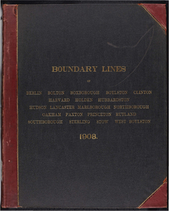
17. Atlas of the boundaries of the city of Marlborough and towns of Boxborough, Hudson, Stow, Middlesex County Berlin, Bolton, Boylston, Clinton, Harvard, Holden,... Creator: Board of Harbor and Land Commissioners of Massachusetts Format: Maps/Atlases Collection: Massachusetts Board of Harbor and Land Commissioners Date: 1908 Institution: State Library of Massachusetts
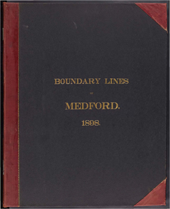
18. Atlas of the boundaries of the city of Medford, Middlesex County Creator: Massachusetts. Topographical Survey Commission Format: Books Collection: Massachusetts Board of Harbor and Land Commissioners Date: 1898 Institution: State Library of Massachusetts
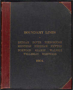
19. Atlas of the boundaries of the city of Newton, Middlesex County and towns of Dedham, Dover, Foxborough, Medfield, Needham, Norwood, Sharon, Walpole, Wellesley,... Creator: Board of Harbor and Land Commissioners of Massachusetts Format: Maps/Atlases Collection: Massachusetts Board of Harbor and Land Commissioners Date: 1904 Institution: State Library of Massachusetts
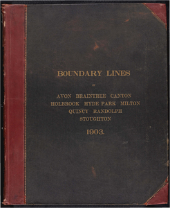
20. Atlas of the boundaries of the city of Quincy and towns of Avon, Braintree, Canton, Holbrook, Hyde Park, Milton, Randolph, Stoughton, Norfolk County Creator: Board of Harbor and Land Commissioners of Massachusetts Format: Maps/Atlases Collection: Massachusetts Board of Harbor and Land Commissioners Date: 1903 Institution: State Library of Massachusetts
21. Atlas of the boundaries of the city of Salem and towns of Danvers, Marblehead and Peabody, Essex County Creator: Board of Harbor and Land Commissioners of Massachusetts Format: Maps/Atlases Collection: Massachusetts Board of Harbor and Land Commissioners Date: 1902 Institution: State Library of Massachusetts
22. Atlas of the boundaries of the city of Springfield, Hampden County Creator: Massachusetts. Topographical Survey Commission Format: Books Collection: Massachusetts Board of Harbor and Land Commissioners Date: 1900 Institution: State Library of Massachusetts
23. Atlas of the boundaries of the city of Taunton, Bristol County Creator: Massachusetts. Topographical Survey Commission Format: Books Collection: Massachusetts Board of Harbor and Land Commissioners Date: 1900 Institution: State Library of Massachusetts
24. Atlas of the boundaries of the city of Woburn, Middlesex County Creator: Massachusetts. Topographical Survey Commission Format: Books Collection: Massachusetts Board of Harbor and Land Commissioners Date: 1899 Institution: State Library of Massachusetts
25. Atlas of the boundaries of the city of Worcester and towns of Auburn, Blackstone, Charlton, Douglas, Dudley, Grafton, Hopedale, Leicester, Mendon, Milford, Millbury,... Creator: Board of Harbor and Land Commissioners of Massachusetts Format: Maps/Atlases Collection: Massachusetts Board of Harbor and Land Commissioners Date: 1908 Institution: State Library of Massachusetts
26. Atlas of the boundaries of the town of Abington, Plymouth County Creator: Massachusetts. Topographical Survey Commission Format: Books Collection: Massachusetts Board of Harbor and Land Commissioners Date: 1898 Institution: State Library of Massachusetts
27. Atlas of the boundaries of the town of Alford, Becket, Egremeont, Great Barrington, Hinsdale, Lee, Lenox, Monterey, Mount Washington, New Marlborough, Otis, Peru,... Creator: Board of Harbor and Land Commissioners of Massachusetts Format: Maps/Atlases Collection: Massachusetts Board of Harbor and Land Commissioners Date: 1915 Institution: State Library of Massachusetts
28. Atlas of the boundaries of the town of Arlington, Middlesex County Creator: Board of Harbor and Land Commissioners of Massachusetts Format: Maps/Atlases Collection: Massachusetts Board of Harbor and Land Commissioners Date: 1901 Institution: State Library of Massachusetts
29. Atlas of the boundaries of the town of Attleborough, Bristol County Creator: Massachusetts. Topographical Survey Commission Format: Books Collection: Massachusetts Board of Harbor and Land Commissioners Date: 1900 Institution: State Library of Massachusetts
30. Atlas of the boundaries of the town of Bourne, Barnstable County Creator: Massachusetts. Topographical Survey Commission Format: Books Collection: Massachusetts Board of Harbor and Land Commissioners Date: 1899 Institution: State Library of Massachusetts
31. Atlas of the boundaries of the town of Bridgewater, Plymouth County Creator: Massachusetts. Topographical Survey Commission Format: Books Collection: Massachusetts Board of Harbor and Land Commissioners Date: 1899 Institution: State Library of Massachusetts
32. Atlas of the boundaries of the town of Duxbury, Plymouth County Creator: Massachusetts. Topographical Survey Commission Format: Books Collection: Massachusetts Board of Harbor and Land Commissioners Date: 1899 Institution: State Library of Massachusetts
33. Atlas of the boundaries of the town of East Bridgewater, Plymouth County Creator: Massachusetts. Topographical Survey Commission Format: Books Collection: Massachusetts Board of Harbor and Land Commissioners Date: 1898 Institution: State Library of Massachusetts
34. Atlas of the boundaries of the town of Easton, Bristol County Creator: Massachusetts. Topographical Survey Commission Format: Books Collection: Massachusetts Board of Harbor and Land Commissioners Date: 1899 Institution: State Library of Massachusetts
35. Atlas of the boundaries of the town of Halifax, Plymouth County Creator: Massachusetts. Topographical Survey Commission Format: Books Collection: Massachusetts Board of Harbor and Land Commissioners Date: 1899 Institution: State Library of Massachusetts
36. Atlas of the boundaries of the town of Hanover, Plymouth County Creator: Massachusetts. Topographical Survey Commission Format: Books Collection: Massachusetts Board of Harbor and Land Commissioners Date: 1898 Institution: State Library of Massachusetts
37. Atlas of the boundaries of the town of Hanson, Plymouth County Creator: Massachusetts. Topographical Survey Commission Format: Books Collection: Massachusetts Board of Harbor and Land Commissioners Date: 1898 Institution: State Library of Massachusetts
38. Atlas of the boundaries of the town of Kingston, Plymouth County Creator: Massachusetts. Topographical Survey Commission Format: Books Collection: Massachusetts Board of Harbor and Land Commissioners Date: 1899 Institution: State Library of Massachusetts
39. Atlas of the boundaries of the town of Lakeville, Plymouth County Creator: Massachusetts. Topographical Survey Commission Format: Books Collection: Massachusetts Board of Harbor and Land Commissioners Date: 1899 Institution: State Library of Massachusetts
40. Atlas of the boundaries of the town of Mansfield, Plymouth County Creator: Massachusetts. Topographical Survey Commission Format: Books Collection: Massachusetts Board of Harbor and Land Commissioners Date: 1899 Institution: State Library of Massachusetts
41. Atlas of the boundaries of the town of Marion, Plymouth County Creator: Massachusetts. Topographical Survey Commission Format: Books Collection: Massachusetts Board of Harbor and Land Commissioners Date: 1899 Institution: State Library of Massachusetts
42. Atlas of the boundaries of the town of Mattapoisett, Plymouth County Creator: Massachusetts. Topographical Survey Commission Format: Books Collection: Massachusetts Board of Harbor and Land Commissioners Date: 1899 Institution: State Library of Massachusetts
43. Atlas of the boundaries of the town of Melrose, Middlesex County Creator: Massachusetts. Topographical Survey Commission Format: Books Collection: Massachusetts Board of Harbor and Land Commissioners Date: 1898 Institution: State Library of Massachusetts
44. Atlas of the boundaries of the town of Middleborough, Plymouth County Creator: Massachusetts. Topographical Survey Commission Format: Books Collection: Massachusetts Board of Harbor and Land Commissioners Date: 1899 Institution: State Library of Massachusetts
45. Atlas of the boundaries of the town of North Attleborough, Bristol County Creator: Massachusetts. Topographical Survey Commission Format: Books Collection: Massachusetts Board of Harbor and Land Commissioners Date: 1900 Institution: State Library of Massachusetts
46. Atlas of the boundaries of the town of Norton, Bristol County Creator: Massachusetts. Topographical Survey Commission Format: Books Collection: Massachusetts Board of Harbor and Land Commissioners Date: 1900 Institution: State Library of Massachusetts
47. Atlas of the boundaries of the town of Norwell, Plymouth County Creator: Massachusetts. Topographical Survey Commission Format: Books Collection: Massachusetts Board of Harbor and Land Commissioners Date: 1899 Institution: State Library of Massachusetts
48. Atlas of the boundaries of the town of Plymouth, Plymouth County Creator: Massachusetts. Topographical Survey Commission Format: Books Collection: Massachusetts Board of Harbor and Land Commissioners Date: 1899 Institution: State Library of Massachusetts
49. Atlas of the boundaries of the town of Plympton, Plymouth County Creator: Massachusetts. Topographical Survey Commission Format: Books Collection: Massachusetts Board of Harbor and Land Commissioners Date: 1899 Institution: State Library of Massachusetts
50. Atlas of the boundaries of the town of Raynham, Bristol County Creator: Massachusetts. Topographical Survey Commission Format: Books Collection: Massachusetts Board of Harbor and Land Commissioners Date: 1900 Institution: State Library of Massachusetts
![Atlas of the boundaries of the cities of Fall River - New Bedford and towns of Acushnet, Berk[e]ley, Dartmouth, Dighton, Fairhaven, Freetown, Somerset, Swansea, Westport, Bristol County](https://bpldcassets.blob.core.windows.net/derivatives/metadata/commonwealth-oai:1r66jh22w/image_thumbnail_300.jpg)