Skip to search
Skip to main content
Skip to first result
Digital Commonwealth
Folders
Sign Up / Log In
Search for
Search
Search
Search
Basic
Advanced
Explore
Map
Collections
Institutions
Formats
For Educators
Primary Source Sets
Lesson Plans
Using Primary Sources
Searching Digital Commonwealth
For Institutions
Join Digital Commonwealth
Conferences, Trainings, & Events
How to Contribute Collections
Digitization Services
Board & Committees
Frequently Asked Questions
About
About Digital Commonwealth
News & Announcements
Copyright & Terms of Use
Harmful Content Statement
Partners
API
Contact Us
Search
Search Constraints
Start Over
Save Search
Your search:
More Like
commonwealth:x633f8883
✖
Remove constraint More Like: commonwealth:x633f8883
« Prev.
|
301
-
400
of
11,458
|
Next »
Sort
by relevance
relevance
title
date (asc)
date (desc)
Number of results to display per page
100
per page
per page
10
per page
20
per page
50
per page
100
per page
View results as:
List
list view
Maps
map view
Gallery
grid view
Search Results
301.
Annapolis Royal ... : St. Mary's Bay
302.
Annexation map
303.
L'Anse including Portage Entry and part of Keweenaw Bay, Lake Superior
304.
Ansei kaisei Oedo ōezu = Map of Jeddo
305.
Antietam Sharpsburg and vicinity : constructed and engraved to illustrate "The war with the South"
306.
Antigoa
307.
Antigua
308.
Antilles ou Indes Occidentales
309.
Antrim, N.H. and Clinton Village : 1887
310.
Antwerp : or Anvers
311.
Apia, Apaiang or Charlotte Island, Kingsmill Group ; Cook Island, Tarawa or Knox Island, Kingsmill Group
312.
Apolima, Samoan Group ; Harbour of Oafonu, Isld. of Tutuila, north side ; Harbour of Aur, Isld. of Tutuila, north side ;...
313.
Apolima, Samoan Group ; Harbour of Oafonu, Isld. of Tutuila, north side ; Hübner Bay, Island of Tutuila ; Harbour of Aur,...
314.
Appearance of Fort Sumter on Sunday afternoon, August 23d, 1863 : sketched from the "Beacon house" on Morris Island
315.
Appearance of the land from the White Islands to St. Marys River taken two leagues off shore : The entrance of Milford Haven at...
316.
Appleton St. Woonerf
317.
Appletons' railway map of the United States and Canada
318.
Appletons' railway map of the United States and the Canadas : representing railways in actual operation, and those in the...
319.
Approach to Ta-Tong River, west coast Corea
320.
Approaches to Cohasset Harbor Mass. : topography surveyed in 1847 ; hydrography surveyed in 1846-'56
321.
Approaches to Fort Butte La Rose, Louisiana : captured by the U.S. fleet, co-operating with the forces under the command of...
322.
Approaches to Fort Hindman, Arkansas Post, on the Arkansas River : captured by the U.S. Mississippi Squadron, under command of...
323.
Approaches to Fort Hindman, Arkansas Post, on the Arkansas River : captured by the U.S. Mississippi Squadron, under command of...
324.
L'Arabia divisa in petrea, deserta, e felice
325.
Arabia, n.e. coast, Gulf of 'Omman, Maskat & Matreh : from British surveys in 1828, 1849 & 1860 : republication of the British...
326.
Arabian Sea, Maskat to Karáchi
327.
Arabia--Red Sea, Mokha Road : from a British survey in 1882
328.
Archaeological map of Castle Neck and vicinity, Ipswich, Mass. showing ancient Indian villages & remains : made from actual...
329.
Archiepiscopatus et Electoratus Coloniensis, maximaeque partes Ducatuum Juliacensis Cliviensis, et Montensis aliaeque minores...
330.
Archiepiscopatus et Electoratus Moguntini et adjacentium regionum, ut Landgraviatuum Hasso Darmstadiensis et Rhenofeldensis,...
331.
Archiepiscopatus et Electoratus Trevirensis novissima delineatio exacte divisa in omnes suas praefecturas in hac quoque tabula...
332.
Archiepiscopatus Trevirensis
333.
Archiepiscopatus Trevirensis recentissima delineatio
334.
The archipelago of the East, being the Sunda, the Molucca, and Phillipps. Islands : the chief settlements of the Dutch in India...
335.
Archipelagus Atlanticus cum suis insulis Canariis, Hesperidibus et Azoribus
336.
Arcihiepiscopatus Cameracensis
337.
Arctic America : eastern sheet
338.
The Arctic Ocean between Greenland and Nova Zemla and between the 60th and 82d parallels of latitude : from the Swedish,...
339.
Arctic Ocean, north of Behrings Strait : Wrangel Island, as surveyed by the officers of the U.S.S. Rodgers, Lieut. R.M. Berry...
340.
Arctic Ocean, north of Behrings Strait, Rodgers Harbor on the south side of Wrangel Island
341.
Arctic Ocean, north of Behrings Strait, track of the U.S.S. Rodgers, Lieut. R.M. Berry Comdg., north of Wrangel Island,...
342.
The Arctic regions : comprising the most recent explorations of Robert E. Peary, Fridtjof Nansen and F. Jackson
343.
Arctic Sea, Spitzbergen : from the Swedish survey of 1861 to 1864, corrected from the German & Norwegian explorations to 1872
344.
Area plan as of May 1962
345.
Argentine railways, 1907
346.
Arizona
347.
Arizona (Coconino County), Bright Angel quadrangle
348.
Arlington, Massachusetts : 1884
349.
Armour food source map
350.
Arragonia regnum
351.
Art forms of the Pacific area
352.
Artarias karte der Russischen sozialistischen förderativen Sowjet-Republik (R.S.F.S.R.)
353.
Artois : Atrebatum regionis vera descriptio
354.
Ashburnham, Mass
355.
Ashland & Bayfield
356.
Ashland, Grafton Co., N.H. 1883
357.
Asia : with the islands adioyning described, the atire of the people, & townes of importance, all of them newly augmented
358.
Asia
359.
Asia
360.
Asia
361.
Asia
362.
Asia, according to the best authorities
363.
Asia, ca. 100 A.D.
364.
Asia, east coast, China Sea in four sheets : compiled from the latest surveys 1885
365.
Asia Florente Persarum Imperio
366.
Asia, Japan and Korea with the surrounding seas and the adjacent coastal region of China : from the latest information
367.
Asia noviter delineata
368.
Asia noviter delineata
369.
Asia recens summa cura delineata
370.
Asia under the Mongols, 1290 A.D.
371.
Asiae Minoris antiquae : tabula in usum scholarum descripta
372.
Asiae Minoris antiquae : tabula in usum scholarum descripta
373.
Asiae noua descriptio
374.
Asiae nova
375.
Asiæ quæ vulgo minor dicitur et Syriæ tabula geographica : quantum per subsidia licuit elaborata, opere, si quod aliud in...
376.
Asiatische Türkei
377.
L'Asie antérieure : d'après le texte de la Nouvelle Géographie Universelle et d'autres documents récents
378.
Asien
379.
Ask Shell!
380.
Aspect général de Paris
381.
Aspect général de Rome
382.
Assiniboia
383.
An astronomical chart or diagram, in which the structure of the solar system is exhibited at one view
384.
At the request of the recorder Thomas Jones Esqr. chairman, & the other gentlemen of the committee, I have surveyed the farm...
385.
Athens
386.
Athol, Mass : 1887
387.
Atlantic Neptune [front matter]
388.
Atlantic Neptune [front matter]
389.
Atlantic Ocean, Azores or Western Isles
390.
Atlantic Ocean, Bay of Biscay, ports on the north coast of Spain : from Spanish government surveys, corrected to 1876
391.
Atlantic Ocean, n.w. coast of Africa, Mogador or Zuerah Harbor : from British and French surveys in 1835 & 1852; the south...
392.
Atlas of Abington and Rockland, Massachusetts : from recent and actual surveys & records
393.
Atlas of Attleboro' Town, Massachusetts
394.
Atlas of Barnstable County, Massachusetts : towns of Bourne, Mashpee, Falmouth, Sandwich, Barnstable, Yarmouth, Dennis,...
395.
Atlas of Berkshire County, Massachusetts
396.
Atlas of Bristol Co., Massachusetts : from actual surveys
397.
Atlas of Brookfield, West Brookfield and No. Brookfield towns, Massachusetts : compiled from recent and actual surveys and records
398.
Atlas of Cape Ann, Gloucester, Rockport and Manchester, Essex County, Mass. : from official plans and actual surveys
399.
Atlas of Dorchester, West Roxbury and Brighton, city of Boston : plate 6
400.
Atlas of Dorchester, West Roxbury and Brighton, city of Boston : plate 5
« Previous
Next »
1
2
3
4
5
6
7
8
…
114
115
Limit your search
Subject
Real property--Massachusetts--Boston--Maps
2,278
Landowners--Massachusetts--Boston--Maps
2,117
Boston (Mass.)--Maps
1,969
Roxbury (Boston, Mass.)--Maps
351
Dorchester (Boston, Mass.)--Maps
317
Cambridge (Mass.)--Maps
266
Brookline (Mass.)--Maps
236
Real property--Massachusetts--Cambridge--Maps
216
more
Subject
»
Place
North and Central America
8,693
United States
7,617
Massachusetts
4,966
Suffolk (county)
3,350
Boston
3,210
Europe
1,378
Middlesex (county)
618
Canada
449
more
Place
»
Format
Maps/Atlases
11,327
Manuscripts
215
Prints
65
Books
35
Photographs
33
Posters
29
Drawings/Illustrations
9
Objects/Artifacts
9
more
Format
»
Available to use
No known restrictions
11,335
Creative Commons license
63
Date
View distribution
Current results range from
1482
to
2023
Date range begin
Date range end
View larger »
Unknown
9
Collection
Norman B. Leventhal Map & Education Center Collection
11,387
Boston and New England Maps (Collection of Distinction)
5,125
Urban Maps (Collection of Distinction)
4,857
Maritime Charts and Atlases (Collection of Distinction)
1,081
American Revolutionary War-Era Maps (Collection of Distinction)
615
Boston Redevelopment Authority Collection
87
Stephen Lewis poster collection, circa 1921-2017
23
Boston Herald-Traveler Photo Morgue
15
more
Collection
»
Institution
Boston Public Library
11,425
University of Massachusetts Boston, Joseph P. Healey Library
23
Phillips Library at the Peabody Essex Museum
2
Spinner Publications
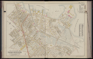
2
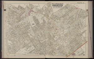
Forbes Library
1
Joseph A. Labadie Collection, University of Michigan
1
Massachusetts Historical Society
1
Newburyport Public Library
1
more
Institution
»


![Atlantic Neptune [front matter]](https://bpldcassets.blob.core.windows.net/derivatives/images/commonwealth:3f462w98b/image_thumbnail_300.jpg)
![Atlantic Neptune [front matter]](https://bpldcassets.blob.core.windows.net/derivatives/images/commonwealth:3f462x58k/image_thumbnail_300.jpg)