Skip to search
Skip to main content
Digital Commonwealth
Sign Up / Log In
Search for
Search
Search
Search
Basic
Advanced
Explore
Map
Collections
Institutions
Formats
For Educators
Primary Source Sets
Lesson Plans
Using Primary Sources
Searching Digital Commonwealth
For Institutions
Join Digital Commonwealth
Conferences, Trainings, & Events
How to Contribute Collections
Digitization Services
Board & Committees
Frequently Asked Questions
About
About Digital Commonwealth
News & Announcements
Copyright & Terms of Use
Harmful Content Statement
Partners
API
Contact Us
Boston Public Library
Norman B. Leventhal Map & Education Center Collection
/
Maritime Charts and Atlases (Collection of Distinction)
Asia, Japan and Korea with the surrounding seas and the adjacent coastal region of China : from the latest information
Asia, Japan and Korea with the surrounding seas and the adjacent coastal region of China
×
Item Information
Title:
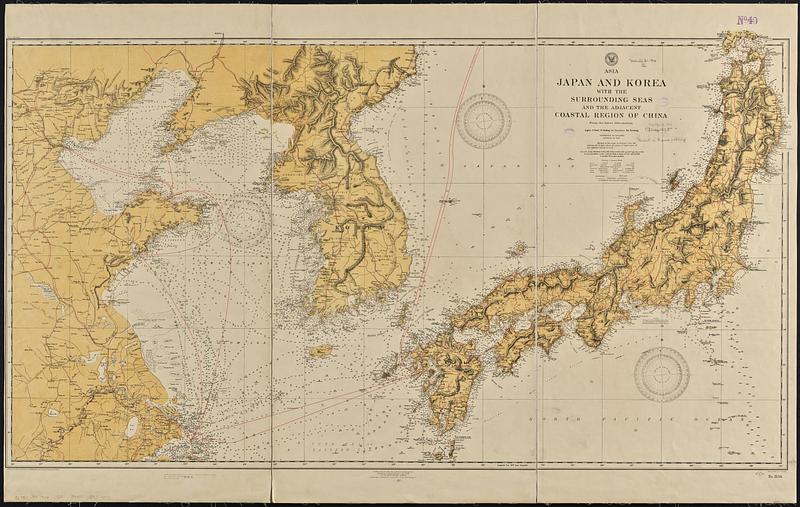
Asia, Japan and Korea with the surrounding seas and the adjacent coastal region of China : from the latest information
Issuing body:
United States. Hydrographic Office
Lithographer:
Noetzel, G. (Gregor)
Name on Item:
lithographed by Gr. Noetzel
Date:
1904
Format:
Maps/Atlases
Genre:
Nautical charts
Location:
Boston Public Library
Norman B. Leventhal Map & Education Center
Collection (local):
Norman B. Leventhal Map & Education Center Collection
Subjects:
Japan--Maps
Korea--Maps
China--Maps
Nautical charts--Japan
Nautical charts--Korea
Nautical charts--China
Places:
Japan
North Korea
South Korea
China
Extent:
1 map : color ; 67 x 120 cm
Permalink:
https://ark.digitalcommonwealth.org/ark:/50959/31982x20m
Terms of Use:
No known copyright restrictions.
No known restrictions on use.
Publisher:
Washington, D.C. : Hydrographic Office
Scale:
Scale approximately 1:2,050,000
Language:
English
Notes:
Relief shown by hachures and spot heights. Depths shown by soundings and isolines.
"Small corrections which can be entered on previous editions by hand from notices to mariners: ('04-11,."
Identifier:
06_01_015706
Call #:
G9096.P5 svar .U55 no. 2156
Barcode:
39999085939070
show more...
View MODS XML
More Like This
The coasts of the Hwang Hai or Yellow Sea and Gulf of Pechili : ...
Japan, south coast of Nipon, Kii Channel to Owasi Bay : from Brit. ...
China : sheet IV south coast from Chauan Bay to Port Matheson ...
China : sheet V eastern coast from Port Matheson to Ragged Point
Find More Like This >>
Tools
Share
Facebook
Pinterest
X
Reddit
Tumblr
Email
Copy link
Add to Folder
Questions/Comments
Cite This Item
IIIF Manifest
Downloads
Primary (full resolution, uncompressed)
(TIF, 526 MB)
Large (full resolution)
(JPEG, 44.2 MB)
Medium
(JPEG, 114 KB)