Skip to search
Skip to main content
Skip to first result
Digital Commonwealth
Folders
Sign Up / Log In
Search for
Search
Search
Search
Basic
Advanced
Explore
Map
Collections
Institutions
Formats
For Educators
Primary Source Sets
Lesson Plans
Using Primary Sources
Searching Digital Commonwealth
For Institutions
Join Digital Commonwealth
Conferences, Trainings, & Events
How to Contribute Collections
Digitization Services
Board & Committees
Frequently Asked Questions
About
About Digital Commonwealth
News & Announcements
Copyright & Terms of Use
Harmful Content Statement
Partners
API
Contact Us
Search
Search Constraints
Start Over
Save Search
Your search:
More Like
commonwealth:x059cc73c
✖
Remove constraint More Like: commonwealth:x059cc73c
« Prev.
|
101
-
150
of
11,709
|
Next »
Sort
by date (desc)
relevance
title
date (asc)
date (desc)
Number of results to display per page
50
per page
per page
10
per page
20
per page
50
per page
100
per page
View results as:
List
list view
Maps
map view
Gallery
grid view
Search Results
101.
Massachusetts open space and recreation facilities
102.
Haiti
103.
Major thoroughfare system, city of Boston, July, 1994
104.
North Atlantic Ocean, southeast coast of North America, including the Bahamas and Greater Antilles
105.
East Asia
106.
Massachusetts areas of critical environmental concern
107.
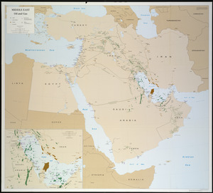
Middle East, oil and gas : Middle East
108.
North Atlantic Ocean, West Indies
109.
Circulation plan of parking lot at the corner of VFW Parkway and Spring Street, West Roxbury
110.
Asia
111.
Infrastructure around Tobin Bridge/US route 1 in Charlestown
112.
Berkeley Street community garden
113.
Massachusetts land use - 1985
114.
Massachusetts land use - 1985
115.
Properties of the Trustees of Reservations and other protected open space
116.
VOC contamination and public water supplies in the commonwealth of Massachusetts
117.
Waterfront skyline
118.
Flirtation walk schematic planting plan Charlestown Navy Yard
119.
Planting beds on Dartmouth Street and Boylston Street in Copley Square
120.
Brighton and Allston urban design strategy
121.
Charlestown Navy Yard master plan
122.
Columbia Point updated base maps
123.
EOEA MassGIS geographic information system transition document : The EOEA geographic information system: MassGIS
124.
Flirtation walk existing conditions plan Charlestown Navy Yard
125.
Gate 5 - Chelsea Street modified landscape scheme, Charlestown, MA
126.
Little Mystic Channel landscape scheme, Charlestown, MA
127.
Massachusetts coastal towns
128.
Outline map of Boston
129.
Profile of Huntington Avenue/St. James Avenue from Harcourt Street to Berkeley Street
130.
Ropewalk bldg. Charlestown Navy Yard
131.
Shadow analysis
132.
Street trees Comm. Ave.
133.
Topographic map of Brighton and Allston
134.
View of the South End
135.
Washington Street boulevard study : generalized land use - proposed
136.
Washington Street boulevard study : proposed fabric
137.
Washington Street boulevard study : corridor wide urban design strategy
138.
Wellhead protection areas in southeastern Massachusetts
139.
Sears Park conceptual site plan with historic waterway
140.
660 Wakulah St., Roxbury
141.
General plan of the MWRA/MDC water system
142.
James Hayes Park
143.
John Hancock office and parking garage complex, Boston, Massachusetts
144.
Mass pike air rights study
145.
We must have order
146.
Zoning districts, city of Boston
147.
New Congress Street improvements
148.
Cultural facilities conceptual plan
149.
Midtown area plan for the public realm
150.
Charlestown Navy Yard area
« Previous
Next »
1
2
3
4
5
6
7
…
234
235
Limit your search
Subject
Real property--Massachusetts--Boston--Maps
2,298
Boston (Mass.)--Maps
2,181
Landowners--Massachusetts--Boston--Maps
2,126
Roxbury (Boston, Mass.)--Maps
353
Dorchester (Boston, Mass.)--Maps
317
Massachusetts--Maps
271
Cambridge (Mass.)--Maps
268
Brookline (Mass.)--Maps
237
more
Subject
»
Place
North and Central America
8,998
United States
7,908
Massachusetts
5,158
Suffolk (county)
3,558
Boston
3,418
Europe
1,359
Middlesex (county)
620
Canada
449
more
Place
»
Format
Maps/Atlases
11,649
Manuscripts
217
Prints
56
Books
36
Objects/Artifacts
10
Drawings/Illustrations
8
Posters
4
Available to use
No known restrictions
11,456
Creative Commons license
70
Date
View distribution
Current results range from
1482
to
2023
Date range begin
Date range end
View larger »
Unknown
6
Collection
Norman B. Leventhal Map & Education Center Collection
11,440
Boston and New England Maps (Collection of Distinction)
5,277
Urban Maps (Collection of Distinction)
4,977
Maritime Charts and Atlases (Collection of Distinction)
1,081
American Revolutionary War-Era Maps (Collection of Distinction)
632
Boston Redevelopment Authority Collection
194
Historic Maps
77
Mapping Boston Collection
22
more
Collection
»
Institution
Boston Public Library
11,524
Salem State University Archives and Special Collections
77
State Library of Massachusetts
61
Private Collection
22
American Antiquarian Society
13
Phillips Academy
9
Boston Athenaeum
1
Massachusetts Historical Society
1
more
Institution
»